Home
States
Colorado
Connecticut
Maine
Massachusetts
New Hampshire
New York
Rhode Island
Utah
Vermont
View All
Lists
NE 4,000 Footers
NE 100 Highest
NH 4,000 Footers
NH 100 Highest
NH 52 With A View
NH Belknap Range
NH Ossipee 10
Links
Trail Conditions
Trip Log
Sunrises
Sunsets
About
|
Mt. Osceola, Mt. Osceola (East Peak)
Livermore, NH, Lincoln, NH
Trailheads, measurements, times, distances, and maps are all approximate and relative to the hike(s) as shown below.
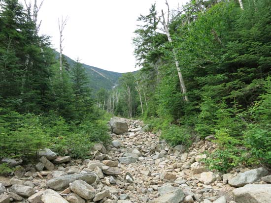
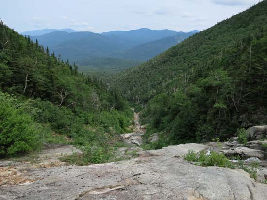
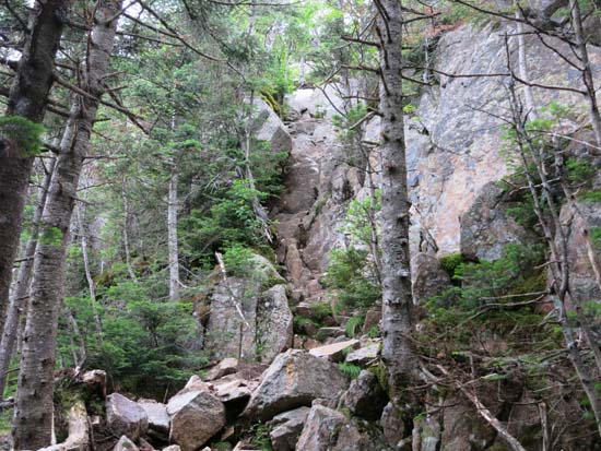
Looking up the Dog Leg Slide on the way to Mt. Osceola
Route: East Pond Trail, bushwhack, Dog Leg Slide, bootleg ski trail, bushwhack, Mt. Osceola Trail, (Mt. Osceola)
For the ascent, we took the East Pond Trail past the brook crossing and continued to a flat area with a big boulder and small spruce. Apparently there's a climbers path in this vicinity, but we didn't look too long for it. Instead, we worked our way to the brook, hitting it where a branch split off, then continued above the west bank for awhile until it opened up a bit.
Once the brook bed widened, we hopped in and went up. It's reasonably wide in part from Irene damage, but the saplings are starting to grow. Pretty smooth sailing though for the first third or so.
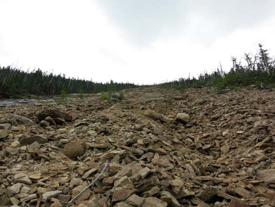
The middle third, approaching the actual dog leg turn, had wet/technical slabs, so we hopped back up to the west bank in scrappy woods for awhile, then popped back onto the slide a little above the turn. From there to the top of the slide there was a lot of loose material, but it was doable.
From the very top of the slide, we hopped into the woods, expecting to bushwhack, but then noticed an opening to our left. Sure enough, there was a bootleg ski trail (some current year stumps, many decades-old stumps) which climbed almost all the way to the main view ledge on Osceola. The trail ceased maybe 30 vertical feet from the big ledge. Very busy day on the summit.
The ridge was mostly dry, as was the chimney.
The descent off East Osceola was rougher than I remember pre-Irene (the last time I had been up there without snow) due to continued erosion. The Greeley Ponds Trail, on the other hand, was a bit smoother due to some advanced maintenance done, such as turnpikes and rock waterbars.
| Hike Ratings |
|
Getting To Trailhead: |
Easy |
| Destination: |
Mt. Osceola |
|
Length: |
Moderate |
|
Steepness: |
Very Difficult |
|
Navigation: |
Difficult |
|
Views: |
Excellent |
|
Crowds: |
Heavy |
| Destination: |
Mt. Osceola (East Peak) |
|
Length: |
Moderate |
|
Steepness: |
Very Difficult |
|
Navigation: |
Easy |
|
Views: |
Excellent |
|
Crowds: |
Heavy |
|
| Hike Stats |
|
Date Hiked: |
Saturday, July 19, 2014 |
| Parking Elevation: |
1,750' |
| Destination: |
Mt. Osceola |
| Time Elapsed: |
04:29 |
| Trailhead Elevation: |
1,750' |
| Summit Elevation: |
4,340' |
| Vertical Gain: |
2,740' |
| Destination: |
Mt. Osceola (East Peak) |
| Time Elapsed: |
00:43 |
| Trailhead Elevation: |
4,340' |
| Summit Elevation: |
4,156' |
| Distance: |
1 mile |
| Vertical Gain: |
386' |
|
|
| Hike Time Elapsed: |
07:25 |
| Hike Vertical Gain: |
3,241' |
|
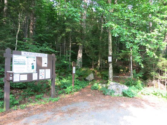
The East Pond Trail trailhead
Looking up the Dog Leg Slide on the way to Mt. Osceola
Looking down the Dog Leg Slide on the way to Mt. Osceola
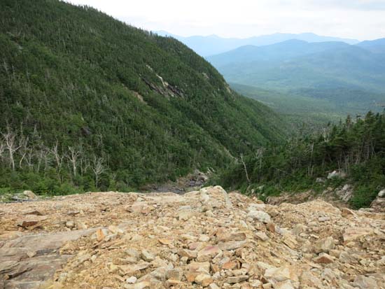
Looking down the Dog Leg Slide above the turn
Looking up the Dog Leg Slide on the way to Mt. Osceola
Looking down the Dog Leg Slide from the top
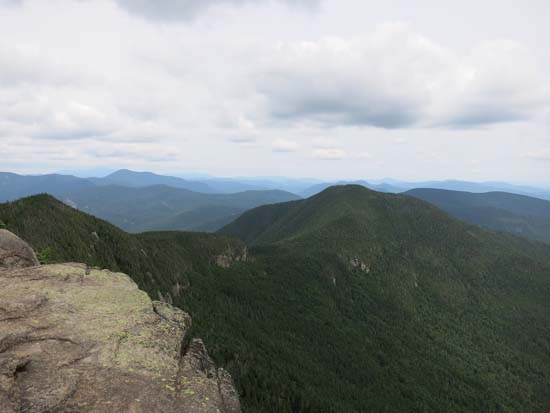
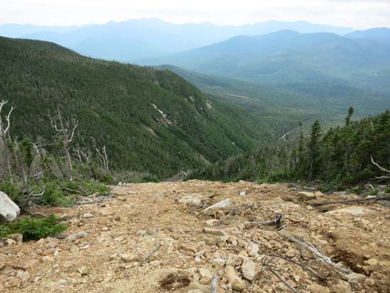
Looking at East Osceola from the Mt. Osceola cliffs
The chimney between Mt. Osceola and the East Peak
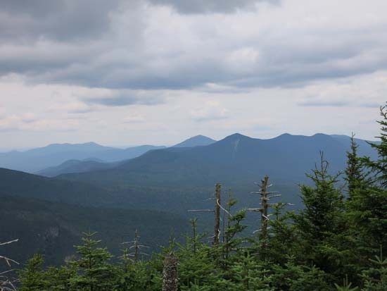
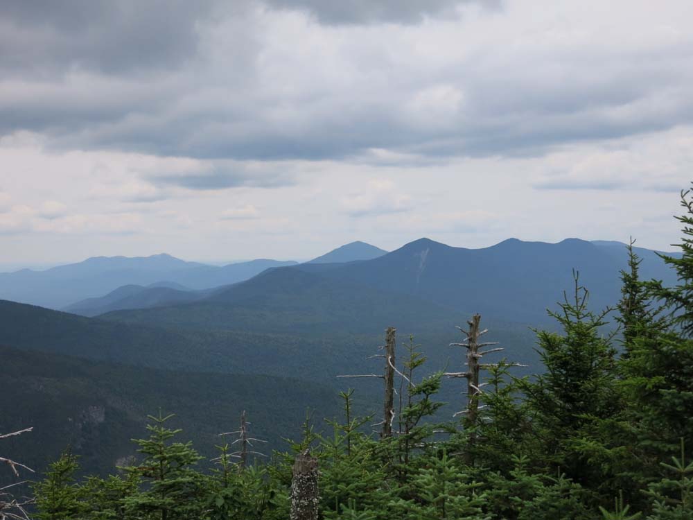
Looking at Chocorua, Mt. Passaconaway, and North Tripyramid from near the summit of the East Peak of Mt. Osceola
Directions to trailhead: Take Route 112 west from Conway. After passing the Hancock Trail trailhead and parking lot, the Greeley Ponds trailhead and WMNF fee parking area will be on the left a few minutes later. The East Pond Trail trailhead and WMNF fee parking lot will be on the left shortly after.
Back to Mt. Osceola Profile
Back to Mt. Osceola (East Peak) Profile
|