Home
States
Colorado
Connecticut
Maine
Massachusetts
New Hampshire
New York
Rhode Island
Utah
Vermont
View All
Lists
NE 4,000 Footers
NE 100 Highest
NH 4,000 Footers
NH 100 Highest
NH 52 With A View
NH Belknap Range
NH Ossipee 10
Links
Trail Conditions
Trip Log
Sunrises
Sunsets
About
|
Mt. Osceola, Mt. Osceola (East Peak)
Livermore, NH, Lincoln, NH
Trailheads, measurements, times, distances, and maps are all approximate and relative to the hike(s) as shown below.
The rough Mt. Osceola Trail to Mt. Osceola
Route: Mt. Osceola Trail
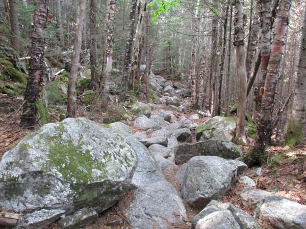
Trail was generally dry, with the exception of the normal mudpits near the summit of Osceola and the slabs about 3/4 of the way up. The slabs are pretty tough, as they're angled and there isn't much room to get around them.
Fairly dry between the peaks. Very little dampness in the chimney.
Noted an area has been logged next to the parking lot that could more than double the capacity.
Nice weather; stark contrast with two days ago!
| Hike Ratings |
|
Getting To Trailhead: |
Easy |
| Destination: |
Mt. Osceola |
|
Length: |
Moderate |
|
Steepness: |
Moderate |
|
Navigation: |
Easy |
|
Views: |
Excellent |
|
Crowds: |
Moderate |
| Destination: |
Mt. Osceola (East Peak) |
|
Length: |
Moderate |
|
Steepness: |
Very Difficult |
|
Navigation: |
Easy |
|
Views: |
Excellent |
|
Crowds: |
Minimal |
|
| Hike Stats |
|
Date Hiked: |
Wednesday, June 20, 2018 |
| Parking Elevation: |
2,340' |
| Destination: |
Mt. Osceola |
| Time Elapsed: |
01:06 |
| Trailhead Elevation: |
2,340' |
| Summit Elevation: |
4,340' |
| Distance: |
3.2 miles |
| Vertical Gain: |
2,090' |
| Destination: |
Mt. Osceola (East Peak) |
| Time Elapsed: |
00:26 |
| Trailhead Elevation: |
4,340' |
| Summit Elevation: |
4,156' |
| Distance: |
1 mile |
| Vertical Gain: |
386' |
|
|
| Hike Time Elapsed: |
03:19 |
| Hike Vertical Gain: |
3,171' |
|
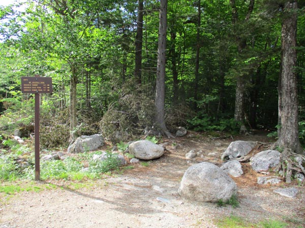
Mt. Osceola Trail trailhead at the Tripoli Road parking lot
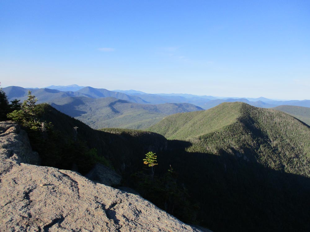
Looking at East Osceola from the Mt. Osceola ledges
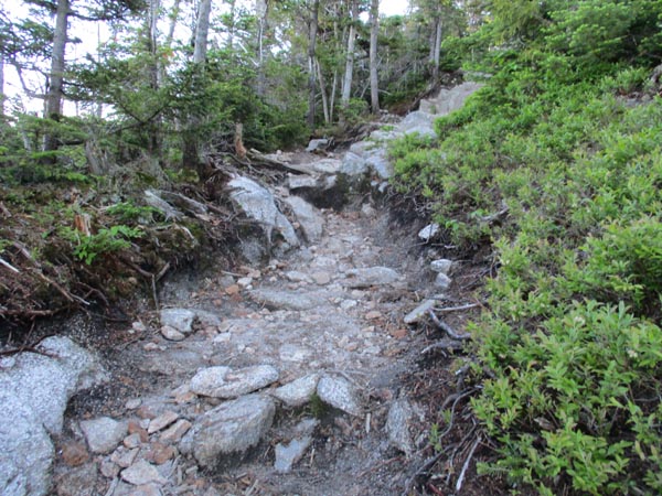
The eroding Mt. Osceola Trail between Mt. Osceola and the East Peak
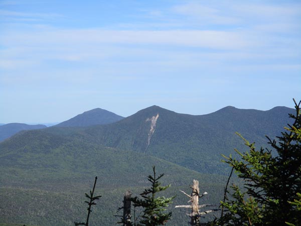
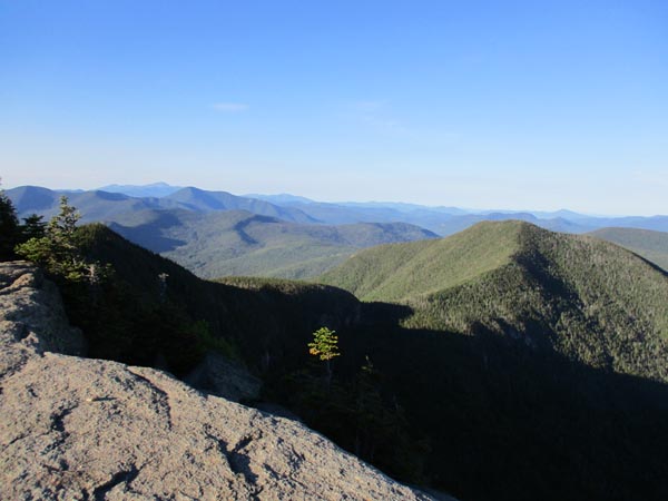
Looking at the Tripyramids from near the summit of the East Peak of Mt. Osceola
Directions to trailhead: From Waterville Valley, take Tripoli Road (bear right at the entrance to the ski area) to the top of the gap. Just after the road turns from pavement from dirt, the Mt. Osceola WMNF fee parking lot appears on the right. The trailhead is located at the back of the parking lot.
Back to Mt. Osceola Profile
Back to Mt. Osceola (East Peak) Profile
|