Home
States
Colorado
Connecticut
Maine
Massachusetts
New Hampshire
New York
Rhode Island
Utah
Vermont
View All
Lists
NE 4,000 Footers
NE 100 Highest
NH 4,000 Footers
NH 100 Highest
NH 52 With A View
NH Belknap Range
NH Ossipee 10
Links
Trail Conditions
Trip Log
Sunrises
Sunsets
About
|
Mt. Parker
Bartlett, NH
Trailheads, measurements, times, distances, and maps are all approximate and relative to the hike(s) as shown below.
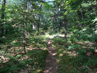
Looking up the Mount Langdon Trail
Route: Mount Langdon Trail, Mt. Parker Trail, (Mt. Parker), Mt. Parker Trail, Mount Langdon Trail
Having not seen the Presidentials from Mt. Parker during my previous visit, I decided to head back on a nice Monday afternoon.
I was able to make decent time up the Mt. Langdon Trail, thanks to decent footing and minimal blowdowns. Once reaching the Mt. Parker Trail, my progress slowed due to blowdowns. While this route has a few ups and downs, they weren't too much of a bear since I knew what to expect from my prior visit.
Eventually reaching the summit, I was greeted with views in almost every direction (there's also a ledge a short bushwhack from the summit that gives views in the missing direction, however I had limited daylight). It was, in particular, a neat way to look at Mt. Washington, with Mt. Resolution standing to the left. I couldn't help but wonder if the spruce trees around the summit will grow up and diminish this great view in a decade or two.
For the descent, I cleaned up a few blowdowns on the Mt. Parker Trail, prior to going into overdrive for the Mt. Langdon Trail walk, reaching the parking lot well before sunset.
| Hike Ratings |
|
Getting To Trailhead: |
Easy |
| Destination: |
Mt. Parker |
|
Length: |
Moderate |
|
Steepness: |
Difficult |
|
Navigation: |
Moderate |
|
Views: |
Excellent |
|
Crowds: |
Minimal |
|
| Hike Stats |
|
Date Hiked: |
Monday, June 21, 2010 |
| Hike Commenced: |
4:23 PM |
| Parking Elevation: |
700' |
| Destination: |
Mt. Parker |
| Ascent Commenced: |
4:23 PM |
| Summit Reached: |
5:49 PM |
| Time Elapsed: |
01:26 |
| Trailhead Elevation: |
700' |
| Summit Elevation: |
3,004' |
| Distance: |
3.9 miles |
| Vertical Gain: |
2,680' |
|
|
| Hike Ended: |
7:32 PM |
| Hike Time Elapsed: |
03:09 |
| Hike Distance: |
7.8 miles |
| Hike Vertical Gain: |
3,056' |
|
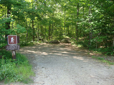
The Mount Langdon Trail trailhead
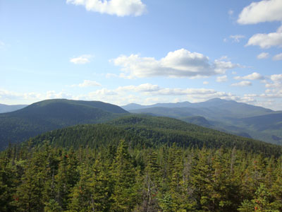
Looking at Mt. Resolution and Mt. Washington from Mt. Parker


Directions to trailhead: Take Route 302 west from North Conway. In downtown Barlett, take a right at the blinking light (Bear Notch Road is on the left). After crossing the river, the Mount Langdon Trail trailhead and small parking lot are located diagonally to the left.
Back to Mt. Parker Profile
|