Home
States
Colorado
Connecticut
Maine
Massachusetts
New Hampshire
New York
Rhode Island
Utah
Vermont
View All
Lists
NE 4,000 Footers
NE 100 Highest
NH 4,000 Footers
NH 100 Highest
NH 52 With A View
NH Belknap Range
NH Ossipee 10
Links
Trail Conditions
Trip Log
Sunrises
Sunsets
About
|
Mt. Paugus (South Peak), NH, Mt. Mexico, NH
Tamworth, NH, Albany, NH
Trailheads, measurements, times, distances, and maps are all approximate and relative to the hike(s) as shown below.
Looking up the Lawrence Trail
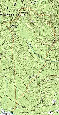
Route: Cabin Trail, Lawrence Trail, (Mt. Paugus South Peak), Old Paugus Trail, Big Rock Cave Trail, (Mt. Mexico), Big Rock Cave Trail, Cabin Trail
Confident that the mosquitoes in the area had subsided enough to make an attempt worthwhile, I headed over to the Wonalancet area for an afternoon hike.
The Cabin Trail was a fairly gradual walk. The footing was generally good with the exception of some areas of blowdowns. The only view of note was a little while after the Whitin Brook Trail junction, when I was able to take a look at the neat cliffs on the southwest side of Paugus.
Reaching the Lawrence Trail, it was even smoother sailing - the trail had been rebuilt a few years earlier, so it sported a generally excellent footbed with most steep areas ascended via switchbacks.
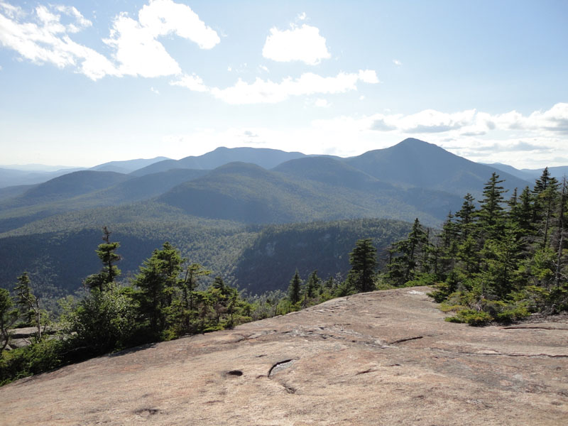
Reaching the summit of the south peak of Paugus (the highpoint is a bushwhack that I'm in no rush to repeat), I headed down about one hundred feet from the trail, pushing through some scrub to a tremendous viewpoint to the southwest.
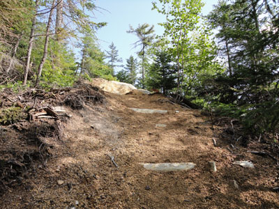
After checking out the views for awhile, I headed down the fittingly named Old Paugus Trail - there were some blowdowns and nasty ledges. One particular ledge, rather slimy, was not much fun to descend.
Eventually reaching the Big Rock Cave junction, I found the subsequent trail a bit tricky to follow due to a few blowdowns, faded blazes, and a lack of a footbed. After crossing Whitin Brook, it was much more prominent as it climbed up to the neat Big Rock Cave.
After passing the cave, I continued up the trail (a bit more gradual) as it passed over the wooded Mt. Mexico. Like Mt. Paugus, I had bushwhacked to the summit a prior time and had no desire to return (in this case, the bushwhack was fairly easy, but there was simply nothing to see).
Beyond the height of land, it was a quiet hike back to Route 113A.
| Hike Ratings |
|
Getting To Trailhead: |
Easy |
| Destination: |
Mt. Paugus (South Peak) |
|
Length: |
Moderate |
|
Steepness: |
Moderate |
|
Navigation: |
Easy |
|
Views: |
Excellent |
|
Crowds: |
Minimal |
| Destination: |
Mt. Mexico |
|
Length: |
Moderate |
|
Steepness: |
Difficult |
|
Navigation: |
Moderate |
|
Views: |
Minimal |
|
Crowds: |
Minimal |
|
| Hike Stats |
|
Date Hiked: |
Thursday, July 29, 2010 |
| Hike Commenced: |
3:15 PM |
| Parking Elevation: |
1,060' |
| Destination: |
Mt. Paugus (South Peak) |
| Ascent Commenced: |
3:15 PM |
| Summit Reached: |
5:02 PM |
| Time Elapsed: |
01:47 |
| Trailhead Elevation: |
1,060' |
| Summit Elevation: |
3,100' |
| Distance: |
3.9 miles |
| Vertical Gain: |
2,220' |
| Destination: |
Mt. Mexico |
| Ascent Commenced: |
5:15 PM |
| Summit Reached: |
6:39 PM |
| Time Elapsed: |
01:24 |
| Trailhead Elevation: |
3,100' |
| Summit Elevation: |
2,010' |
| Vertical Gain: |
420' |
|
|
| Hike Ended: |
7:09 PM |
| Hike Time Elapsed: |
03:54 |
| Hike Vertical Gain: |
2,680' |
|
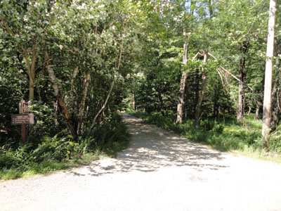
The Cabin Trail trailhead
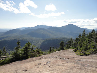
Looking at the western Sandwich Range from the ledges on the south peak of Mt. Paugus
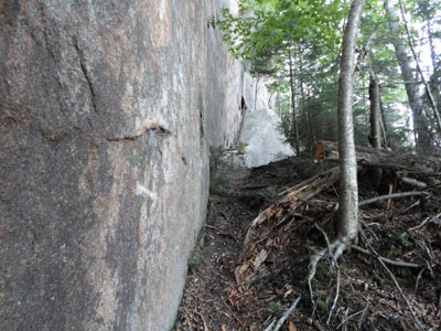
The Old Paugus Trail
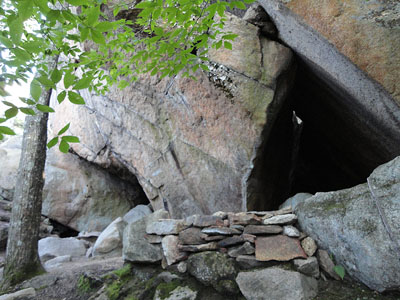
The Big Rock Cave on the northeast slope of Mt. Mexico

Directions to trailhead: Take Route 113A West from Tamworth. Just prior to arriving in Wonalancet village, the Cabin Trail follows a dirt road on the right. There is some room for parking on the left side of Route 113A West.
Back to Mt. Paugus (South Peak) Profile
Back to Mt. Mexico Profile
|