Home
States
Colorado
Connecticut
Maine
Massachusetts
New Hampshire
New York
Rhode Island
Utah
Vermont
View All
Lists
NE 4,000 Footers
NE 100 Highest
NH 4,000 Footers
NH 100 Highest
NH 52 With A View
NH Belknap Range
NH Ossipee 10
Links
Trail Conditions
Trip Log
Sunrises
Sunsets
About
|
Mt. Pemigewasset
Lincoln, NH
Trailheads, measurements, times, distances, and maps are all approximate and relative to the hike(s) as shown below.
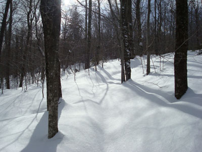
Looking up the Mt. Pemigewasset Trail
Route: Bike path, Mt. Pemigewasset Trail, (Mt. Pemigewasset), Mt. Pemigewasset Trail, bike path
After spending much of the week off my feet with a back/hip injury, I decided to get at least a little big of exercise. Weighing my options, I decided to do something that looked to be easy - maybe a grand or so of vertical and less than 4 miles of total distance. These requirements fit Mt. Pemigewasset perfectly - a peak that I had been intending to hike for awhile.
Arriving at the Flume Visitor Center, I navigated my way through the maze of parking lots to the northern most side. After suiting up, I headed up the snowmobile trail briefly, before hitting the Mt. Pemigewasset Trail.
The trail itself starts interestingly enough - three highway underpasses in rapid fire. After this, the trail starts rather gradually up the slope of the mountain, traversing to the north a bit.
My hip was getting a bit sore, but fortunately the trail was broken out - that is, until I passed just about the halfway point. After this, I was on my own - breaking trail all the way to the summit. The surface was about 3" of powder, on top of almost an inch of ice, on top of maybe half a foot of powder. Interesting combination!
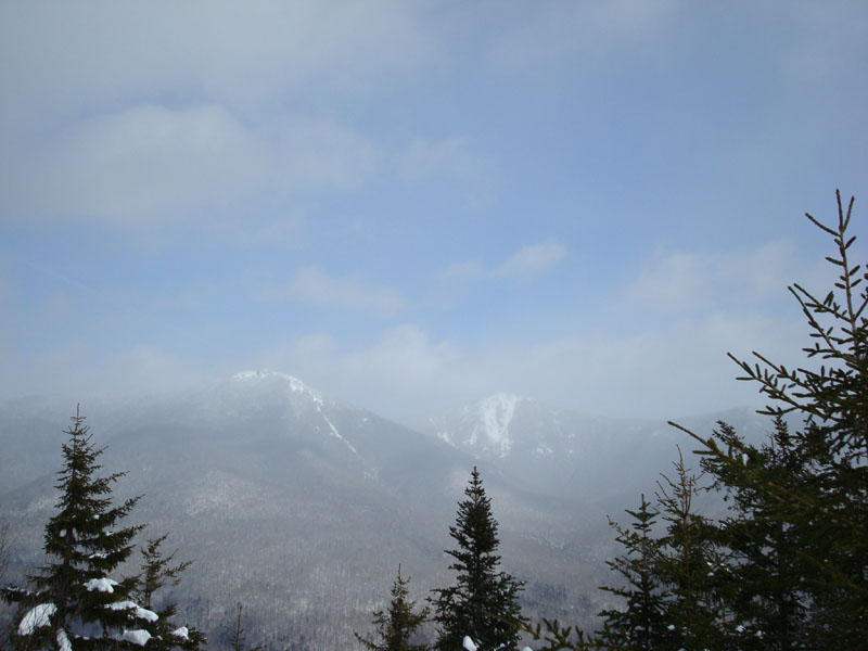
Arriving at the wide ledges near the summit, the views were hindered with nearby snow flurries. Nonetheless, I-93 past Lincoln was easily seen. The views from the summit area were a bit better, as some blue sky could be seen through the clouds above Mt. Liberty and Mt. Lincoln.
The descent was a bit easier as I wasn't breaking trail. By the time I reached the highway I was ready to call it a day, as my hip was getting a bit sore again. I wonder if I can get can an AARP card 20+ years early with my aging body.
| Hike Ratings |
|
Getting To Trailhead: |
Easy |
| Destination: |
Mt. Pemigewasset |
|
Length: |
Moderate |
|
Steepness: |
Moderate |
|
Navigation: |
Easy |
|
Views: |
Excellent |
|
Crowds: |
Minimal |
|
| Hike Stats |
|
Date Hiked: |
Saturday, February 16, 2008 |
| Hike Commenced: |
11:52 AM |
| Parking Elevation: |
1,350' |
| Destination: |
Mt. Pemigewasset |
| Ascent Commenced: |
11:54 AM |
| Summit Reached: |
1:02 PM |
| Time Elapsed: |
01:06 |
| Trailhead Elevation: |
1,370' |
| Summit Elevation: |
2,557' |
| Distance: |
1.8 miles |
| Vertical Gain: |
1,277' |
|
|
| Hike Ended: |
2:05 PM |
| Hike Time Elapsed: |
02:13 |
| Hike Distance: |
3.6 miles |
| Hike Vertical Gain: |
1,387' |
|
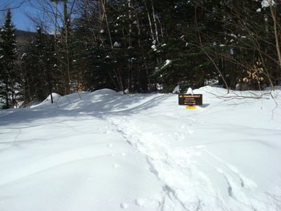
The Mt. Pemigewasset Trail trailhead on the bike path
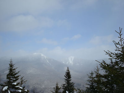
Looking at Mt. Liberty and Mt. Flume from the Mt. Pemigewasset summit
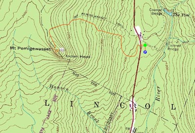

Directions to trailhead: Take Route 3 North to the Flume Visitor Center. The bike path to the trailhead is next to the furthest north row of parking spaces. Head north on the bike path - the Mt. Pemigewasset Trail trailhead is on the left shortly thereafter.
Back to Mt. Pemigewasset Profile
|