Home
States
Colorado
Connecticut
Maine
Massachusetts
New Hampshire
New York
Rhode Island
Utah
Vermont
View All
Lists
NE 4,000 Footers
NE 100 Highest
NH 4,000 Footers
NH 100 Highest
NH 52 With A View
NH Belknap Range
NH Ossipee 10
Links
Trail Conditions
Trip Log
Sunrises
Sunsets
About
|
Mt. Percival, Sawtooth, Mt. Morgan
Campton, NH, Holderness, NH
Trailheads, measurements, times, distances, and maps are all approximate and relative to the hike(s) as shown below.
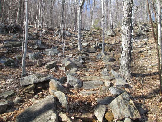
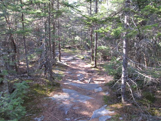
Looking up the Mt. Percival Trail
Route: Mt. Morgan Trail, Morse Trail, Mt. Percival Trail, Crawford-Ridgepole Trail, bushwhack, Crawford-Ridgepole Trail, Mt. Morgan Trail
Morse Trail and Mt. Percival trails were generally dry. Crawford Ridgepole Trail between the peaks was also generally dry with minor mud. Did the short bushwhack to the Sawtooth peak. A few potential highpoints (each with cairns). A little scrappy in places, but not bad, and only a few hundred feet south of the trail. Some directional views to be found as well.
Encountered ice on the upper Mt. Morgan Trail on either side of the upper Crawford Ridgepole Trail junction. Descended via the ladders, which was ice free (but not a recommended descent). No ice below there.
| Hike Ratings |
|
Getting To Trailhead: |
Easy |
| Destination: |
Mt. Percival |
|
Length: |
Moderate |
|
Steepness: |
Difficult |
|
Navigation: |
Easy |
|
Views: |
Excellent |
|
Crowds: |
Minimal |
| Destination: |
Sawtooth |
|
Length: |
Moderate |
|
Steepness: |
Difficult |
|
Navigation: |
Difficult |
|
Views: |
Excellent |
|
Crowds: |
Minimal |
| Destination: |
Mt. Morgan |
|
Length: |
Moderate |
|
Steepness: |
Difficult |
|
Navigation: |
Easy |
|
Views: |
Excellent |
|
Crowds: |
Minimal |
|
| Hike Stats |
|
Date Hiked: |
Tuesday, April 19, 2016 |
| Parking Elevation: |
810' |
| Destination: |
Mt. Percival |
| Time Elapsed: |
00:44 |
| Trailhead Elevation: |
820' |
| Summit Elevation: |
2,212' |
| Distance: |
2.2 miles |
| Vertical Gain: |
1,522' |
| Destination: |
Sawtooth |
| Time Elapsed: |
00:17 |
| Trailhead Elevation: |
2,212' |
| Summit Elevation: |
2,280' |
| Vertical Gain: |
138' |
| Destination: |
Mt. Morgan |
| Time Elapsed: |
00:10 |
| Trailhead Elevation: |
2,280' |
| Summit Elevation: |
2,220' |
| Vertical Gain: |
80' |
|
|
| Hike Time Elapsed: |
01:53 |
| Hike Vertical Gain: |
1,785' |
|
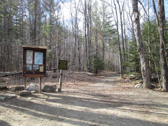
Mt. Morgan Trail trailhead
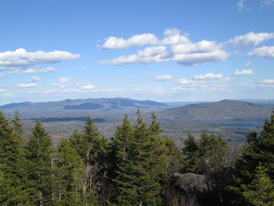
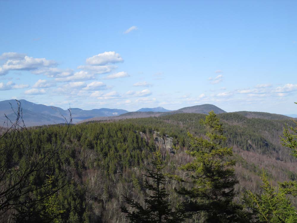
Looking at the Ossipees and Red Hill from Mt. Percival
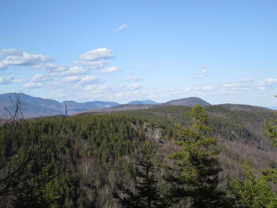
Crawford-Ridgepole trail from Mt. Percival toward Sawtooth
Looking at Mt. Chocorua from Sawtooth
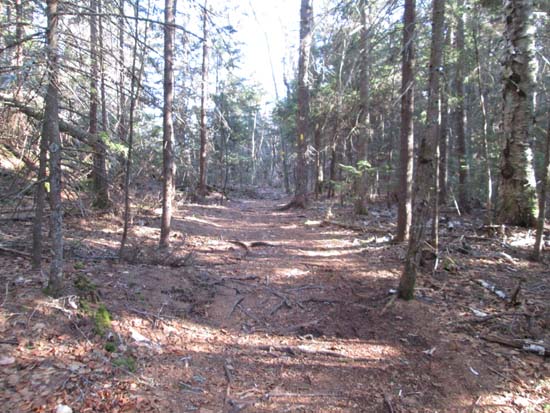
Crawford-Ridgepole Trail to Mt. Morgan
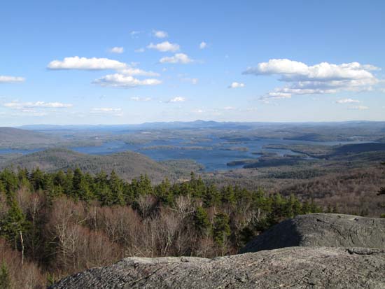
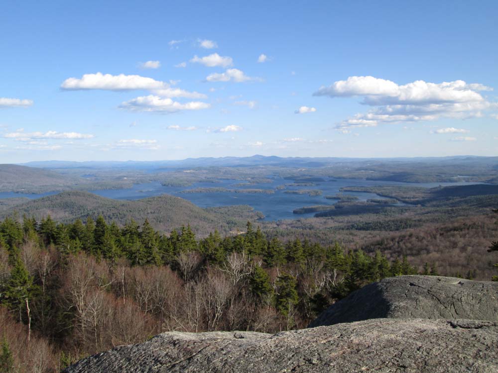
Squam Lake as seen from Mt. Morgan
Directions to trailhead: Mt. Morgan trailhead parking is located on Route 113, west of Sandwich, across from the Old Bridle Path (West Rattlensnake) lot.
Back to Mt. Percival Profile
Back to Sawtooth Profile
Back to Mt. Morgan Profile
|