Home
States
Colorado
Connecticut
Maine
Massachusetts
New Hampshire
New York
Rhode Island
Utah
Vermont
View All
Lists
NE 4,000 Footers
NE 100 Highest
NH 4,000 Footers
NH 100 Highest
NH 52 With A View
NH Belknap Range
NH Ossipee 10
Links
Trail Conditions
Trip Log
Sunrises
Sunsets
About
|
Mt. Pierce, Mt. Jackson
Bean's Grant, NH, Chandler's Purchase, NH, Sargent's Purchase, NH
Trailheads, measurements, times, distances, and maps are all approximate and relative to the hike(s) as shown below.
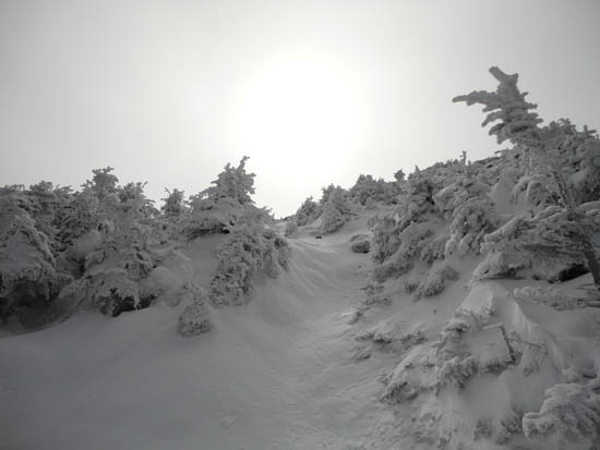
The Webster Cliff Trail near the summit of Mt. Pierce
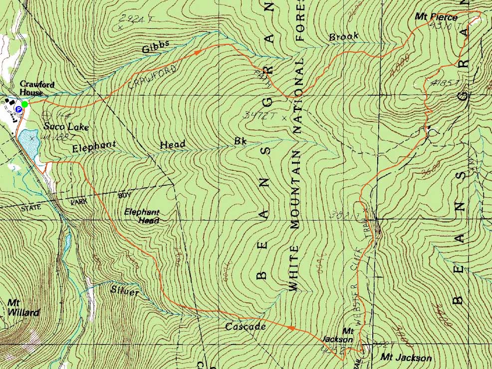
Route: Crawford Path, Webster Cliff Trail, (Mt. Pierce), Webster Cliff Trail, (Mt. Jackson), Webster-Jackson Trail
With decent weather forecasted and snow in the Presis, we decided to head to Crawford Notch. Starting on the Crawford Path, we donned snowshoes for the hike up to Mt. Pierce. A hardpacked base of snow was covered in about 2-3" of powder, resulting in good conditions.
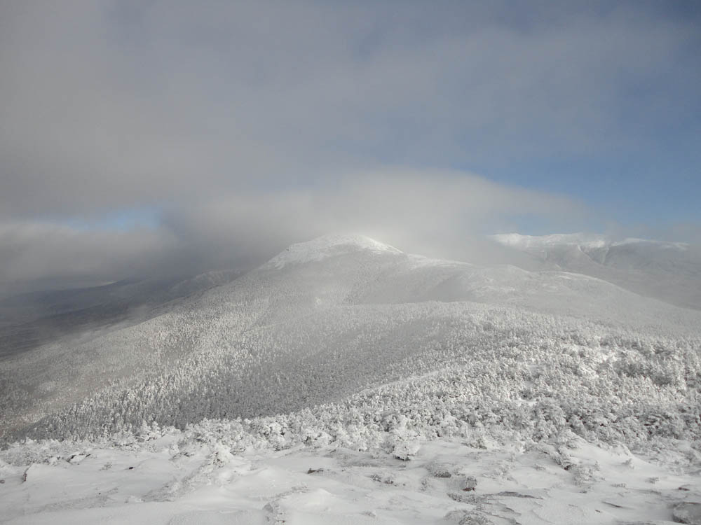
While there were views from Pierce, clouds were still trying to move out. With temperatures likely around zero, we didn't linger for long and were soon on our way to Mt. Jackson.
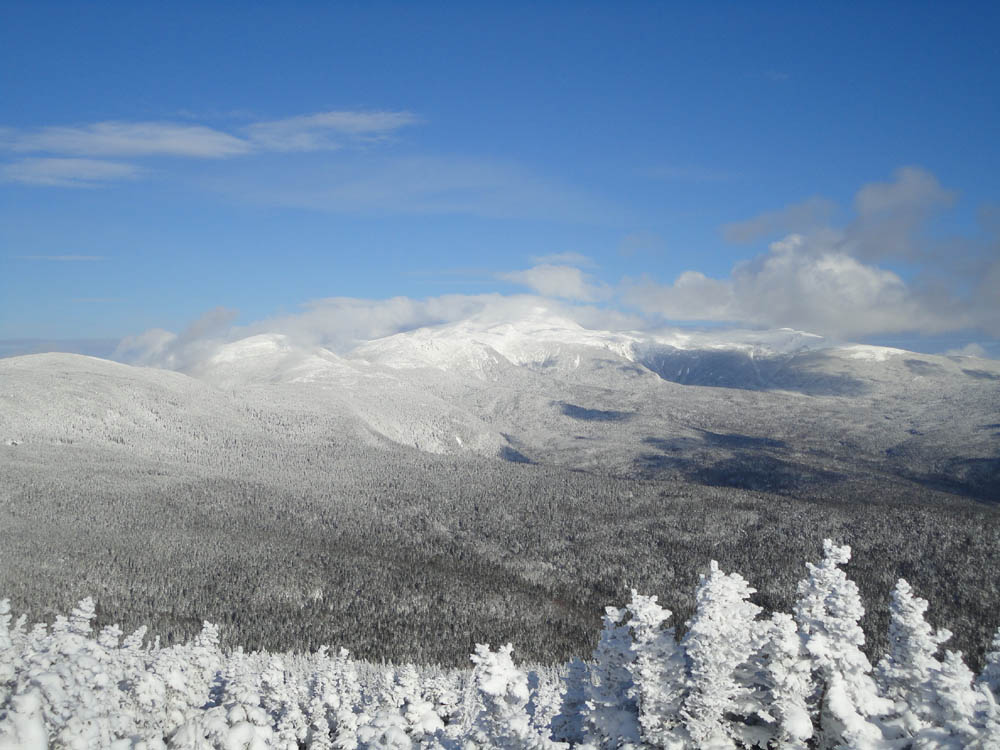
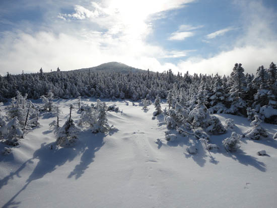
The stretch between the hut and Jackson had been largely untouched, resulting in a nice winter look. Upon reaching the summit of Mt. Jackson, we had much stronger views of the Presis than on Pierce, though nearby mountains such as Mt. Willey were still obscured by clouds.
We continued down the Webster-Jackson Trail in snowshoes for awhile, but eventually changed over to Microspikes, as the footbed had been largely barebooted by previous hikers (and there were plenty of rocks still sticking up above the snow).
| Hike Ratings |
|
Getting To Trailhead: |
Easy |
| Destination: |
Mt. Pierce |
|
Length: |
Moderate |
|
Steepness: |
Moderate |
|
Navigation: |
Easy |
|
Views: |
Excellent |
|
Crowds: |
Moderate |
| Destination: |
Mt. Jackson |
|
Length: |
Moderate |
|
Steepness: |
Difficult |
|
Navigation: |
Moderate |
|
Views: |
Excellent |
|
Crowds: |
Minimal |
|
| Hike Stats |
|
Date Hiked: |
Saturday, December 18, 2010 |
| Hike Commenced: |
8:20 AM |
| Parking Elevation: |
1,900' |
| Destination: |
Mt. Pierce |
| Ascent Commenced: |
8:20 AM |
| Summit Reached: |
10:17 AM |
| Time Elapsed: |
01:57 |
| Trailhead Elevation: |
1,910' |
| Summit Elevation: |
4,310' |
| Vertical Gain: |
2,420' |
| Destination: |
Mt. Jackson |
| Ascent Commenced: |
10:24 AM |
| Summit Reached: |
11:58 AM |
| Time Elapsed: |
01:34 |
| Trailhead Elevation: |
4,310' |
| Summit Elevation: |
4,052' |
| Vertical Gain: |
558' |
|
|
| Hike Ended: |
1:42 PM |
| Hike Time Elapsed: |
05:22 |
| Hike Vertical Gain: |
3,163' |
|
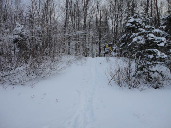
The Crawford Path trailhead on US 302
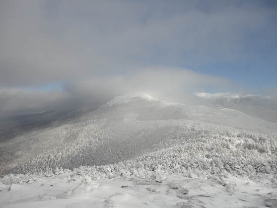
Mt. Eisenhower as seen from Mt. Pierce
The Webster Cliff Trail on the way to Mt. Jackson

Looking northeast from Mt. Jackson
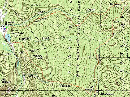

Directions to trailhead: Take Route 302 West from Bartlett into Carroll. The Highland Center parking lot is located on the left shortly after the Webster-Jackson trailhead (right). The Crawford Path trailhead is located just beyond the Highland Center parking lot, on the right.
Back to Mt. Pierce Profile
Back to Mt. Jackson Profile
|