Home
States
Colorado
Connecticut
Maine
Massachusetts
New Hampshire
New York
Rhode Island
Utah
Vermont
View All
Lists
NE 4,000 Footers
NE 100 Highest
NH 4,000 Footers
NH 100 Highest
NH 52 With A View
NH Belknap Range
NH Ossipee 10
Links
Trail Conditions
Trip Log
Sunrises
Sunsets
About
|
Mt. Randolph
Randolph, NH
Trailheads, measurements, times, distances, and maps are all approximate and relative to the hike(s) as shown below.

The overgrown Four Soldiers Path
Route: Four Soldiers Path, Crescent Ridge Trail, Underhill Path
Nice to explore in a new area, but probably a one and done due to the overgrown nature of the trails and minimal views (some manicuring could result in excellent views). I made the brilliant decision to wear shorts.
Four Soldiers Path from Pond of Safety Road to Crescent Ridge was unpleasant with mud hidden by grass/weeds. Clearcut area was hard to follow due to lack of blazes and no obvious path. Slab at contour at first, then there's a diagonal route into mixed woods. Didn't notice any blazes in this section for descent.
Crescent Ridge Trail was generally dry and a bit brushy in a few places.
Underhill Path was muddy and overgrown in the lower elevations, but better marked than Four Soldiers and generally in better condition.
Also did the short roadwalk down to Pond of Safety at the end, which was neat to see.
| Hike Ratings |
|
Getting To Trailhead: |
Easy |
| Destination: |
Mt. Randolph |
|
Length: |
Moderate |
|
Steepness: |
Difficult |
|
Navigation: |
Difficult |
|
Views: |
Moderate |
|
Crowds: |
Minimal |
|
| Hike Stats |
|
Date Hiked: |
Monday, July 30, 2012 |
| Parking Elevation: |
1,840' |
| Destination: |
Mt. Randolph |
| Time Elapsed: |
01:10 |
| Trailhead Elevation: |
2,180' |
| Summit Elevation: |
3,081' |
| Vertical Gain: |
1,101' |
|
|
| Hike Time Elapsed: |
2:31 |
| Hike Vertical Gain: |
1,501' |
|

Four Soldiers Path eastbound from Pond of Safety Road

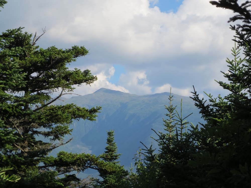
Slight views of Mt. Adams from near the summit of Mt. Randolph

Pond of Safety
Back to Mt. Randolph Profile
|