Home
States
Colorado
Connecticut
Maine
Massachusetts
New Hampshire
New York
Rhode Island
Utah
Vermont
View All
Lists
NE 4,000 Footers
NE 100 Highest
NH 4,000 Footers
NH 100 Highest
NH 52 With A View
NH Belknap Range
NH Ossipee 10
Links
Trail Conditions
Trip Log
Sunrises
Sunsets
About
|
Mt. Resolution, Mt. Parker
Hart's Location, NH, Hadley's Purchase, NH
Trailheads, measurements, times, distances, and maps are all approximate and relative to the hike(s) as shown below.
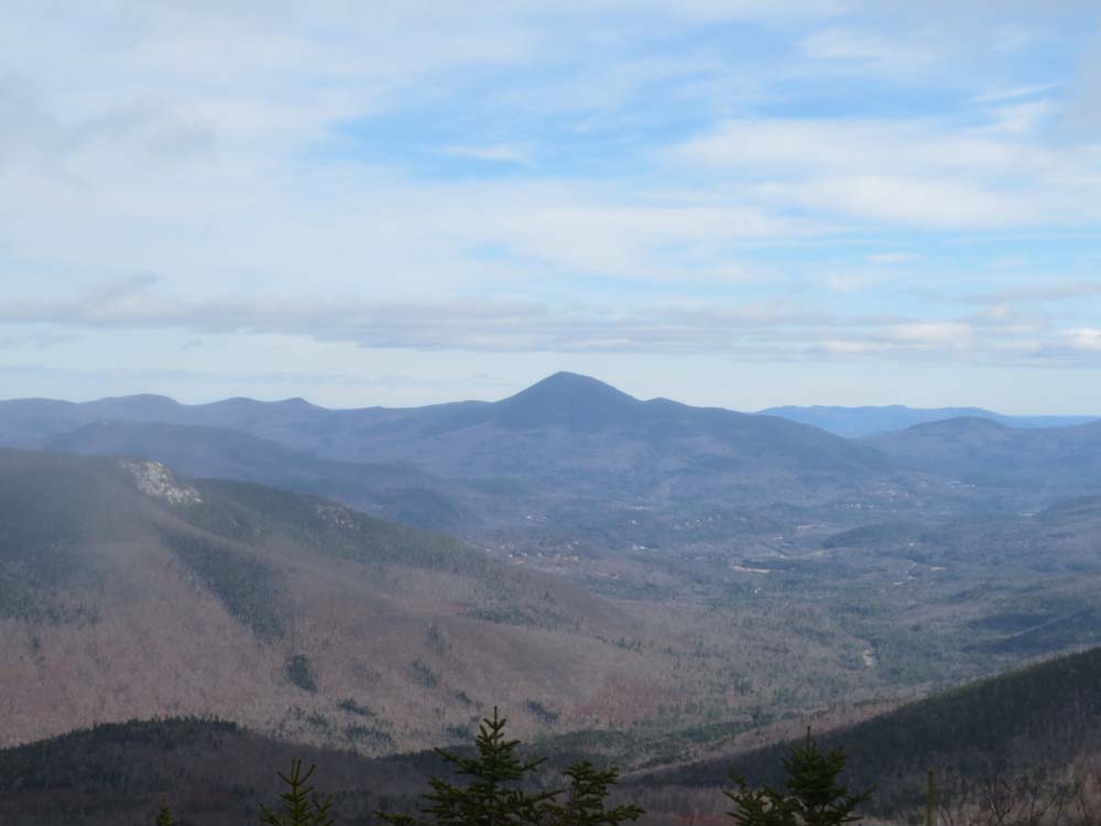
Looking at Mt. Crawford on the way to Mt. Resolution on the Davis Path
Route: Davis Path, Mt. Parker Trail, bushwhack, Mt. Parker Trail, Mt. Langdon Trail
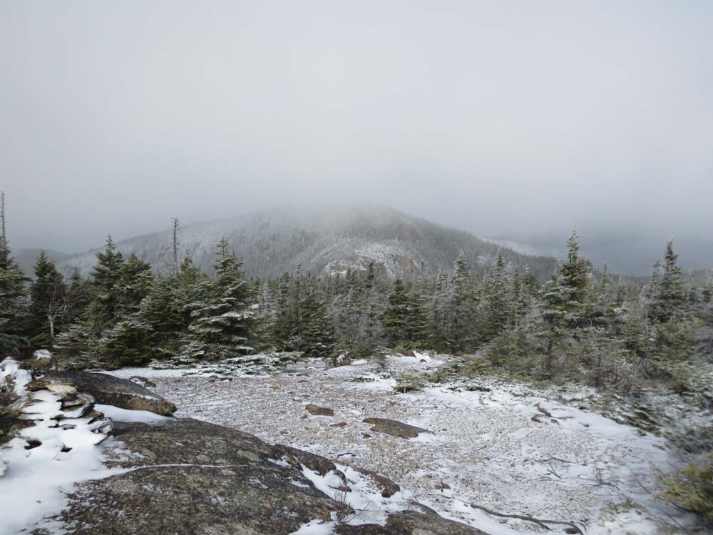
Snow/ice started perhaps halfway to thirds of the way up the Davis Path to the Crawford Dome spur. Due to icy ledges, bitter winds, and limited visibility, we skipped Crawford Dome and continued to the Mt. Parker Trail. This section had some isolated patches of ice, as well as some areas of mud and standing water. Ground was generally not frozen, though a few areas were setting up.
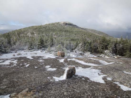
Some of the angle ledges on the side of Mt. Resolution on the Mt. Parker Trail had ice, making for tricky going. The bushwhack to the highpoint was unpleasant, due to bitter winds and wet/snowy woods. Limited views from the open summit area (highest point in my two visits seems to be a small tree with a cairn built into it) due to the blowing snow.
Generally a dusting of snow in the upper elevations (half inch max), with the ground not yet frozen. Wet going in places between the peaks due to a brushy corridor. Conditions were a little bit more tolerable on Mt. Parker, though still bitter and windy.
Walked back into fall on the way down from Mt. Parker, but had slow going due to slippery leaves. Once over Oak Ridge and out of the wilderness, one enters the year or so old logged area. Plenty of signs, so it should be generally easy to follow as the woods grow back in.
Mostly sunny forecast for this area never panned out. We never put on Microspikes, but some may have preferred them on a few of the icy ledge areas around Crawford Dome and Resolution for short stretches (especially if descending).
| Hike Ratings |
|
Getting To Trailhead: |
Easy |
| Destination: |
Mt. Resolution |
|
Length: |
Moderate |
|
Steepness: |
Difficult |
|
Navigation: |
Difficult |
|
Views: |
Excellent |
|
Crowds: |
Minimal |
| Destination: |
Mt. Parker |
|
Length: |
Moderate |
|
Steepness: |
Moderate |
|
Navigation: |
Moderate |
|
Views: |
Excellent |
|
Crowds: |
Minimal |
|
| Hike Stats |
|
Date Hiked: |
Sunday, November 4, 2012 |
| Parking Elevation: |
995' |
| Destination: |
Mt. Resolution |
| Time Elapsed: |
02:52 |
| Trailhead Elevation: |
995' |
| Summit Elevation: |
3,415' |
| Vertical Gain: |
2,745' |
| Destination: |
Mt. Parker |
| Time Elapsed: |
02:13 |
| Trailhead Elevation: |
3,415' |
| Summit Elevation: |
3,004' |
| Vertical Gain: |
604' |
|
|
| Hike Time Elapsed: |
7:19 |
| Hike Vertical Gain: |
3,729' |
|
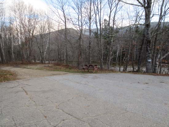
The Davis Path trailhead
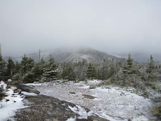
Looking at Stairs Mountain from Mt. Resolution
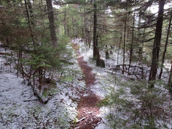
The Mt. Parker Trail between Mt. Resolution and Mt. Parker
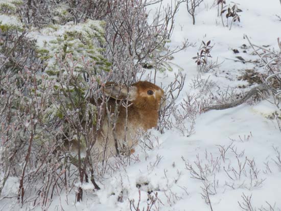
A not so well hidden bunny near Mt. Resolution
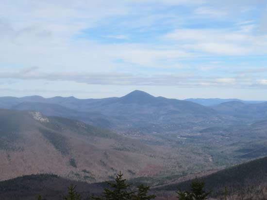
Looking at the Iron Mountain ledges and Kearsarge North Mountain from Mt. Parker
Directions to trailhead: Take Route 302 West from Bartlett. The Davis Path parking lot and trailhead will be on the right.
Back to Mt. Resolution Profile
Back to Mt. Parker Profile
|