Home
States
Colorado
Connecticut
Maine
Massachusetts
New Hampshire
New York
Rhode Island
Utah
Vermont
View All
Lists
NE 4,000 Footers
NE 100 Highest
NH 4,000 Footers
NH 100 Highest
NH 52 With A View
NH Belknap Range
NH Ossipee 10
Links
Trail Conditions
Trip Log
Sunrises
Sunsets
About
|
Mt. Roberts, Black Snout, Faraway Mountain
Moultonborough, NH, Tamworth, NH
Trailheads, measurements, times, distances, and maps are all approximate and relative to the hike(s) as shown below.
Looking down the Mt. Roberts Trail
Route: Herd path, Mt. Roberts Trail, High Ridge Trail, bushwhack, (Black Snout), bushwhack, (Faraway Mountain), access road, Faraway Mountain Trail, ski trail, Cold Spring Trail, herd path, Cold Spring Road
Cut across the non-electrified pasture to hop onto the old carriage road that connects to the Mt. Roberts Trail (picked up at the top of the pasture, where fence slats are down). Mt. Roberts trail had very little snow - maybe 2" max through the ledges. Appears that a good portion of it may have melted during the rain a week ago. We tortured our snowshoes, but could have probably barebooted it as others had been (but perhaps light traction would have been good too).
Probably a good 6" of snow on the High Ridge Trail. We stuck with it until just passing the first swamp, where we hopped into the woods between the two swamps and cut around Faraway Mountain. Generally decent woods, though some hobblebush lived up to its name. Nice views, including Mt. Washington, from the communication tower site atop the peak north of Faraway. Didn't look around too much, but didn't observe any sort of access road to it.
As shown on the Trail Bandit map, the logging road crossing in the next col is barely noticeable. But, there was breakable ice over water, so it took some care to cut around it.
We then climbed up to the next unnamed peak, then headed northwest on the ridge to Black Snout in generally open hardwoods. Quite pleasantly surprised with this summit, as a birch glade bumps up to the summit on the north and east sides, resulting in far reaching, partially obstructed views with the leaves down, including Mt. Washington, Pleasant Mountain, and Green Mountain. About 2.5 miles of bushwhacking to get here.
We generally retraced our steps back to the north peak of Faraway. After reaching the col, we cut east and headed to Faraway, occasionally hitting blowdown and thicker hobblebush. Cutting further east appeared to be helpful. The views from Faraway aren't as good as a few years back due to tree growth, but there are still some slight views. We then picked up the tower access road on the southeast side of the clearing and followed this out to the High Ridge Trail, which we then followed south to the Faraway viewpoint.
Just past this, we hopped into open woods and headed downhill, quickly picking up a ski trail. This emptied onto the Faraway Mountain Trail at a switchback, then departed and cut down to the Cold Spring Trail. Good snowshoeing conditions with about 4" of snowpack (frozen granular base with a couple inches of powder on top).
We then took the Cold Spring Trail briefly, then dropped onto the herd path that heads down to the water facility, at which point we barebooted the plowed road.
| Hike Ratings |
|
Getting To Trailhead: |
Easy |
| Destination: |
Mt. Roberts |
|
Length: |
Moderate |
|
Steepness: |
Moderate |
|
Navigation: |
Easy |
|
Views: |
Excellent |
|
Crowds: |
Minimal |
| Destination: |
Black Snout |
|
Length: |
Moderate |
|
Steepness: |
Moderate |
|
Navigation: |
Difficult |
|
Views: |
Excellent |
|
Crowds: |
Minimal |
| Destination: |
Faraway Mountain |
|
Length: |
Moderate |
|
Steepness: |
Moderate |
|
Navigation: |
Difficult |
|
Views: |
Minimal |
|
Crowds: |
Minimal |
|
| Hike Stats |
|
Date Hiked: |
Sunday, January 17, 2016 |
| Parking Elevation: |
1,240' |
| Destination: |
Mt. Roberts |
| Time Elapsed: |
01:12 |
| Trailhead Elevation: |
1,250' |
| Summit Elevation: |
2,582' |
| Vertical Gain: |
1,407' |
| Destination: |
Black Snout |
| Time Elapsed: |
02:41 |
| Trailhead Elevation: |
2,582' |
| Summit Elevation: |
2,689' |
| Vertical Gain: |
657' |
| Destination: |
Faraway Mountain |
| Time Elapsed: |
01:46 |
| Trailhead Elevation: |
2,582' |
| Summit Elevation: |
2,782' |
| Vertical Gain: |
593' |
|
|
| Hike Time Elapsed: |
07:19 |
| Hike Vertical Gain: |
2,707' |
|
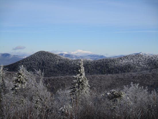
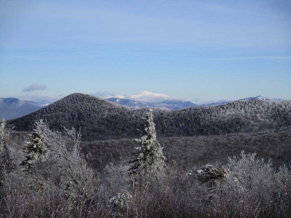
Looking at the Black Snout, Mt. Washington, and Mt. Chocorua from the Mt. Roberts summit.
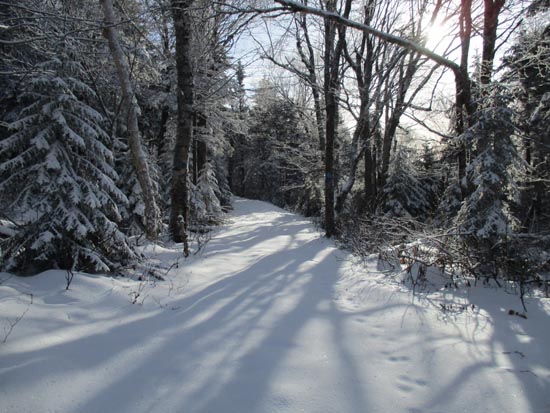
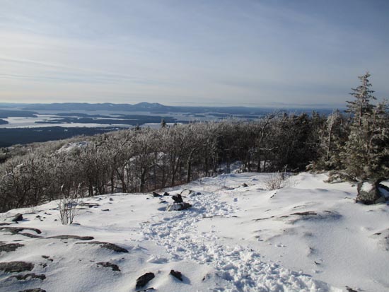
The High Ridge Trail
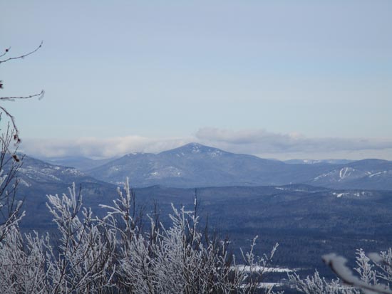
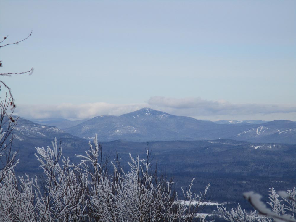
Looking at Kearsarge North from near the summit of Black Snout
Bushwhacking between Black Snout and Faraway Mountain

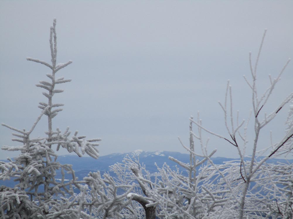
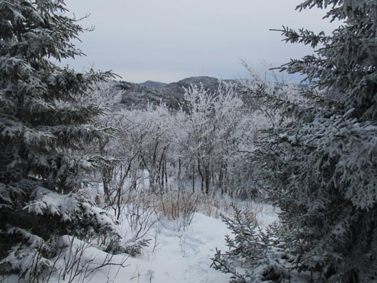
Slight views of Cardigan from Faraway Mountain
Directions to trailhead: Take Route 109 South from Route 25. Bear left onto Route 171. Shortly thereafter, take a left onto Ossipee Park Road. The small hiker parking lot is located just after the gatehouse, on the right. Continue on the road on foot, taking a left at the intersection. The Mt. Roberts Trail trailhead is located at the corner of the field near the barn.
Back to Mt. Roberts Profile
Back to Black Snout Profile
Back to Faraway Mountain Profile
|