Home
States
Colorado
Connecticut
Maine
Massachusetts
New Hampshire
New York
Rhode Island
Utah
Vermont
View All
Lists
NE 4,000 Footers
NE 100 Highest
NH 4,000 Footers
NH 100 Highest
NH 52 With A View
NH Belknap Range
NH Ossipee 10
Links
Trail Conditions
Trip Log
Sunrises
Sunsets
About
|
Mt. Tecumseh (West Peak), Mt. Tecumseh
Waterville Valley, NH
Trailheads, measurements, times, distances, and maps are all approximate and relative to the hike(s) as shown below.
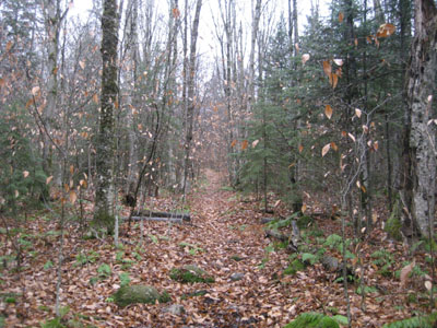
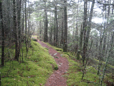
Looking up the Mt. Tecumseh Trail on a gloomy day
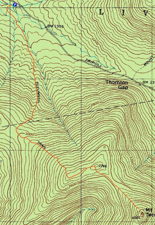
Route: Mt. Tecumseh Trail, (West Tecumseh), Mt. Tecumseh Trail, (Mt. Tecumseh), Mt. Tecumseh Trail, (West Tecumseh), Mt. Tecumseh Trail
Since it was looking like the weekend, much like the week preceeding it, would be a washout, I decided to do a relatively local 4,000 footer for some exercise.
While Tripoli Road had a sign saying it was closed November-May, it was fortunately still open as I made my way to the Tecumseh trailhead. Not surprisingly, I didn't see any other vehicles at either this trailhead or as I passed the Osceola parking area.
Fortunately, the brook crossings weren't too bad (maybe an inch of water over some of the rocks). Other than a few short muddy spots down low, the Mt. Tecumseh Trail was in surprisingly decent shape considering the wet weather - that is, other than blowdowns. I was surprised to see the trail littered with downed trees and branches - it wasn't this bad a few months earlier!
While the forecast the day before had said a 20% chance of rain before mid morning, the odds seemed to be in the favor of the rain. Nonetheless, I didn't get overly wet.
This time, I think I found the supposed highpoint of West Tecumseh (the trail takes a dip after running the fairly flat ridge, before climbing again to another height of land with an increasingly-obscure herd path to the right...though I question if this is really the highpoint, or if so, by how much as compared to another area to the left of the trail along the ridge).
From there, the trail dropped fairly steeply into the col, before climbing fairly steeply back out, along some rocky terrain (a little bit slippery in the rain).
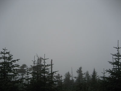
Like West Tecumseh, there wasn't anything to see but cloud from the Mt. Tecumseh summit.
On the way back, I went on blowdown patrol and was able to cut and/or remove most of them (save for two or three larger ones). Not a particularly memorable hike, but nonetheless it was nice to get some exercise.
| Hike Ratings |
|
Getting To Trailhead: |
Easy |
| Destination: |
Mt. Tecumseh (West Peak) |
|
Length: |
Moderate |
|
Steepness: |
Difficult |
|
Navigation: |
Easy |
|
Views: |
Minimal (due to weather) |
|
Crowds: |
Minimal |
| Destination: |
Mt. Tecumseh |
|
Length: |
Moderate |
|
Steepness: |
Difficult |
|
Navigation: |
Easy |
|
Views: |
Minimal (due to weather) |
|
Crowds: |
Minimal |
|
| Hike Stats |
|
Date Hiked: |
Saturday, November 8, 2008 |
| Hike Commenced: |
7:35 AM |
| Parking Elevation: |
1,820' |
| Destination: |
Mt. Tecumseh (West Peak) |
| Ascent Commenced: |
7:35 AM |
| Summit Reached: |
8:47 AM |
| Time Elapsed: |
01:12 |
| Trailhead Elevation: |
1,820' |
| Summit Elevation: |
3,766' |
| Vertical Gain: |
1,996' |
| Destination: |
Mt. Tecumseh |
| Ascent Commenced: |
8:47 AM |
| Summit Reached: |
9:08 AM |
| Time Elapsed: |
00:21 |
| Trailhead Elevation: |
3,766' |
| Summit Elevation: |
4,003' |
| Vertical Gain: |
393' |
|
|
| Hike Ended: |
11:29 AM |
| Hike Time Elapsed: |
03:54 |
| Hike Distance: |
6.2 miles |
| Hike Vertical Gain: |
2,615' |
|
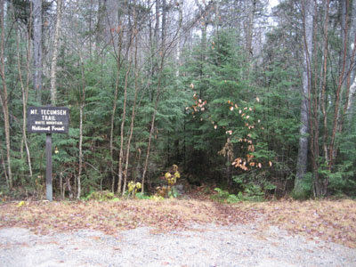
The Mt. Tecumseh Trail trailhead
Looking suspended moisture from the West Tecumseh vista
The Mt. Tecumseh Trail between the peaks
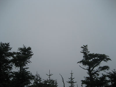
Looking at all sorts of nothing from the Mt. Tecumseh vista
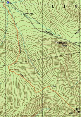

Directions to trailhead: Take Route 49 into Waterville Valley. Take a left onto Tripoli Road, bear right at a junction near the ski area, continue past the height of land. The Mt. Tecumseh Trail trailhead and WMNF fee parking area will be a few minutes down the road on the left.
Back to Mt. Tecumseh (West Peak) Profile
Back to Mt. Tecumseh Profile
|