Home
States
Colorado
Connecticut
Maine
Massachusetts
New Hampshire
New York
Rhode Island
Utah
Vermont
View All
Lists
NE 4,000 Footers
NE 100 Highest
NH 4,000 Footers
NH 100 Highest
NH 52 With A View
NH Belknap Range
NH Ossipee 10
Links
Trail Conditions
Trip Log
Sunrises
Sunsets
About
|
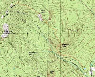
Nickerson Ledge, Carter Ledge, Middle Sister
Albany, NH
Trailheads, measurements, times, distances, and maps are all approximate and relative to the hike(s) as shown below.
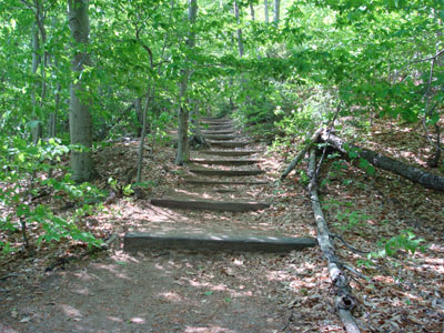
Looking up the Piper Trail on the way to Nickerson Ledge
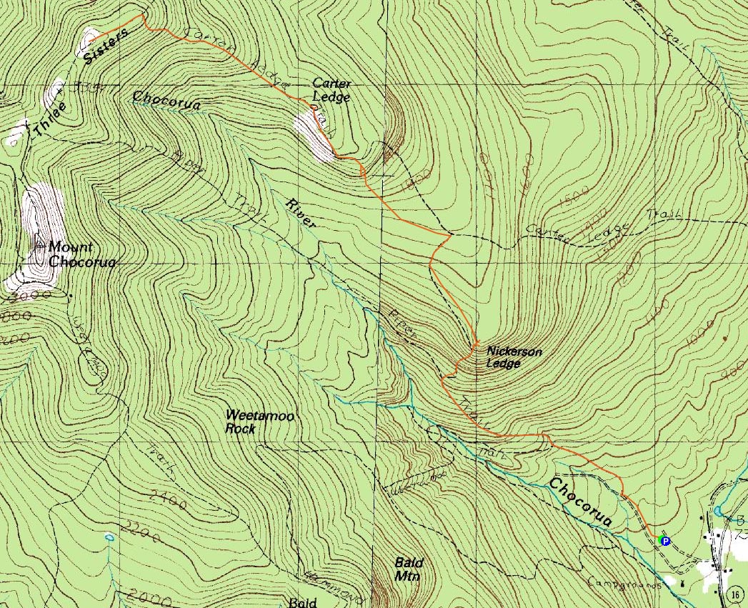
Route: Piper Trail, Nickerson Ledge Trail, (Nickerson Ledge), Nickerson Ledge Trail, Carter Ledge Trail, (Carter Ledge), Carter Ledge Trail, Middle Sister Trail, (Middle Sister), Middle Sister Trail, Carter Ledge Trail, (Carter Ledge), Carter Ledge Trail, Nickerson Ledge Trail, (Nickerson Ledge), Nickerson Ledge Trail, Piper Trail
Since the weekend weather forecast wasn't looking that great, I decided to try to do a decent sized hike or two after work. On this day, I decided to stay close to home.
Arriving at a nearly empty Piper Trail parking lot, I quickly was on my way, not enjoying the somewhat hot weather. After taking the mostly gradual section of the Piper Trail, I took a right and headed up the steep Nickerson Ledge Trail to Nickerson Ledge. The views were good, though a bit hazy.
Since I had a lot more hiking left to do, I quickly continued up the Nickerson Ledge Trail, a gradual ascent at this point. After joining the Carter Ledge Trail and dipping a bit, things steepened up quickly, eventually leading to a dirt slide. It seemed like the trail disappeared at this point, so I did a quasi bushwack up to the top of the ridge, and back to the trail.
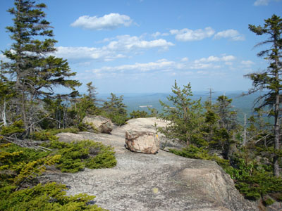
I found the long ledge walks and excellent views from the highpoint of Carter Ledge to be very enjoyable. In particular, seeing the area between Carter Ledge and White Ledge was new to me, as it tends to be obstructed from Chocorua and Middle Sister.
After spending a few minutes enjoying the views, I continued up the Carter Ledge Trail, ascending steeply to the Middle Sister Trail. From there, the walk was a bit more gradual, passing by Third Sister and reaching Middle Sister shortly thereafter.
The strong breeze on Middle Sister was much appreciated in the warm weather. One of my favorite local viewpoints, I spent a good fifteen minutes taking in the sights.
The ascent down to Carter Ledge took a bit longer than I had planned - a porcupine was slowly heading down the trail and didn't seem to care that I wanted to get through. Finally, after a few minutes, he (she?) headed into the bushes.
With the exception of the last few minutes of the hike (the wet portion of the Piper Trail), the bugs were not bad at all.
| Hike Ratings |
|
Getting To Trailhead: |
Easy |
| Destination: |
Nickerson Ledge |
|
Length: |
Moderate |
|
Steepness: |
Difficult |
|
Navigation: |
Easy |
|
Views: |
Excellent |
|
Crowds: |
Minimal |
| Destination: |
Carter Ledge |
|
Length: |
Moderate |
|
Steepness: |
Difficult |
|
Navigation: |
Moderate |
|
Views: |
Excellent |
|
Crowds: |
Minimal |
| Destination: |
Middle Sister |
|
Length: |
Moderate |
|
Steepness: |
Very Difficult |
|
Navigation: |
Easy |
|
Views: |
Excellent |
|
Crowds: |
Minimal |
|
| Hike Stats |
|
Date Hiked: |
Thursday, May 29, 2008 |
| Hike Commenced: |
3:19 PM |
| Parking Elevation: |
780' |
| Destination: |
Nickerson Ledge |
| Ascent Commenced: |
3:19 PM |
| Summit Reached: |
3:52 PM |
| Time Elapsed: |
00:33 |
| Trailhead Elevation: |
780' |
| Summit Elevation: |
1,670' |
| Distance: |
1.4 miles |
| Vertical Gain: |
910' |
| Destination: |
Carter Ledge |
| Ascent Commenced: |
3:52 PM |
| Summit Reached: |
4:33 PM |
| Time Elapsed: |
00:41 |
| Trailhead Elevation: |
1,670' |
| Summit Elevation: |
2,420' |
| Distance: |
1.4 miles |
| Vertical Gain: |
850' |
| Destination: |
Middle Sister |
| Ascent Commenced: |
4:36 PM |
| Summit Reached: |
5:12 PM |
| Time Elapsed: |
00:36 |
| Trailhead Elevation: |
2,420' |
| Summit Elevation: |
3,340' |
| Distance: |
1.2 miles |
| Vertical Gain: |
980' |
|
|
| Hike Ended: |
7:40 PM |
| Hike Time Elapsed: |
04:21 |
| Hike Distance: |
8 miles |
| Hike Vertical Gain: |
2,910' |
|
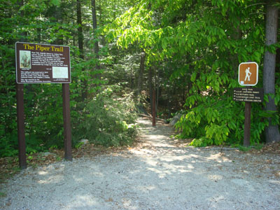
Piper Trail trailhead
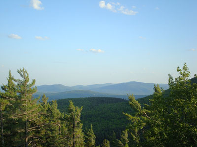
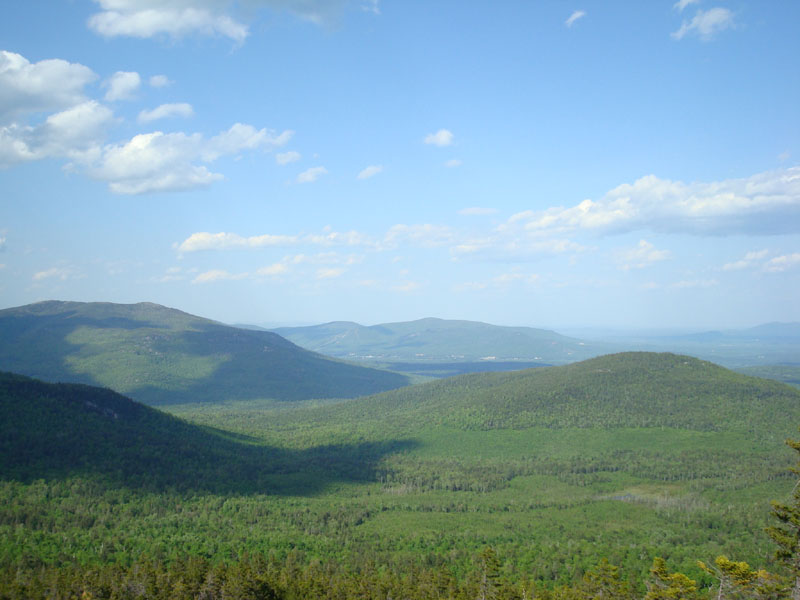
Looking south at the Mt. Whittier ski area (Nickerson Mountain) and the real Mt. Whittier from Nickerson Ledge
Looking down the Carter Ledge Trail near Carter Ledge

Looking at the backside of White Ledge and at the Green Hills from the top of Carter Ledge
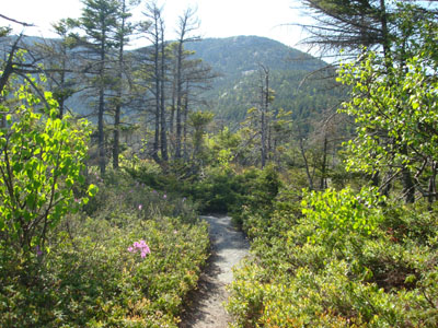
Looking up the Carter Ledge Trail on the way to Middle Sister
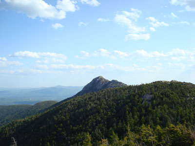
Looking at Mt. Chocorua from the Middle Sister summit

Directions to trailhead: Take Route 16 North from Tamworth. The Piper Trail WMNF sign is on the left, immediately after a general store. The WMNF fee parking area is about a minute or off Route 16. The Piper Trail trailhead is at the back corner of the parking lot.
Back to Nickerson Ledge Profile
Back to Carter Ledge Profile
Back to Middle Sister Profile
|