Home
States
Colorado
Connecticut
Maine
Massachusetts
New Hampshire
New York
Rhode Island
Utah
Vermont
View All
Lists
NE 4,000 Footers
NE 100 Highest
NH 4,000 Footers
NH 100 Highest
NH 52 With A View
NH Belknap Range
NH Ossipee 10
Links
Trail Conditions
Trip Log
Sunrises
Sunsets
About
|
North Sugarloaf, Middle Sugarloaf
Bethlehem, NH
Trailheads, measurements, times, distances, and maps are all approximate and relative to the hike(s) as shown below.
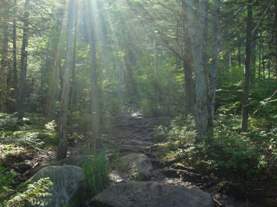
Looking up the Sugarloaf Trail
Route: Trestle Trail, Sugarloaf Trail, (North Sugarloaf viewpoint), Sugarloaf Trail, (Middle Sugarloaf), Sugarloaf Trail, Trestle Trail
With a less than optimal forecast for clouds and rain, I saw a better day on the radar and satellite, so I decided to head up to Mt. Hale for a hike. Dealing with some back pain and seeing fairly nice weather, I turned around just before the Mt. Hale trailhead and decided to give the Sugarloaves a try.
The Trestle Trail was fairly easy going - a short, fairly level riverside walk. Soon, the Sugarloaf Trail branched left. The first portion of this trail was somewhat muddy, though there were plenty of little herd paths around the messy sections.
Soon, the trail started to rise somewhat steeply, arriving at the ridge after awhile. I decided to go to the lower peak, North Sugarloaf, first.
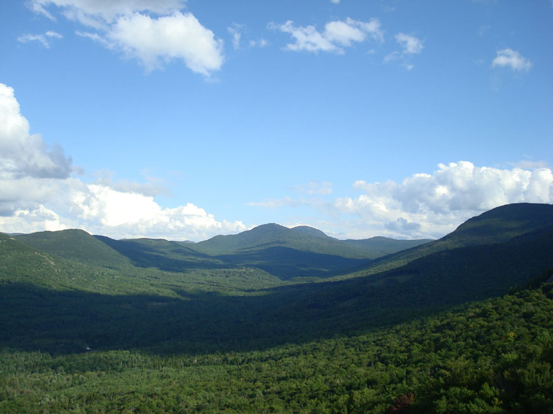
The trail dropped down a bit, then climbed up again, arriving at a nice viewpoint. While I was skeptical of this being the summit, I didn't see any evidence of the trail continuing. Had I researched this hike (rather than doing it as a spur of the moment thing), I would have known that I was a bit below the summit, which was apparently a little bit south. Nonetheless, the directional views from the ledge were excellent.
My second stop was Middle Sugarloaf. Back at the junction, the trail started off gradually, before ascending somewhat steeply in a few sections (including a stairway).
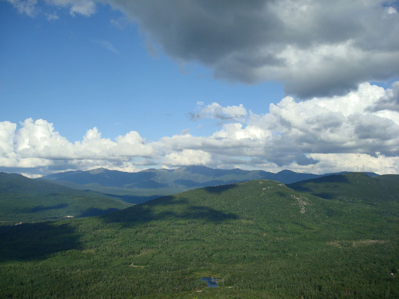
The vast ledgy summit featured excellent views in nearly all directions - I couldn't help but hang out for awhile and take in the views under partly sunny skies.
A botched weather forecast in my favor!
| Hike Ratings |
|
Getting To Trailhead: |
Easy |
| Destination: |
North Sugarloaf |
|
Length: |
Moderate |
|
Steepness: |
Moderate |
|
Navigation: |
Moderate |
|
Views: |
Excellent |
|
Crowds: |
Minimal |
| Destination: |
Middle Sugarloaf |
|
Length: |
Moderate |
|
Steepness: |
Difficult |
|
Navigation: |
Easy |
|
Views: |
Excellent |
|
Crowds: |
Minimal |
|
| Hike Stats |
|
Date Hiked: |
Thursday, August 14, 2008 |
| Hike Commenced: |
4:34 PM |
| Parking Elevation: |
1,644' |
| Destination: |
North Sugarloaf |
| Ascent Commenced: |
4:35 PM |
| View Ledge Reached: |
5:06 PM |
| Time Elapsed: |
00:31 |
| Trailhead Elevation: |
1,644' |
| Ledge Elevation: |
2,300' |
| Vertical Gain: |
716' |
| Destination: |
Middle Sugarloaf |
| Ascent Commenced: |
5:10 PM |
| Summit Reached: |
5:33 PM |
| Time Elapsed: |
00:23 |
| Trailhead Elevation: |
2,300' |
| Summit Elevation: |
2,539' |
| Vertical Gain: |
419' |
|
|
| Hike Ended: |
6:26 PM |
| Hike Time Elapsed: |
01:52 |
| Hike Vertical Gain: |
1,205' |
|
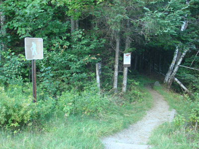
The Trestle Trail trailhead on Zealand Road
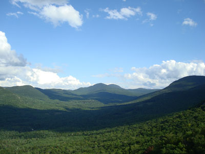
Looking at Mt. Tom and Mt. Field from near the North Sugarloaf summit
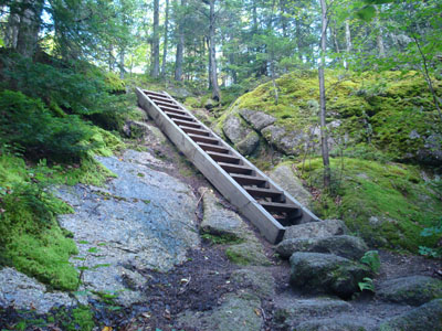
Looking up the Sugarloaf Trail near the Middle Sugarloaf summit

Looking at the Presidentials from near the Middle Sugarloaf summit
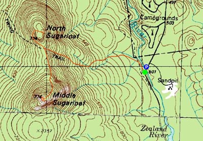

Directions to trailhead: From Bretton Woods, take Route 302 West, then take a left onto Zealand Road. The parking area for the Sugarloaf Trail is on the right shortly after the campground, just before a bridge. The Trestle Trail trailhead is just after the bridge on the left.
Back to North Sugarloaf Profile
Back to Middle Sugarloaf Profile
|