Home
States
Colorado
Connecticut
Maine
Massachusetts
New Hampshire
New York
Rhode Island
Utah
Vermont
View All
Lists
NE 4,000 Footers
NE 100 Highest
NH 4,000 Footers
NH 100 Highest
NH 52 With A View
NH Belknap Range
NH Ossipee 10
Links
Trail Conditions
Trip Log
Sunrises
Sunsets
About
|
North Sugarloaf, Middle Sugarloaf
Bethlehem, NH
Trailheads, measurements, times, distances, and maps are all approximate and relative to the hike(s) as shown below.
The Sugarloaf Trail
Route: Trestle Trail, Sugarloaf Trail, (North Sugarloaf), Sugarloaf Trail, (Middle Sugarloaf), Sugarloaf Trail, Trestle Trail
Trails were mostly dry and in good shape. A few black flies around sunset, but never too bad.
| Hike Ratings |
|
Getting To Trailhead: |
Easy |
| Destination: |
North Sugarloaf |
|
Length: |
Moderate |
|
Steepness: |
Moderate |
|
Navigation: |
Easy |
|
Views: |
Excellent |
|
Crowds: |
Minimal |
| Destination: |
Middle Sugarloaf |
|
Length: |
Moderate |
|
Steepness: |
Difficult |
|
Navigation: |
Easy |
|
Views: |
Excellent |
|
Crowds: |
Minimal |
|
| Hike Stats |
|
Date Hiked: |
Tuesday, June 18, 2013 |
| Parking Elevation: |
1,644' |
| Destination: |
North Sugarloaf |
| Time Elapsed: |
00:23 |
| Trailhead Elevation: |
1,644' |
| Summit Elevation: |
2,310' |
| Distance: |
1.2 miles |
| Vertical Gain: |
726' |
| Destination: |
Middle Sugarloaf |
| Time Elapsed: |
00:16 |
| Trailhead Elevation: |
2,300' |
| Summit Elevation: |
2,539' |
| Distance: |
0.8 miles |
| Vertical Gain: |
419' |
|
|
| Hike Time Elapsed: |
02:02 |
| Hike Distance: |
3.4 miles |
| Hike Vertical Gain: |
1,215' |
|
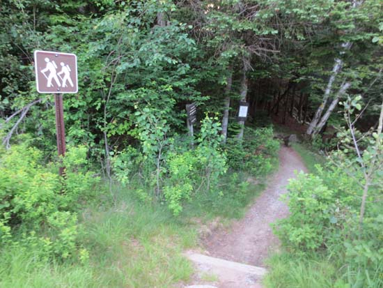
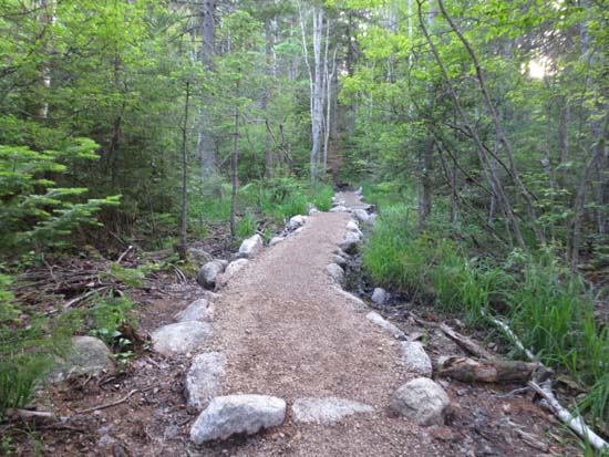
The Trestle Trail trailhead on Zealand Road
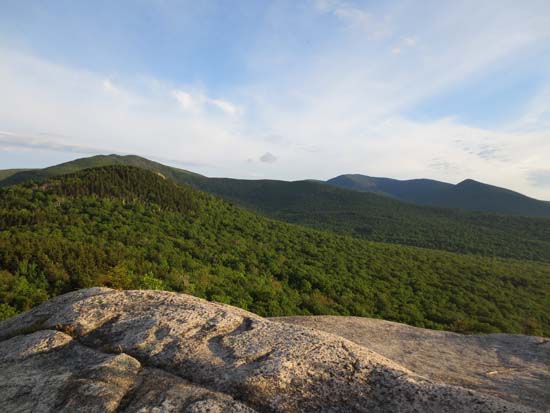
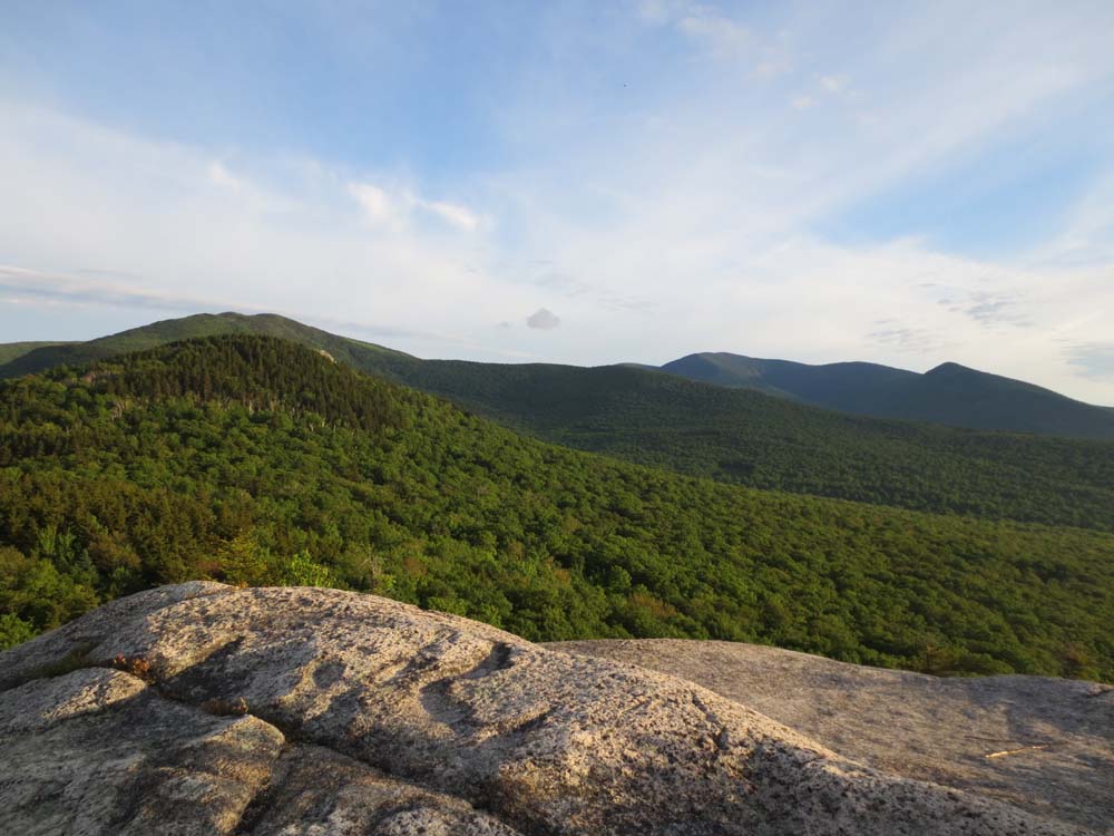
Middle Sugarloaf, Mt. Hale, and North Twin as seen from North Sugarloaf
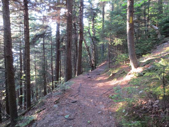
The Sugarloaf Trail between the peaks
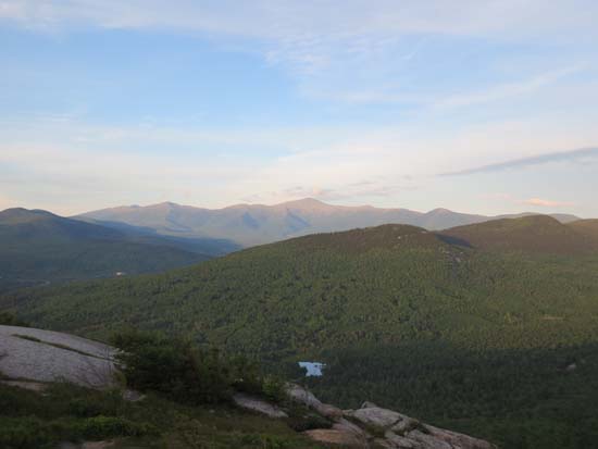
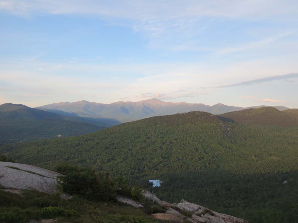
The Presidentials as seen from Middle Sugarloaf
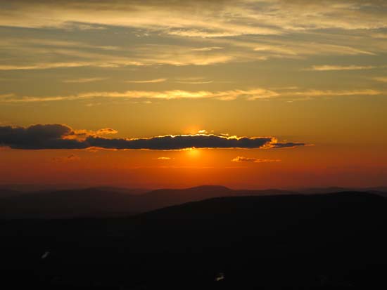
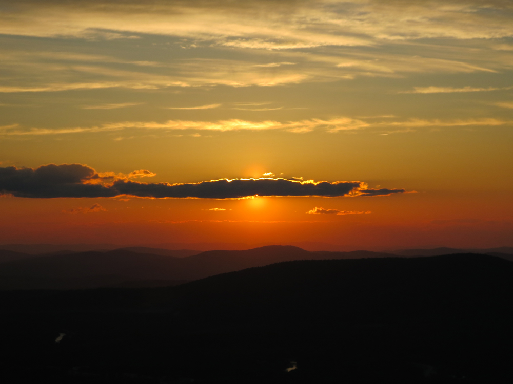
The sunset from Middle Sugarloaf
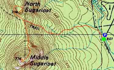

Directions to trailhead: From Bretton Woods, take Route 302 West, then take a left onto Zealand Road. The parking area for the Sugarloaf Trail is on the right shortly after the campground, just before a bridge. The Trestle Trail trailhead is just after the bridge on the left.
Back to North Sugarloaf Profile
Back to Middle Sugarloaf Profile
|