Home
States
Colorado
Connecticut
Maine
Massachusetts
New Hampshire
New York
Rhode Island
Utah
Vermont
View All
Lists
NE 4,000 Footers
NE 100 Highest
NH 4,000 Footers
NH 100 Highest
NH 52 With A View
NH Belknap Range
NH Ossipee 10
Links
Trail Conditions
Trip Log
Sunrises
Sunsets
About
|
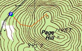
Page Hill
Tamworth, NH
Trailheads, measurements, times, distances, and maps are all approximate and relative to the hike(s) as shown below.
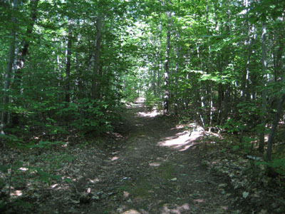
The trail to the Page Hill ledges
I had a few minutes to spare on a nice Friday afternoon (the forecast was wrong!), so I decided to do a quick hike up Page Hill.
I had been planning to check out Page Hill for quite some time, as I knew of the existence of a ski area on it at one point. Not knowing for sure how to access it or if there were views from the top in part kept me from exploring. However, after reading about a geocache on it, I discovered the path I suspected was indeed the one and that there was a view.
The gap in the stonewall was rather obvious on Page Hill Road - as well as the dirt on the opposite shoulder from people parking. The ascent wasn't too challenging - moderate at best. Not much to see on the way up - just a generic old dirt/logging road.
Before I knew it, I was at the ledge - which provided views of Chocorua and Whiteface-Passaconaway. With not much time left, I quickly headed into the woods to look for some sort of a highpoint (this north subpeak).
I jogged back to the road. It's nice to know of another short, scenic hike in the area!
| Hike Ratings |
|
Getting To Trailhead: |
Easy |
| Destination: |
Page Hill |
|
Length: |
Easy |
|
Steepness: |
Moderate |
|
Navigation: |
Moderate |
|
Views: |
Excellent |
|
Crowds: |
Minimal |
|
| Hike Stats |
|
Date Hiked: |
Friday, August 10, 2007 |
| Hike Commenced: |
4:47 PM |
| Parking Elevation: |
840' |
| Destination: |
Page Hill |
| Ascent Commenced: |
4:47 PM |
| Summit Reached: |
4:56 PM |
| Time Elapsed: |
00:09 |
| Trailhead Elevation: |
840' |
| Summit Elevation: |
1,130' |
| Vertical Gain: |
300' |
|
|
| Hike Ended: |
5:02 PM |
| Hike Time Elapsed: |
00:15 |
| Hike Vertical Gain: |
315' |
|
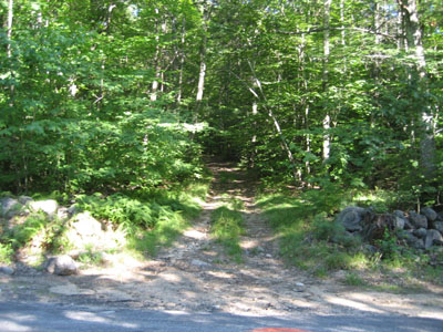
Trailhead to Page Hill on Page Hill Road
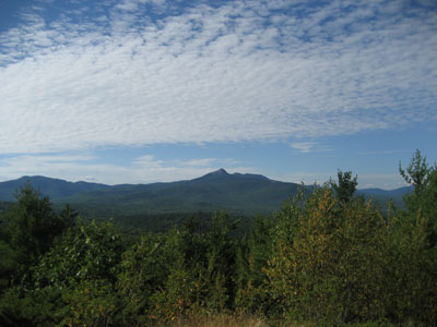
Looking north-northwest at Mt. Chocorua from near the Page Hill summit

Directions to trailhead: Take Page Hill Road west from Route 16 in Chocorua. Toward the end of the high point of this road, on the left side there is a break in the stonewall and an old dirt road through it. There is some room to park on Page Hill Road's right hand shoulder.
Back to Page Hill Profile
|

