Home
States
Colorado
Connecticut
Maine
Massachusetts
New Hampshire
New York
Rhode Island
Utah
Vermont
View All
Lists
NE 4,000 Footers
NE 100 Highest
NH 4,000 Footers
NH 100 Highest
NH 52 With A View
NH Belknap Range
NH Ossipee 10
Links
Trail Conditions
Trip Log
Sunrises
Sunsets
About
|
Piper Mountain
Gilford, NH, Gilmanton, NH
Trailheads, measurements, times, distances, and maps are all approximate and relative to the hike(s) as shown below.
The Piper-Whiteface Link
Route: Whiteface Mountain Trail, Piper-Whiteface Link
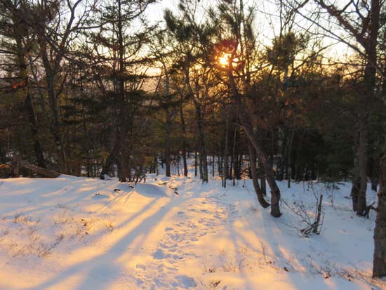
Trails were hard pack, easily barebooted (but could be snowshoed). A few blue ice bulges on the ledges ascending Piper, but easily avoided. About 1-3" of snowpack with a breakable crust on top. Someone has been taking a four wheeler all the way to the water crossing.
| Hike Ratings |
|
Getting To Trailhead: |
Easy |
| Destination: |
Piper Mountain |
|
Length: |
Moderate |
|
Steepness: |
Moderate |
|
Navigation: |
Easy |
|
Views: |
Excellent |
|
Crowds: |
Minimal |
|
| Hike Stats |
|
Date Hiked: |
Monday, January 4, 2016 |
| Parking Elevation: |
1,050' |
| Destination: |
Piper Mountain |
| Time Elapsed: |
00:22 |
| Trailhead Elevation: |
1,060' |
| Summit Elevation: |
2,044' |
| Vertical Gain: |
1,024' |
|
|
| Hike Time Elapsed: |
01:07 |
| Hike Vertical Gain: |
1,064' |
|
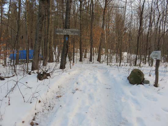
The Whiteface Mountain Trail trailhead
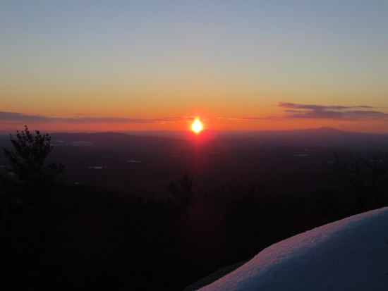
The sunset from ledges near the Piper Mountain summit
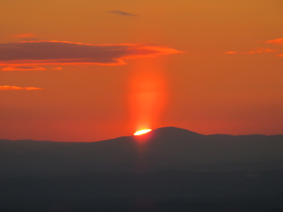
The sunset from ledges near the Piper Mountain summit
Directions to trailhead: From Route 11A East (from Route 3), take a right on Hoyt Road. Continue down this road as it becomes Belknap Mountain Road. At the end of this road, take a left. There will eventually be a turnaround area with a private road sign. Park here, and continue up the road on foot. The Piper Whiteface Trail trailhead will be on the left side of the road.
Back to Piper Mountain Profile
|


