Home
States
Colorado
Connecticut
Maine
Massachusetts
New Hampshire
New York
Rhode Island
Utah
Vermont
View All
Lists
NE 4,000 Footers
NE 100 Highest
NH 4,000 Footers
NH 100 Highest
NH 52 With A View
NH Belknap Range
NH Ossipee 10
Links
Trail Conditions
Trip Log
Sunrises
Sunsets
About
|
Plymouth Mountain
Plymouth, NH
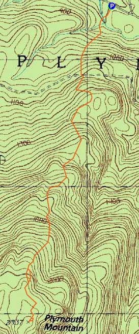
Trailheads, measurements, times, distances, and maps are all approximate and relative to the hike(s) as shown below.
Looking up the Sutherland Trail
Route: Fauver Link, Sutherland Trail (Plymouth Mountain), Sutherland Trail, Fauver Link
Having previously hiked Plymouth Mountain via a grown in trail from the Newfound Lake side, I decided to check out the northern approach.
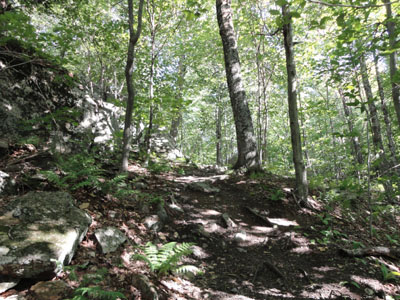
Starting on the Fauver Link, I jogged my way up the fairly gradual trail, eventually crossing over a logging road onto the Sutherland Trail. The footing was generally pretty good as the trail passed through hardwood glades.
After awhile I noticed an unmarked trail going sharply uphill to the left - I correctly suspected it was a ledge known as Pike's Peak. I opted to stay on the Sutherland Trail and continue onto the summit. Shortly thereafter, I reached a series of ledges leading to the summit (faded blazes), a few requiring minor scrambles.
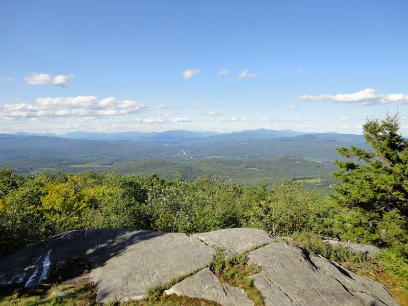
Just below the summit, I stood on a large rock ledge (with a sharp dropoff on two sides) and had excellent views to the north and east.
Heading down the trail, I followed a herd path right to Pike's Peak, which had tremendous views to the north. In comparison to the ledge near the summit of Plymouth, the views are not as wide reaching, however they are much stronger and allow easy sitting/viewing.
From Pike's Peak, I followed the steep path that I had seen earlier back to the Sutherland Trail, then jogged my way back to the bottom.
| Hike Ratings |
|
Getting To Trailhead: |
Easy |
| Destination: |
Plymouth Mountain |
|
Length: |
Moderate |
|
Steepness: |
Difficult |
|
Navigation: |
Moderate |
|
Views: |
Excellent |
|
Crowds: |
Minimal |
|
| Hike Stats |
|
Date Hiked: |
Friday, July 30, 2010 |
| Hike Commenced: |
4:26 PM |
| Parking Elevation: |
790' |
| Destination: |
Plymouth Mountain |
| Ascent Commenced: |
4:26 PM |
| Summit Reached: |
5:13 PM |
| Time Elapsed: |
00:47 |
| Trailhead Elevation: |
790' |
| Summit Elevation: |
2,193' |
| Distance: |
2.2 miles |
| Vertical Gain: |
1,463' |
|
|
| Hike Ended: |
6:10 PM |
| Hike Time Elapsed: |
01:44 |
| Hike Vertical Gain: |
1,563' |
|
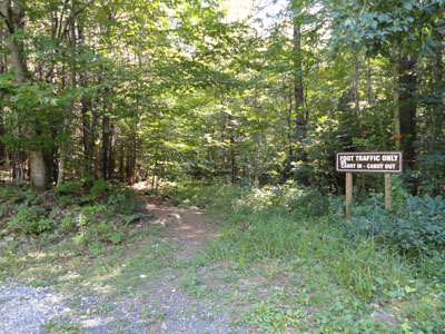
The Fauver Trail trailhead

A foreshadowing of things to come...
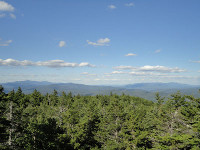
Looking east at the Sandwich, Squam, and Ossipee ranges from the viewpoint near the summit of Plymouth Mountain

Looking north at the White Mountains from the Pike's Peak vista
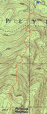

Directions to trailhead: Take Route 25 West from Ashland. A few minutes after leaving Ashland, take a left onto Cummings Road. A minute or two after a sharp left turn, take a right onto Texas Hill Road. A few minutes later, continue straight through a junction onto Old Hebron Road. The Fauver Link parking lot will be on the left a few hundred yards thereafter. The Fauver Link Trail trailhead is located at the back end of the parking lot.
Back to Plymouth Mountain Profile
|