Home
States
Colorado
Connecticut
Maine
Massachusetts
New Hampshire
New York
Rhode Island
Utah
Vermont
View All
Lists
NE 4,000 Footers
NE 100 Highest
NH 4,000 Footers
NH 100 Highest
NH 52 With A View
NH Belknap Range
NH Ossipee 10
Links
Trail Conditions
Trip Log
Sunrises
Sunsets
About
|
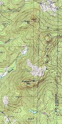
Prospect Mountain, Durgin Hill
Freedom, NH
Trailheads, measurements, times, distances, and maps are all approximate and relative to the hike(s) as shown below.
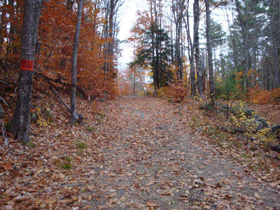
The logging road portion of the Scarboro Ridge Trail
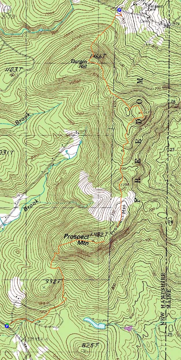
Route: Scarboro Ridge Trail, (Prospect Mountain), Scarboro Ridge Trail, bushwhack, Scarboro Ridge Trail, (Durgin Hill), Scarboro Ridge Trail
Though I had been to every peak along the new Scarboro Ridge Trail during its construction, I had not yet hiked it end to end.
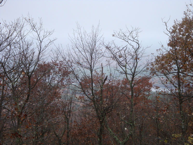
Starting on Old Portland Road, we followed the trail as it started off as a gradual dirt road walk. Reaching an open area with one standing tree, the trail veered off to the left, soon ascending Prospect Mountain at a moderate pace. After crossing over some ledges, the trail reached the Bucknell Trail and continued to the summit (the end of the Bucknell Trail). Unfortunately, there were minimal views to be had due to the low cloud level.
The Scarboro Ridge Trail continued a bit, prior to reaching the short bushwhack connecting the two sections. Beyond the bushwhack, there were some limited views (again due to the clouds) from two unnamed peaks on the way to Durgin Hill. In addition, there was some nice foliage in the low points of the trail.
As the clouds lifted, there were halfway decent views from near the summit of Durgin, including a look back at Prospect Mountain and a glance at Green Mountain (still partially covered in clouds). From there, after following an incorrect flagged trail, we hopped back onto the Scarboro Ridge Trail and took it to our endpoint for the day, Rice Hill Road.
Though the trail still is lacking in markings (still surveying tape), it is becoming a bit more obvious due to use. It certainly warrants a return trip on a nice day, as to fully enjoy the many fine ledge views.
| Hike Ratings |
|
Getting To Trailhead: |
Moderate |
| Destination: |
Prospect Mountain |
|
Length: |
Easy |
|
Steepness: |
Moderate |
|
Navigation: |
Moderate |
|
Views: |
Minimal (due to weather) |
|
Crowds: |
Minimal |
| Destination: |
Durgin Hill |
|
Length: |
Moderate |
|
Steepness: |
Moderate |
|
Navigation: |
Moderate |
|
Views: |
Moderate (due to weather) |
|
Crowds: |
Minimal |
|
| Hike Stats |
|
Date Hiked: |
Saturday, October 31, 2009 |
| Hike Commenced: |
9:30 AM |
| Parking Elevation: |
500' |
| Destination: |
Prospect Mountain |
| Ascent Commenced: |
9:30 AM |
| Summit Reached: |
10:31 AM |
| Time Elapsed: |
01:01 |
| Trailhead Elevation: |
500' |
| Summit Elevation: |
1,482' |
| Vertical Gain: |
1,057' |
| Destination: |
Durgin Hill |
| Ascent Commenced: |
10:38 AM |
| Summit Reached: |
12:23 PM |
| Time Elapsed: |
01:45 |
| Trailhead Elevation: |
1,482' |
| Summit Elevation: |
1,466' |
| Vertical Gain: |
841' |
|
|
| Hike Ended: |
1:07 PM |
| Hike Time Elapsed: |
03:37 |
| Hike Vertical Gain: |
1,898' |
|
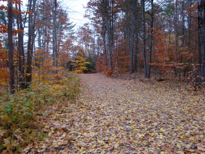
The Scarboro Ridge southern trailhead off Old Portland Road
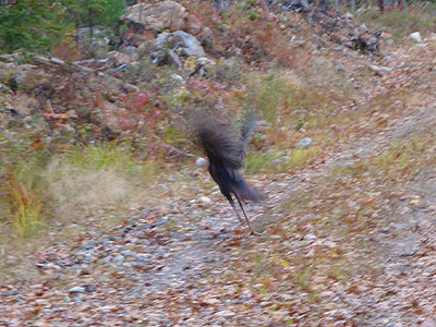
Thanksgiving dinner!

Looking into a cloud from Prospect Mountain
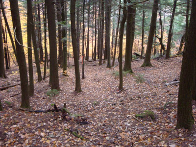
The Scarboro Ridge Trail between Prospect Mountain and Durgin Hill
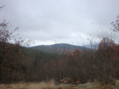
Prospect Mountain as seen from Durgin Hill

Directions to trailhead: ---As of Fall 2009, the southern trailhead of the Scarboro Ridge Trail has been closed and will be relocated.--- To get to the northern trailhead, take Moulton Road north from Freedom. Eventually at T intersection, take a right onto Rice Hill Road (labelled as Cold Brook Road on some maps). Shortly after passing over a height of land (a house will be on the left), the northern trailhead of the Scarboro Ridge Trail will be on the right - a grassy road. There is limited room to park roadside.
Back to Prospect Mountain Profile
Back to Durgin Hill Profile
|