Home
States
Colorado
Connecticut
Maine
Massachusetts
New Hampshire
New York
Rhode Island
Utah
Vermont
View All
Lists
NE 4,000 Footers
NE 100 Highest
NH 4,000 Footers
NH 100 Highest
NH 52 With A View
NH Belknap Range
NH Ossipee 10
Links
Trail Conditions
Trip Log
Sunrises
Sunsets
About
|
Ragged Mountain
Andover, NH
Trailheads, measurements, times, distances, and maps are all approximate and relative to the hike(s) as shown below.
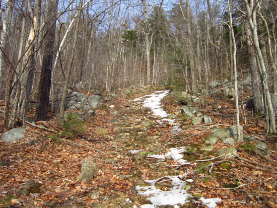
Looking up the Ragged Mountain Trail
Route: Ragged Mountain Trail, East Ridge Trail, bushwhack, (Ragged Mountain), bushwhack, East Ridge Trail, (Old Top), East Ridge Trail, Ragged Mountain Trail, Balanced Rock Spur, Ragged Mountain Trail
First half of trail was probably half bare ground, other half blue ice or spring snow. Southern slopes were generally bare and dry, while flats tended to have snow. One small area of pooled water, as well as two areas in which water was running down the trail.
Consistent snow started probably around 2.5 miles in. Snowpack ranged from 1-12", but was generally 3-5".
The highpoint seemed to be a non-view ledge a few dozen feet to the right of the trail with a small cairn.
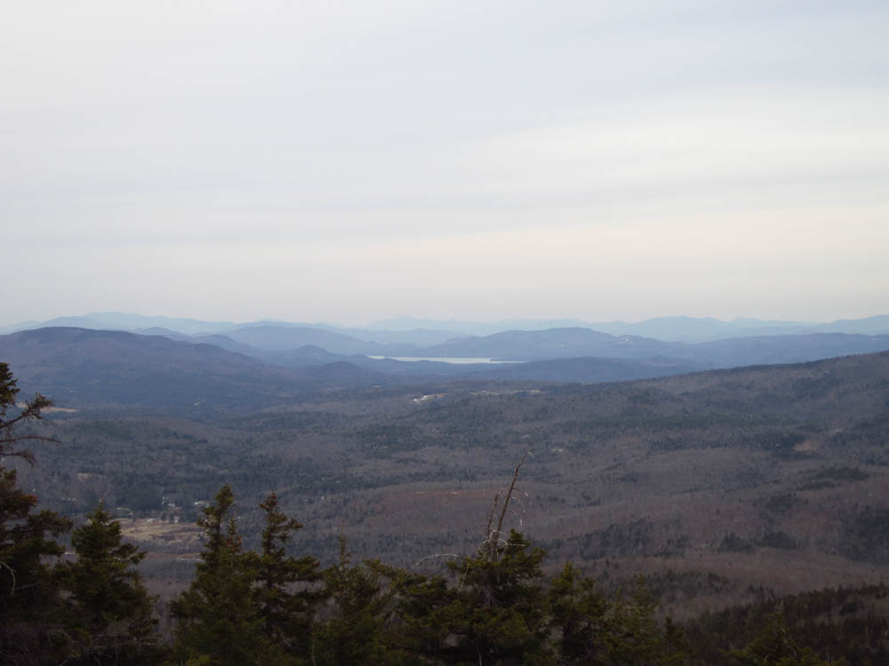
Views from the ledges at the end of the East Ridge Trail were well worth the extra few minutes of walking beyond the highpoint (only rugged portion of this hike with a few small scrambles). Views just past the Balance Rock were also very much worth the side trip.
I wore Microspikes twice (the icy area near the trailhead, and an icy area on the East Ridge Trail). Even if I had brought snowshoes, I don't think I would have used them today.
| Hike Ratings |
|
Getting To Trailhead: |
Easy |
| Destination: |
Ragged Mountain |
|
Length: |
Moderate |
|
Steepness: |
Difficult |
|
Navigation: |
Moderate |
|
Views: |
Excellent |
|
Crowds: |
Minimal |
|
| Hike Stats |
|
Date Hiked: |
Monday, March 12, 2012 |
| Parking Elevation: |
650' |
| Destination: |
Ragged Mountain |
| Time Elapsed: |
01:32 |
| Trailhead Elevation: |
670' |
| Summit Elevation: |
2,286' |
| Vertical Gain: |
1,696' |
|
|
| Hike Time Elapsed: |
03:18 |
| Hike Vertical Gain: |
1,946' |
|
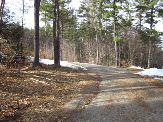
The Ragged Mountain Trail trailhead near the Proctor Academy Field House
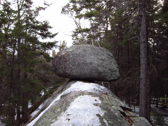
Balanced Rock

Newfound Lake as seen from the Old Top ledges near the Ragged Mountain summit
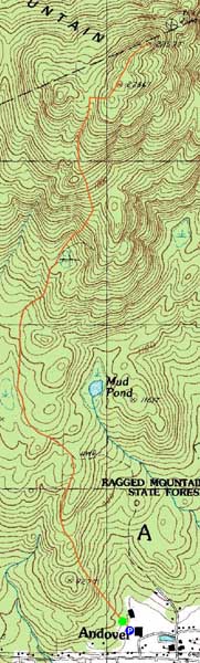

Directions to trailhead: Take Route 11 West from I-93 to Andover and Proctor Academy. The Field House will be just off the road on the right. From the back of the parking lot, start on the access road leading uphill to the tennis courts. Where the road starts to curve left, continue straight into the woods on the Ragged Mountain Trail.
Back to Ragged Mountain Profile
|