Home
States
Colorado
Connecticut
Maine
Massachusetts
New Hampshire
New York
Rhode Island
Utah
Vermont
View All
Lists
NE 4,000 Footers
NE 100 Highest
NH 4,000 Footers
NH 100 Highest
NH 52 With A View
NH Belknap Range
NH Ossipee 10
Links
Trail Conditions
Trip Log
Sunrises
Sunsets
About
|
Ragged Mountain
Andover, NH
Trailheads, measurements, times, distances, and maps are all approximate and relative to the hike(s) as shown below.
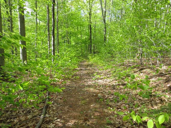
Looking up the Ragged Mountain Trail
Route: Ragged Mountain Trail, East Ridge Trail, bushwhack, (Ragged Mountain), bushwhack, East Ridge Trail, (Old Top), East Ridge Trail, Ragged Mountain Trail, Balanced Rock Spur, Bulkhead Trail, unknown trails, Phelps Trail, road walk
Ragged Mountain Trail to the ridge was generally dry with a few short muddy areas. Lots of fringed polygala in bloom.
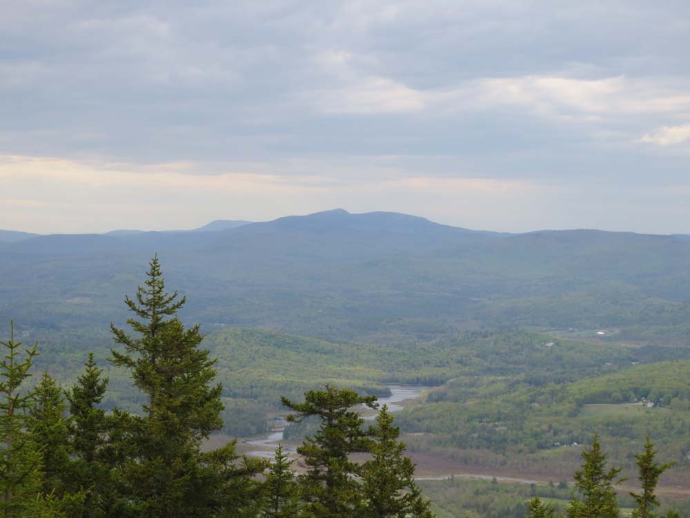
East Ridge Trail was dry. Continued past the highpoint to Old Top, from where there are excellent views. I also noted a path headed down from the northern ledge, which is marked with cairns. Loop possibility from near the ski area?
Back on Ragged Mountain Trail, I took the spur to Balanced Rock. From the ledges adjacent to Balanced Rock, a yellow diamond blazed trail ascends briefly, then descends steeply, then climbs up to a nice ledge viewpoint called the Bulkhead (it's not the USGS labelled peak nearby). Distance from the Ragged Mountain Trail to the ledge is 0.7 miles.
From that ledge, I descended on a less formally marked trail (cairns, flagging tape, and the occasional sign) down to an area northeast of Mud Pond. At a fork, the Bulkhead Trail split east with a sign denoting a shelter, while a less-used trail for Mud Pond went west (I took this).
Eventually ended up on a faded blue blaze trail on the east side of Mud Pond, which then connected to a logging road that eventually led to an area just above the Proctor Academy field house. Certainly a lot of trails to be explored.
| Hike Ratings |
|
Getting To Trailhead: |
Easy |
| Destination: |
Ragged Mountain |
|
Length: |
Moderate |
|
Steepness: |
Difficult |
|
Navigation: |
Moderate |
|
Views: |
Excellent |
|
Crowds: |
Minimal |
|
| Hike Stats |
|
Date Hiked: |
Thursday, May 16, 2013 |
| Parking Elevation: |
650' |
| Destination: |
Ragged Mountain |
| Time Elapsed: |
00:54 |
| Trailhead Elevation: |
670' |
| Summit Elevation: |
2,286' |
| Vertical Gain: |
1,696' |
|
|
| Hike Time Elapsed: |
02:39 |
| Hike Vertical Gain: |
2,046' |
|
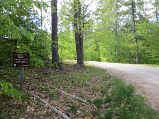
The Ragged Mountain Trail trailhead near the Proctor Academy Field House
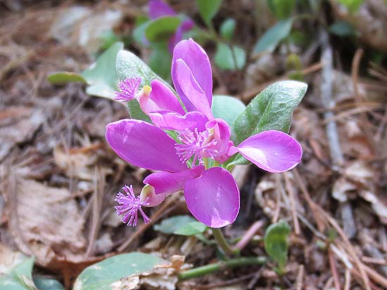
Fringed polygala
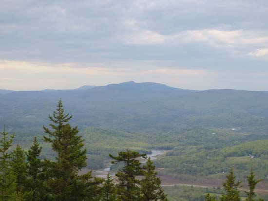
Newfound Lake as seen from the Old Top ledges near the Ragged Mountain summit
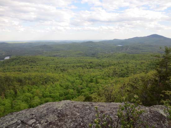
The Bulkhead vista
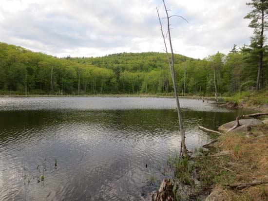
Mud Pond


Directions to trailhead: Take Route 11 West from I-93 to Andover and Proctor Academy. The Field House will be just off the road on the right. From the back of the parking lot, start on the access road leading uphill to the tennis courts. Where the road starts to curve left, continue straight into the woods on the Ragged Mountain Trail.
Back to Ragged Mountain Profile
|