Home
States
Colorado
Connecticut
Maine
Massachusetts
New Hampshire
New York
Rhode Island
Utah
Vermont
View All
Lists
NE 4,000 Footers
NE 100 Highest
NH 4,000 Footers
NH 100 Highest
NH 52 With A View
NH Belknap Range
NH Ossipee 10
Links
Trail Conditions
Trip Log
Sunrises
Sunsets
About
|
Red Hill
Moultonborough, NH
Trailheads, measurements, times, distances, and maps are all approximate and relative to the hike(s) as shown below.
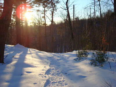
Looking down the Red Hill Trail
Route: Red Hill Trail
Since the forecast leading up to this day wasn't great, I wasn't planning on hitting the trails. The clouds moved out after a few inches of snow, however, allowing for the perfect setup for a sunset.
Arriving at a partially plowed parking lot (most of the rest of it would be plowed when I came back), I put on my snowshoes and headed up the trail - the first portion packed by snowmobiles. Soon thereafter, the snowmobile trail continues straight while the Red Hill Trail forks off to the left. Despite getting all snow 20 minutes east of here, it was pretty obvious that the end of the storm had seen sleet and/or rain, resulting in a granular snow underneath a crust. Surprisingly, the trail had already been broken out by multiple snowshoers.
By the time I reached the summit after the moderate pitched hike, I had passed the other snowshoers (who were heading down) - once again, I had a Red Hill sunset to myself.
While the temperature was nearly 40 at the trailhead, the wind was hitting the summit at a pretty decent clip - it was time to get more than just a short sleeve shirt on!
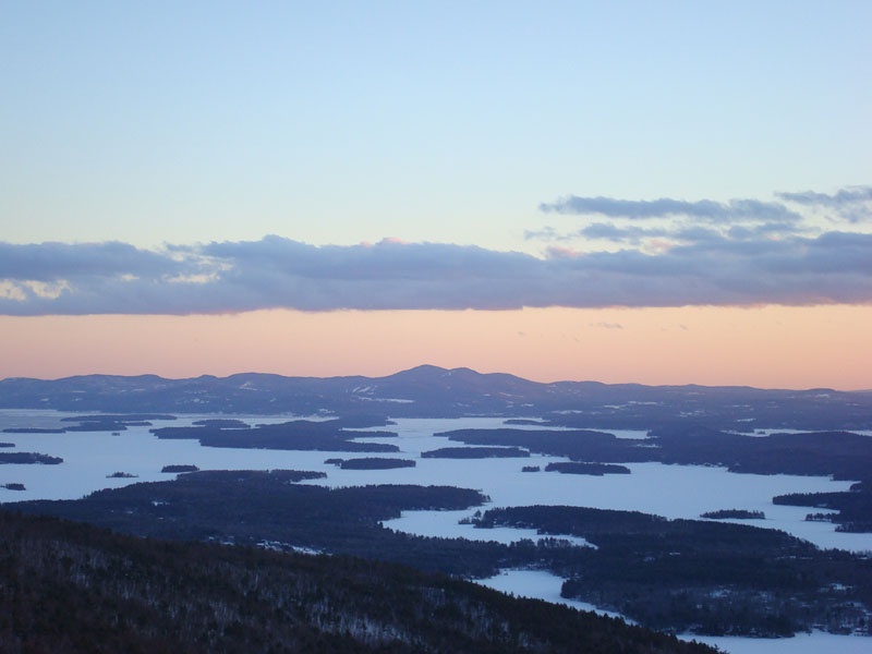
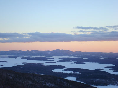
The sunset was fantastic. Tremendous orange color filled up the western skies - some clouds loomed over the top of Cardigan, with the colors further pronouncing the white peaks.
With the moon nearly full, I didn't need to have my headlamp on. The first part of the descent was especially neat, as the remaining light from the sunset, along with the moonglow, produced dueling shadows. The lights of Gunstock in the distance also made the hike down enjoyable. Not bad for what looked to be a cloudy day.
| Hike Ratings |
|
Getting To Trailhead: |
Easy |
| Destination: |
Red Hill |
|
Length: |
Moderate |
|
Steepness: |
Moderate |
|
Navigation: |
Easy |
|
Views: |
Excellent |
|
Crowds: |
Minimal |
|
| Hike Stats |
|
Date Hiked: |
Friday, January 18, 2008 |
| Hike Commenced: |
3:42 PM |
| Parking Elevation: |
635' |
| Destination: |
Red Hill |
| Ascent Commenced: |
3:43 PM |
| Summit Reached: |
4:27 PM |
| Time Elapsed: |
00:44 |
| Trailhead Elevation: |
640' |
| Summit Elevation: |
2,033' |
| Distance: |
1.7 miles |
| Vertical Gain: |
1,398' |
|
|
| Hike Ended: |
5:40 PM |
| Hike Time Elapsed: |
01:58 |
| Hike Distance: |
3.4 miles |
| Hike Vertical Gain: |
1,408' |
|
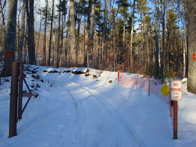
Red Hill Trail trailhead
Looking southeast at the Belknap Range
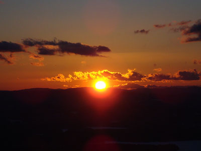
The sunset as seen from the Red Hill fire tower
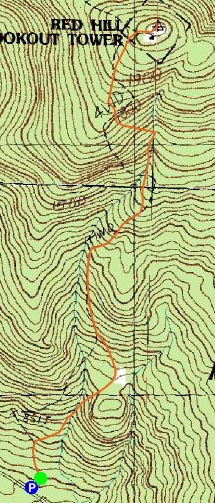

Directions to trailhead: Take Red Hill Road (also signed as Sawmill Road in some places) north from Route 25 near Center Harbor. Parking area and trailhead are on the right shortly after passing Sibley Road on the left.
Back to Red Hill Profile
|