Home
States
Colorado
Connecticut
Maine
Massachusetts
New Hampshire
New York
Rhode Island
Utah
Vermont
View All
Lists
NE 4,000 Footers
NE 100 Highest
NH 4,000 Footers
NH 100 Highest
NH 52 With A View
NH Belknap Range
NH Ossipee 10
Links
Trail Conditions
Trip Log
Sunrises
Sunsets
About
|
Red Hill
Moultonborough, NH
Trailheads, measurements, times, distances, and maps are all approximate and relative to the hike(s) as shown below.
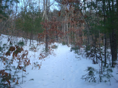
Looking up the Red Hill Trail
Route: Red Hill Trail
While the day had been mostly sunny, things looked to be clouding up as the afternoon progressed. Nonetheless, I decided to attempt a sunset hike.
After having hiked in some rather cold weather in previous days, it was interesting to hike in near-above freezing weather. The Red Hill Trail had a firm base of frozen granular with a half an inch to an inch of powder on top - perfect for Microspikes!
Though there were lots of clouds to the west, I did get some nice glimpses of orange glow around snow flurries and the setting sun - unfortunately, I wasn't quite positioned to snap any shots. Nonetheless, I was able to get some decent colors considering - the muted pinks and purples above the Ossipee Range were particularly nice later in the display.
Thanks to the snow cover and my knowledge of the trail, I was able to make it back to the parking lot without needing a headlamp. Not a bad after work hike!
| Hike Ratings |
|
Getting To Trailhead: |
Easy |
| Destination: |
Red Hill |
|
Length: |
Moderate |
|
Steepness: |
Moderate |
|
Navigation: |
Easy |
|
Views: |
Excellent |
|
Crowds: |
Minimal |
|
| Hike Stats |
|
Date Hiked: |
Monday, January 5, 2009 |
| Hike Commenced: |
3:36 PM |
| Parking Elevation: |
635' |
| Destination: |
Red Hill |
| Ascent Commenced: |
3:36 PM |
| Summit Reached: |
4:13 PM |
| Time Elapsed: |
00:37 |
| Trailhead Elevation: |
640' |
| Summit Elevation: |
2,033' |
| Distance: |
1.7 miles |
| Vertical Gain: |
1,398' |
|
|
| Hike Ended: |
5:07 PM |
| Hike Time Elapsed: |
01:31 |
| Hike Distance: |
3.4 miles |
| Hike Vertical Gain: |
1,408' |
|
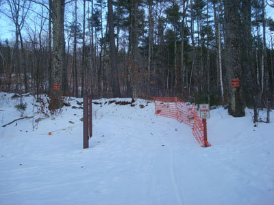
Red Hill Trail trailhead
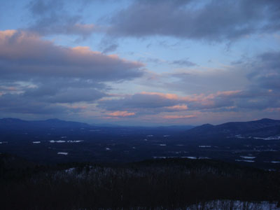
Looking between the Sandwich Range and Ossipee Range from the Red Hill fire tower
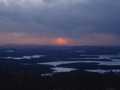
Sunset colors as seen from the Red Hill fire tower
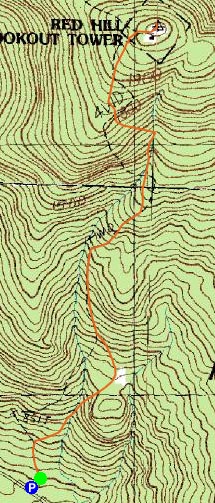

Directions to trailhead: Take Red Hill Road (also signed as Sawmill Road in some places) north from Route 25 near Center Harbor. Parking area and trailhead are on the right shortly after passing Sibley Road on the left.
Back to Red Hill Profile
|


