Home
States
Colorado
Connecticut
Maine
Massachusetts
New Hampshire
New York
Rhode Island
Utah
Vermont
View All
Lists
NE 4,000 Footers
NE 100 Highest
NH 4,000 Footers
NH 100 Highest
NH 52 With A View
NH Belknap Range
NH Ossipee 10
Links
Trail Conditions
Trip Log
Sunrises
Sunsets
About
|
Red Hill
Moultonborough, NH
Trailheads, measurements, times, distances, and maps are all approximate and relative to the hike(s) as shown below.
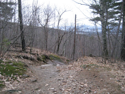
Looking down the Red Hill Trail
Route: Red Hill Trail
Though the weather wasn't overly pleasant, I nonetheless decided to get some exercise after a twelve plus hour day at work. Arriving at the trailhead, I quickly headed up the Red Hill trail, jogging some of the flats as to help ensure arriving at the summit before sunset.
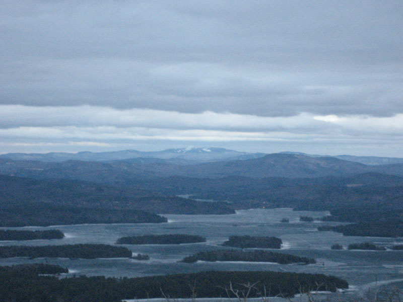
One of the first trails in the region to thaw in the spring, there was very little snow or ice on the Red Hill Trail. Thus, I was able to easily bareboot without traction. Arriving at the summit, there was very little to see in way of sunset colors, as heavy clouds muted any light from the western horizon. Nonetheless, the views were still decent, though the higher peaks to the north were in the clouds. Things were also quite cold and windy at the summit - spring is here, sort of.
Without the help of a snow covered trail to assist in a smooth, light descent, I was forced to use my headlamp for the last portion of the hike, as to not trip and wipe out. Though sort of a miserable afternoon/evening weatherwise, it was nice to get out.
| Hike Ratings |
|
Getting To Trailhead: |
Easy |
| Destination: |
Red Hill |
|
Length: |
Moderate |
|
Steepness: |
Moderate |
|
Navigation: |
Easy |
|
Views: |
Excellent |
|
Crowds: |
Minimal |
|
| Hike Stats |
|
Date Hiked: |
Tuesday, April 7, 2009 |
| Hike Commenced: |
6:36 PM |
| Parking Elevation: |
640' |
| Destination: |
Red Hill |
| Ascent Commenced: |
6:36 PM |
| Summit Reached: |
7:09 PM |
| Time Elapsed: |
00:33 |
| Trailhead Elevation: |
640' |
| Summit Elevation: |
2,033' |
| Distance: |
1.7 miles |
| Vertical Gain: |
1,398' |
|
|
| Hike Ended: |
8:03 PM |
| Hike Time Elapsed: |
01:27 |
| Hike Distance: |
3.4 miles |
| Hike Vertical Gain: |
1,403' |
|
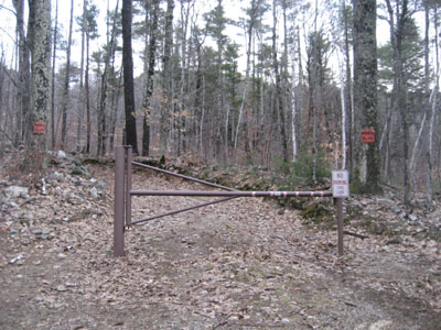
Red Hill Trail trailhead
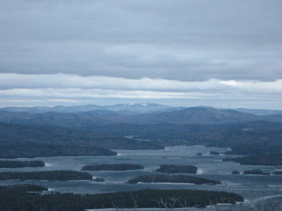
Looking over Sqaum Lake at Mt. Cardigan
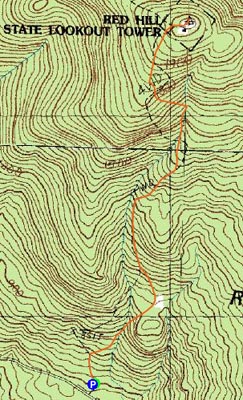

Directions to trailhead: Take Red Hill Road (also signed as Sawmill Road in some places) north from Route 25 near Center Harbor. Parking area and trailhead are on the right shortly after passing Sibley Road on the left.
Back to Red Hill Profile
|