Home
States
Colorado
Connecticut
Maine
Massachusetts
New Hampshire
New York
Rhode Island
Utah
Vermont
View All
Lists
NE 4,000 Footers
NE 100 Highest
NH 4,000 Footers
NH 100 Highest
NH 52 With A View
NH Belknap Range
NH Ossipee 10
Links
Trail Conditions
Trip Log
Sunrises
Sunsets
About
|
Red Hill
Moultonborough, NH
Trailheads, measurements, times, distances, and maps are all approximate and relative to the hike(s) as shown below.
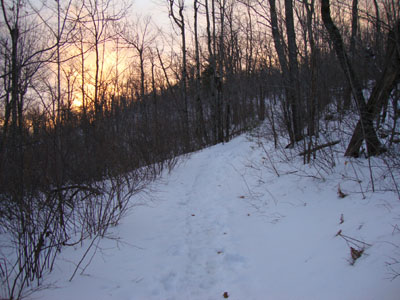
Looking up the Red Hill Trail
Route: Red Hill Trail
With the following day looking very windy and cold, I decided to hit up Red Hill for a sunset hike in more tolerable weather. Arriving at the lower parking area (the upper one was not plowed), I opted to go with snowshoes, even though the trail looked to be bootable with Microspikes.
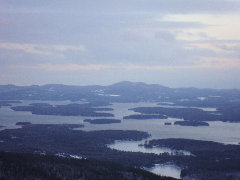
Heading up the Red Hill Trail, I could see clouds moving in - a recurring theme in my Red Hill sunset hikes. Nearing the summit, the colors were looking quite nice - however, I could see that the sun was going to set into the clouds prior to my arrival at the tower.
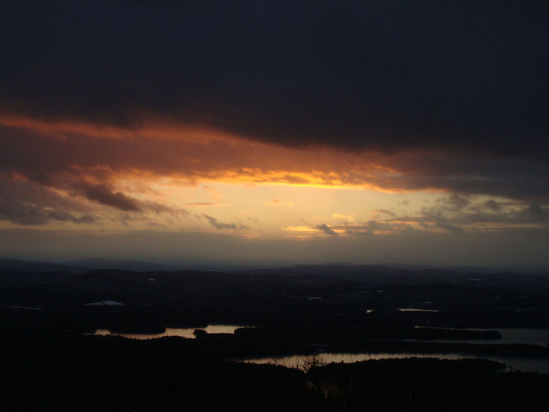
Climbing up the tower, I was able to witness just a bit of color prior to things going grey. With bitter cold winds blowing, I opted not to loiter at the tower for long. Thanks to the snow cover's brightness, I was able to get back to the trailhead without needing a headlamp.
| Hike Ratings |
|
Getting To Trailhead: |
Easy |
| Destination: |
Red Hill |
|
Length: |
Moderate |
|
Steepness: |
Moderate |
|
Navigation: |
Easy |
|
Views: |
Excellent |
|
Crowds: |
Minimal |
|
| Hike Stats |
|
Date Hiked: |
Wednesday, December 16, 2009 |
| Hike Commenced: |
3:20 PM |
| Parking Elevation: |
635' |
| Destination: |
Red Hill |
| Ascent Commenced: |
3:21 PM |
| Summit Reached: |
3:59 PM |
| Time Elapsed: |
00:38 |
| Trailhead Elevation: |
640' |
| Summit Elevation: |
2,033' |
| Distance: |
1.7 miles |
| Vertical Gain: |
1,398' |
|
|
| Hike Ended: |
4:43 PM |
| Hike Time Elapsed: |
01:23 |
| Hike Distance: |
3.4 miles |
| Hike Vertical Gain: |
1,408' |
|
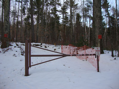
Red Hill Trail trailhead

Lake Winnipesaukee as seen from the Red Hill fire tower
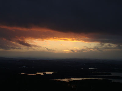
Sunset colors as seen from the Red Hill fire tower
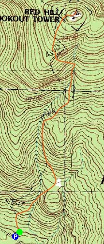

Directions to trailhead: Take Red Hill Road (also signed as Sawmill Road in some places) north from Route 25 near Center Harbor. Parking area and trailhead are on the right shortly after passing Sibley Road on the left.
Back to Red Hill Profile
|