Home
States
Colorado
Connecticut
Maine
Massachusetts
New Hampshire
New York
Rhode Island
Utah
Vermont
View All
Lists
NE 4,000 Footers
NE 100 Highest
NH 4,000 Footers
NH 100 Highest
NH 52 With A View
NH Belknap Range
NH Ossipee 10
Links
Trail Conditions
Trip Log
Sunrises
Sunsets
About
|
Red Hill
Moultonborough, NH
Trailheads, measurements, times, distances, and maps are all approximate and relative to the hike(s) as shown below.
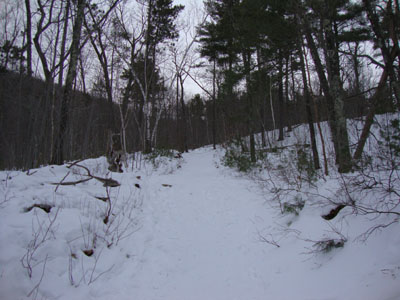
Looking up the Red Hill Trail
Route: Red Hill Trail
After two days of before sunrise to after sunset work, I wanted to stretch my legs. While the skies were increasingly cloudy, the forecast called for clearing around 5:00. Initially, I had planned to head down to the Belknaps. In route, though, I decided to go for a 360 degree viewpoint, as to perhaps get potential colors to the east if there was no sunset.
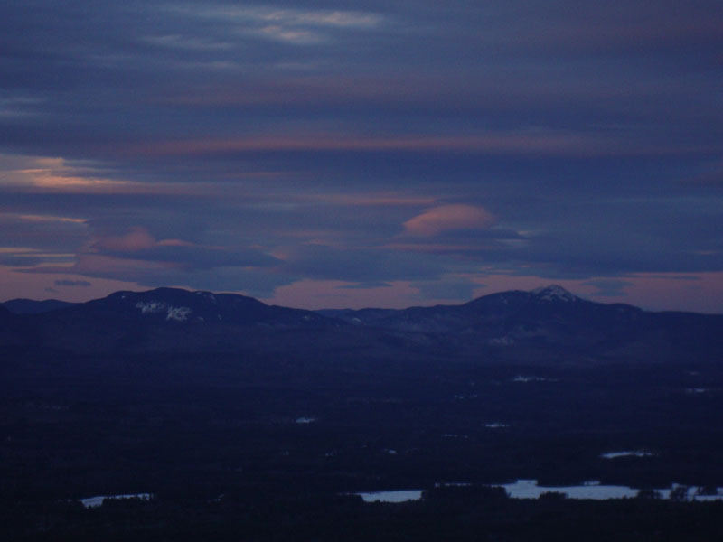
The Red Hill Trail was a well packed snow sidewalk - no traction or snowshoes were needed. Though cold and windy, I hung out on the summit fire tower almost half an hour. While there wasn't much in way of a sunset, there were some nicely colored lenticular clouds to the east over the Sandwich Range.
Sure enough, the clouds moved out about half an hour after sunset, but alas too late for an sort of display.
| Hike Ratings |
|
Getting To Trailhead: |
Easy |
| Destination: |
Red Hill |
|
Length: |
Moderate |
|
Steepness: |
Moderate |
|
Navigation: |
Easy |
|
Views: |
Excellent |
|
Crowds: |
Minimal |
|
| Hike Stats |
|
Date Hiked: |
Wednesday, January 13, 2010 |
| Hike Commenced: |
3:25 PM |
| Parking Elevation: |
640' |
| Destination: |
Red Hill |
| Ascent Commenced: |
3:25 PM |
| Summit Reached: |
4:03 PM |
| Time Elapsed: |
00:38 |
| Trailhead Elevation: |
640' |
| Summit Elevation: |
2,033' |
| Distance: |
1.7 miles |
| Vertical Gain: |
1,398' |
|
|
| Hike Ended: |
5:03 PM |
| Hike Time Elapsed: |
01:38 |
| Hike Distance: |
3.4 miles |
| Hike Vertical Gain: |
1,403' |
|
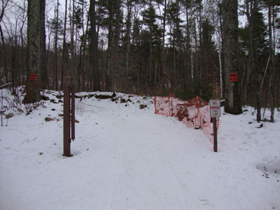
Red Hill Trail trailhead
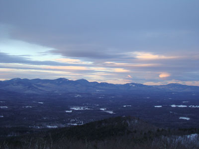
Looking at the Sandwich Range from the Red Hill fire tower

Slight sunset colors over the Sandwich Range as seen from the Red Hill fire tower
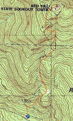

Directions to trailhead: Take Red Hill Road (also signed as Sawmill Road in some places) north from Route 25 near Center Harbor. Parking area and trailhead are on the right shortly after passing Sibley Road on the left.
Back to Red Hill Profile
|