Home
States
Colorado
Connecticut
Maine
Massachusetts
New Hampshire
New York
Rhode Island
Utah
Vermont
View All
Lists
NE 4,000 Footers
NE 100 Highest
NH 4,000 Footers
NH 100 Highest
NH 52 With A View
NH Belknap Range
NH Ossipee 10
Links
Trail Conditions
Trip Log
Sunrises
Sunsets
About
|
Red Hill
Moultonborough, NH
Trailheads, measurements, times, distances, and maps are all approximate and relative to the hike(s) as shown below.
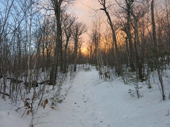
Looking up the Red Hill Trail
Route: Red Hill Trail
Still plenty of snow in them there hills after this week's rains.
First few tenths of a mile of trail was mostly snow free. Consistent snowpack started around 1,000 feet in elevation, initially a few inches, then more along the line of 6". Around 1,900 feet in elevation, snowpack was 6-12" of spring snow.
This trail gets steady foot traffic, so I was able to bareboot in spring conditions late this afternoon. I do suspect that temperatures could get low enough overnight to firm up the soft ice and thus make carrying Microspikes a good idea if venturing up tomorrow morning. If planning to bushwhack in the upper elevations in the Lakes Region, I suspect snowshoes will be a good idea.
| Hike Ratings |
|
Getting To Trailhead: |
Easy |
| Destination: |
Red Hill |
|
Length: |
Moderate |
|
Steepness: |
Moderate |
|
Navigation: |
Easy |
|
Views: |
Excellent |
|
Crowds: |
Minimal |
|
| Hike Stats |
|
Date Hiked: |
Thursday, December 25, 2014 |
| Parking Elevation: |
640' |
| Destination: |
Red Hill |
| Time Elapsed: |
00:31 |
| Trailhead Elevation: |
640' |
| Summit Elevation: |
2,033' |
| Distance: |
1.7 miles |
| Vertical Gain: |
1,398' |
|
|
| Hike Time Elapsed: |
01:04 |
| Hike Distance: |
3.4 miles |
| Hike Vertical Gain: |
1,403' |
|
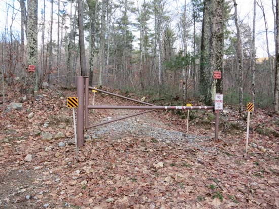
Red Hill Trail trailhead
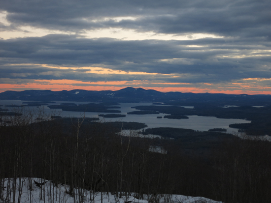
The Belknaps from the Red Hill fire tower
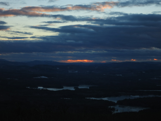
The sunset from the Red Hill fire tower
Directions to trailhead: Take Red Hill Road (also signed as Sawmill Road in some places) north from Route 25 near Center Harbor. Parking area and trailhead are on the right shortly after passing Sibley Road on the left.
Back to Red Hill Profile
|


