Home
States
Colorado
Connecticut
Maine
Massachusetts
New Hampshire
New York
Rhode Island
Utah
Vermont
View All
Lists
NE 4,000 Footers
NE 100 Highest
NH 4,000 Footers
NH 100 Highest
NH 52 With A View
NH Belknap Range
NH Ossipee 10
Links
Trail Conditions
Trip Log
Sunrises
Sunsets
About
|
Red Hill
Moultonborough, NH
Trailheads, measurements, times, distances, and maps are all approximate and relative to the hike(s) as shown below.
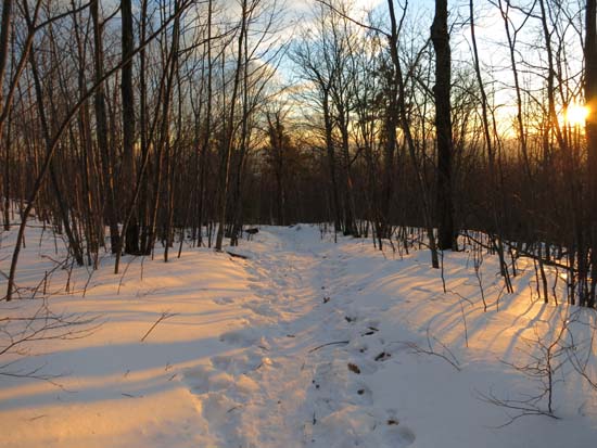
Looking down the Red Hill Trail
Route: Red Hill Trail
Was hoping the footbed would soften up in the afternoon sun, but the footing was pretty awkward for the first few tenths of a mile due to the thaw and refreeze - lots of shallow slush postholes. Above the chain, the footbed was a bit better, but still frozen granular and ice. I was able to bareboot for the ascent, but opted for Microspikes for the descent. Skipped the gully and instead took the snowmobile trail down low, which had much better footing. Snowpack down low is maybe 2-3", increasing to maybe 6-10" up high. Signs of boot use of Red Hill Loop Trail and Eagle Cliff Trail.
| Hike Ratings |
|
Getting To Trailhead: |
Easy |
| Destination: |
Red Hill |
|
Length: |
Moderate |
|
Steepness: |
Moderate |
|
Navigation: |
Easy |
|
Views: |
Excellent |
|
Crowds: |
Minimal |
|
| Hike Stats |
|
Date Hiked: |
Thursday, January 22, 2015 |
| Parking Elevation: |
640' |
| Destination: |
Red Hill |
| Time Elapsed: |
00:27 |
| Trailhead Elevation: |
640' |
| Summit Elevation: |
2,033' |
| Distance: |
1.7 miles |
| Vertical Gain: |
1,398' |
|
|
| Hike Time Elapsed: |
01:07 |
| Hike Distance: |
3.4 miles |
| Hike Vertical Gain: |
1,403' |
|
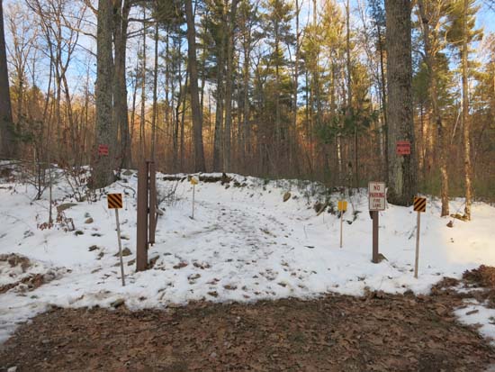
Red Hill Trail trailhead
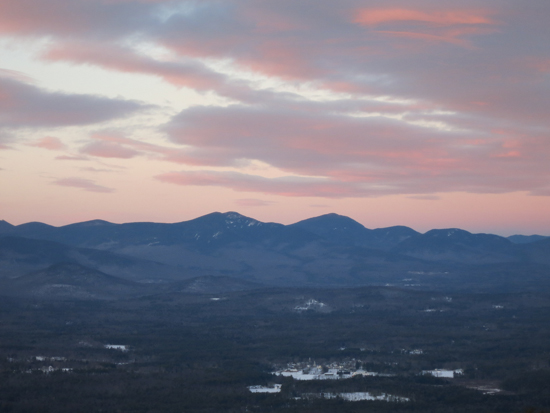
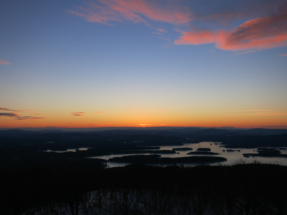
The Sandwich Range from the Red Hill fire tower

The sunset from the Red Hill fire tower
Directions to trailhead: Take Red Hill Road (also signed as Sawmill Road in some places) north from Route 25 near Center Harbor. Parking area and trailhead are on the right shortly after passing Sibley Road on the left.
Back to Red Hill Profile
|