Home
States
Colorado
Connecticut
Maine
Massachusetts
New Hampshire
New York
Rhode Island
Utah
Vermont
View All
Lists
NE 4,000 Footers
NE 100 Highest
NH 4,000 Footers
NH 100 Highest
NH 52 With A View
NH Belknap Range
NH Ossipee 10
Links
Trail Conditions
Trip Log
Sunrises
Sunsets
About
|
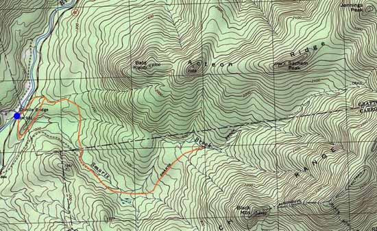
Sachem Peak, Acteon Peak Ridge (Middle Peak), Bald Knob
Thornton, NH, Waterville Valley, NH, Sandwich, NH
Trailheads, measurements, times, distances, and maps are all approximate and relative to the hike(s) as shown below.
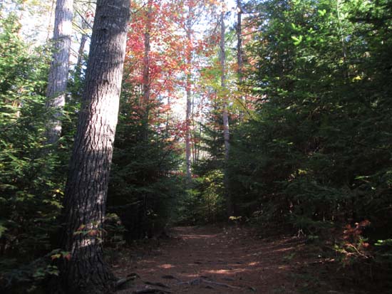
The Pine Flats Trail
Route: Old Waterville Road Trail, Pine Flats Trail, Yellow Jacket Trail, Smarts Brook Trail, herd path, bushwhack, (Sachem Peak), herd path, bushwhack, (Acteon Ridge Middle Peak), bushwhack, (Bald Knob), bushwhack, herd path, Yellow Jacket Trail, Old Waterville Road
Trails were mostly dry and in good shape. Network of trails off the highway were quickly nice...good footing, some neat natural features (such as a nice gorge along the Pine Flats Trail). Took the wrong trailhead off 49 (Waterville map suggests the trail runs parallel to the highway, but it's actually on the shoulder of the highway...we took the signed south trailhead, but come to find out there was also an unsigned north trailhead, which is the one we wanted), so took the Pine Flats Trail to correct our way to the Yellow Jacket Trail (fortunately didn't live up to its name) and to Smarts Brook Trail. The Smarts Brook Trail was the only place where we encountered any mud (from the old USFS logging operations).
We left the Smarts Brook Trail shortly after crossing a tributary, adjacent to some massive boulders. We found a herd path of sorts (occasional flagging) that wove its way around some very impressive boulders. We eventually arrived at the base of the cliffs via genearlly decent woods...I suspect there could be a way to free climb up, but we opted to cut around the east side through some scrubby stuff.
The AMC and 7.5 minute USGS maps suggest point 2,784 is the summit of Sachem Peak. This is not true. The highpoint is on the northeastern portion of that countor (as indicated in the old 1930s USGS maps). If the 2,784 is accurate, then the highpoint is likely in excess of 2,800 feet. Regardless, the highpoint provides 360 degree views and has to be one of the nicest trailless summits in the WMNF.
From there, we descended to the middle peak of Acteon Ridge (2,489'), though generally decent woods. We found multiple nice cliff view ledges just southeast of the recognized summit.
From there, we headed over to Bald Knob in one again descent woods, with some of the ascent on ledges. Lots of ledges to explore around the summit area. For the descent, we initially connected ledges to the southwest, but then cliffed out and favored west. We hit another cliffband that lasted for a good tenth of a mile, but found an exit on the north side of it, then hit another cliff band around 1,600 feet or so. Interestingly, we descended into a 30 foot long cave to get through this cliff band - pretty neat. Below there, the terrain grew a bit more gradual and the woods were pretty decent (though this may not last, as it looks like there are logging markings). We crossed a few herd paths running along contours, but eventually followed a dry brook down to the Yellow Jacket Trail, not too far from its junction with the Pine Flats Trail. From there, we took the Old Waterville Road Trail out to Route 49.
| Hike Ratings |
|
Getting To Trailhead: |
Easy |
| Destination: |
Sachem Peak |
|
Length: |
Moderate |
|
Steepness: |
Very Difficult |
|
Navigation: |
Difficult |
|
Views: |
Excellent |
|
Crowds: |
Minimal |
| Destination: |
Acteon Ridge (Middle Peak) |
|
Length: |
Moderate |
|
Steepness: |
Difficult |
|
Navigation: |
Difficult |
|
Views: |
Excellent |
|
Crowds: |
Minimal |
| Destination: |
Bald Knob |
|
Length: |
Moderate |
|
Steepness: |
Difficult |
|
Navigation: |
Difficult |
|
Views: |
Excellent |
|
Crowds: |
Minimal |
|
| Hike Stats |
|
Date Hiked: |
Saturday, September 27, 2014 |
| Parking Elevation: |
931' |
| Destination: |
Sachem Peak |
| Time Elapsed: |
02:44 |
| Trailhead Elevation: |
931' |
| Summit Elevation: |
2,860' |
| Vertical Gain: |
2,079' |
| Destination: |
Acteon Ridge (Middle Peak) |
| Time Elapsed: |
01:00 |
| Trailhead Elevation: |
2,860' |
| Summit Elevation: |
2,489' |
| Vertical Gain: |
289' |
| Destination: |
Bald Knob |
| Time Elapsed: |
00:20 |
| Trailhead Elevation: |
2,489' |
| Summit Elevation: |
2,300' |
| Vertical Gain: |
100' |
|
|
| Hike Time Elapsed: |
09:04 |
| Hike Vertical Gain: |
2,568' |
|
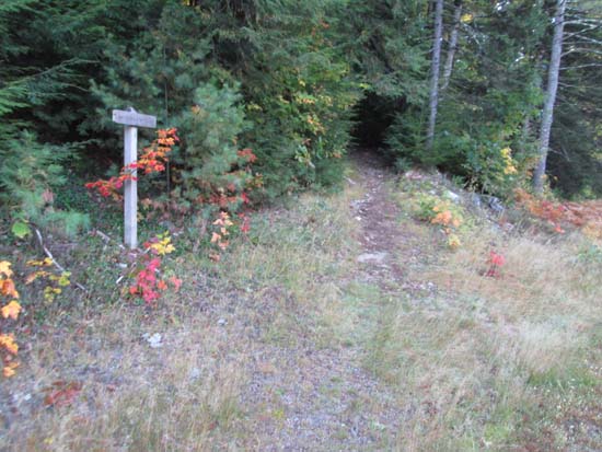
The southern Old Waterville Six Mile Bridge trailhead
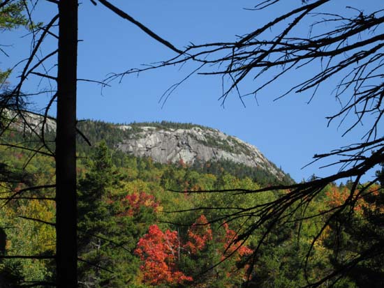
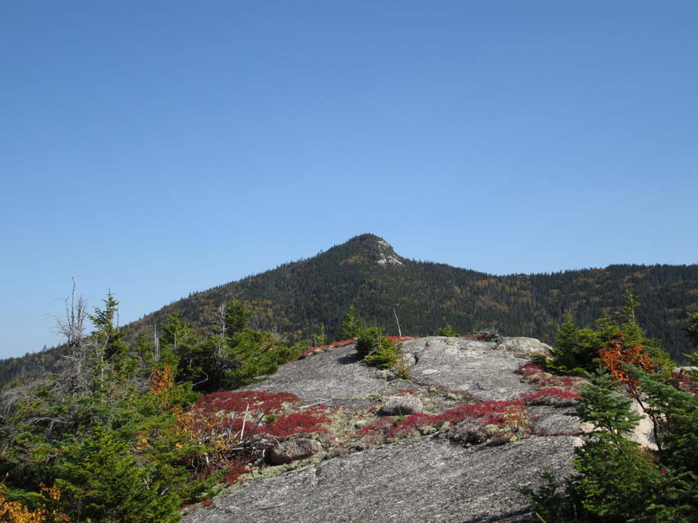
Sachem Peak as seen from Smarts Brook Trail

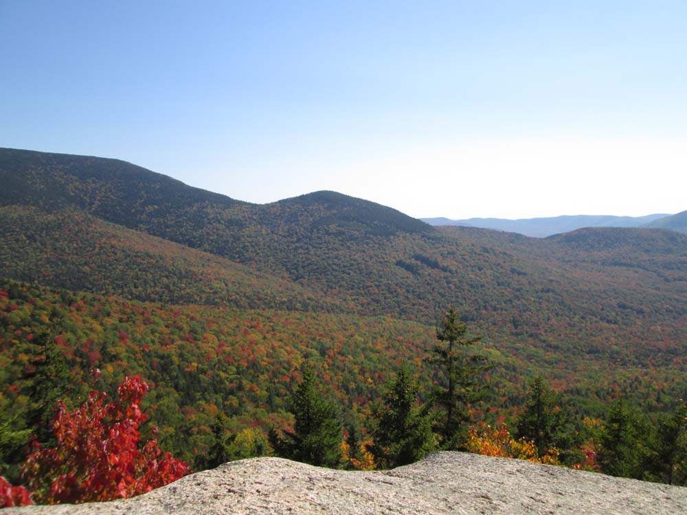
Jennings Peak as seen from near the summit of Sachem Peak
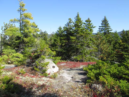
A brief stretch of herd path on the way to Acteon Ridge Middle Peak

Looking south at Black Mountain from near the summit of Acteon Ridge Middle Peak
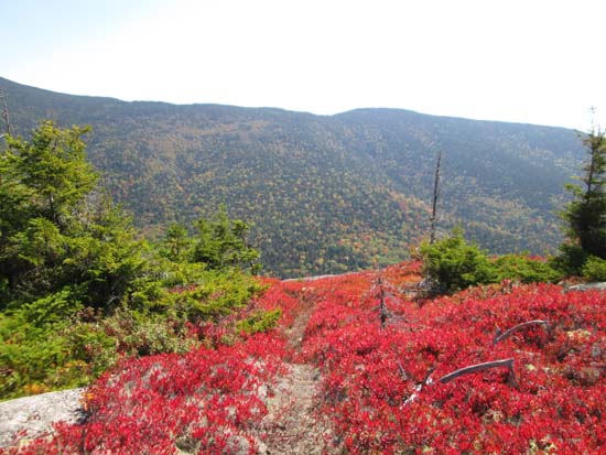
Ledgy areas on the way to Bald Knob
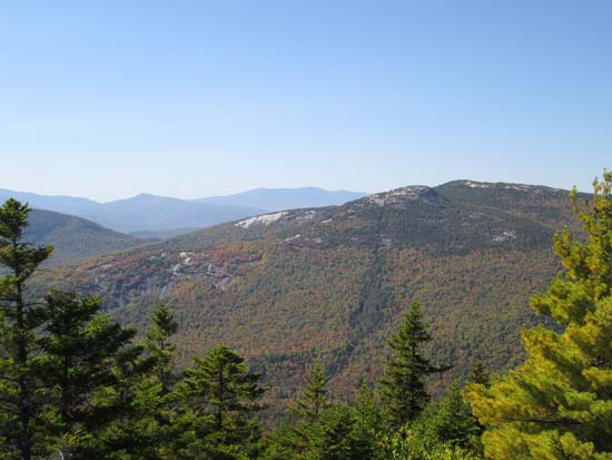
Welch and Dickey as seen from near the summit of Bald Knob
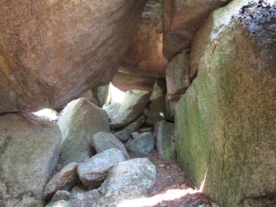
Descending through a cave on the way down Bald Knob

Directions to trailhead: From Exit 28 of I-93, take Route 49 North toward Waterville Valley. Shortly after passing Sandwich Notch Road and the Smarts Brook trailhead, Six Mile Bridge will be on the left. There is room to park on the paved turnoff just south of the bridge. Old Waterville Road can be reached across Route 49, just south (sign in 2014) and just north (no sign in 2014) of the bridge.
Back to Sachem Peak Profile
Back to Acteon Ridge (Middle Peak) Profile
Back to Bald Knob Profile
|