Home
States
Colorado
Connecticut
Maine
Massachusetts
New Hampshire
New York
Rhode Island
Utah
Vermont
View All
Lists
NE 4,000 Footers
NE 100 Highest
NH 4,000 Footers
NH 100 Highest
NH 52 With A View
NH Belknap Range
NH Ossipee 10
Links
Trail Conditions
Trip Log
Sunrises
Sunsets
About
|
Sandwich Mountain
Waterville Valley, NH
Trailheads, measurements, times, distances, and maps are all approximate and relative to the hike(s) as shown below.
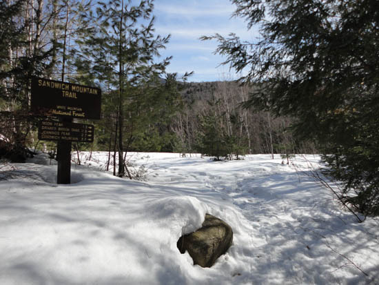
Looking up the Sandwich Mountain Trail
Route: Sandwich Mountain Trail, (Sandwich Mountain), Sandwich Mountain Trail
With a nice, bluebird spring day, finally, I headed up to Waterville Valley for a mid afternoon hike. Starting at the trailhead, I headed down to the brook crossing and found some rocks to hop across. While the lower portion of the trail was soft, the upper parts were still rock hard with a bunch of postholes. Nonetheless, the weather was nice, as were the views.
Reaching the summit, Mt. Washington and the Franconias were easily seen. In addition, thanks to the snowpack, parts of the Lakes Region could be seen over the trees.
While I had planned to ascend Jennings Peak, the subpar postholed trail conditions slowed me enough to decide to skip it. Nonetheless I was able to make it out before dark. Rather than recross the somewhat tricky brook crossing, I opted to do a short bushwhack along the shore and cross via the highway bridge.
| Hike Ratings |
|
Getting To Trailhead: |
Easy |
| Destination: |
Sandwich Mountain |
|
Length: |
Moderate |
|
Steepness: |
Difficult |
|
Navigation: |
Easy |
|
Views: |
Excellent |
|
Crowds: |
Minimal |
|
| Hike Stats |
|
Date Hiked: |
Tuesday, March 15, 2011 |
| Parking Elevation: |
1,420' |
| Destination: |
Sandwich Mountain |
| Time Elapsed: |
02:01 |
| Trailhead Elevation: |
1,420' |
| Summit Elevation: |
3,980' |
| Vertical Gain: |
2,730' |
|
|
| Hike Time Elapsed: |
03:51 |
| Hike Vertical Gain: |
2,900' |
|
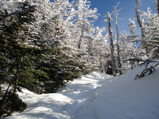
The Sandwich Mountain Trail trailhead near Route 49
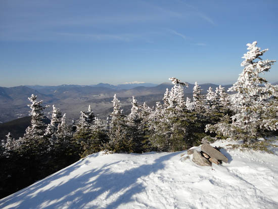
Looking at Mt. Washington from Sandwich Dome
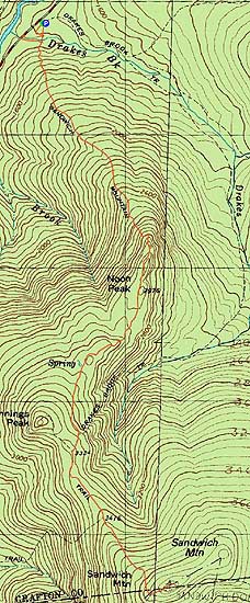

Directions to trailhead: Take Route 49 toward Waterville Valley. Take a right less than a mile before (south of) Tripoli Road. The small WMNF fee parking lot is straight ahead. The Sandwich Mountain Trail trailhead is located just before the parking lot on the right.
Back to Sandwich Mountain Profile
|