Home
States
Colorado
Connecticut
Maine
Massachusetts
New Hampshire
New York
Rhode Island
Utah
Vermont
View All
Lists
NE 4,000 Footers
NE 100 Highest
NH 4,000 Footers
NH 100 Highest
NH 52 With A View
NH Belknap Range
NH Ossipee 10
Links
Trail Conditions
Trip Log
Sunrises
Sunsets
About
|
Smarts Mountain
Lyme, NH
Trailheads, measurements, times, distances, and maps are all approximate and relative to the hike(s) as shown below.
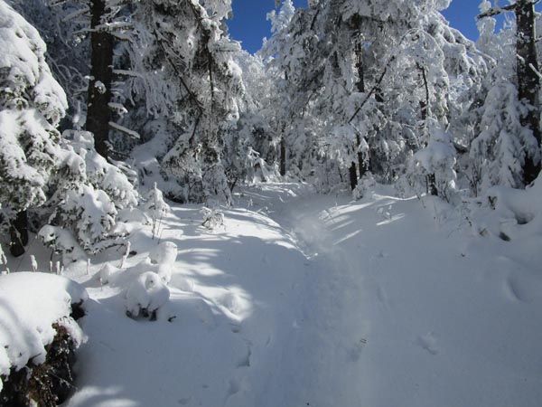
Looking up the Lambert Ridge Trail
Route: Lambert Ridge Trail, (Smarts Mountain), Lambert Ridge Trail, Ranger Trail
Snowpack was a little bit skimpy at the trailhead, but quickly increased to a foot deep within a few minutes. Lots of postholing on the Lambert Ridge Trail as the depths increased. We did our best to fix the damage with our snowshoes.
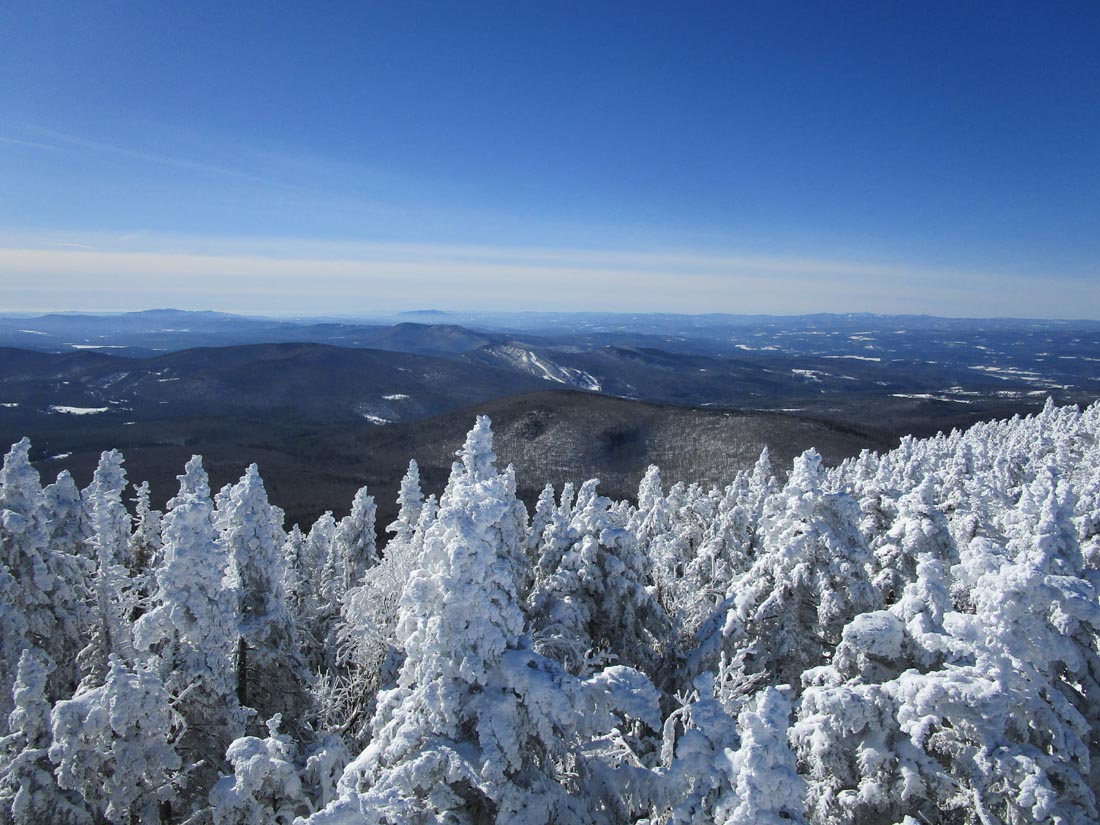
Above the junction, snowpack increased to 2+ feet. One blue ice bulge at that junction. Decent snowshoe track forming above. Snowshoes were needed to go to other areas of interest, such as the tentsite vista (best non-tower view) and the cabin, neither of which the many barebooters had been to likely due to depths.
Tower steps are caked in snow/rime, but could be barebooted. I opted not to go into the cab, as the windows were rimed over. Really strong views with some atmospheric distortion on the Ossipees and Sunapee.
Ranger Trail was decent going on snowshoes; much better than the wet/slippery mess it can be in summertime.
Sub-zero start, but warmed up to about 20 by lunchtime. Crisp, blue skies.
| Hike Ratings |
|
Getting To Trailhead: |
Easy |
| Destination: |
Smarts Mountain |
|
Length: |
Moderate |
|
Steepness: |
Difficult |
|
Navigation: |
Easy |
|
Views: |
Excellent |
|
Crowds: |
Minimal |
|
| Hike Stats |
|
Date Hiked: |
Sunday, January 31, 2021 |
| Parking Elevation: |
1,110' |
| Destination: |
Smarts Mountain |
| Time Elapsed: |
02:23 |
| Trailhead Elevation: |
1,110' |
| Summit Elevation: |
3,238' |
| Vertical Gain: |
2,498' |
|
|
| Hike Time Elapsed: |
04:17 |
| Hike Vertical Gain: |
2,668' |
|
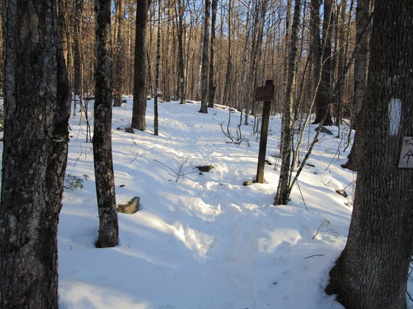
The Lambert Ridge Trail trailhead

Looking at Dartmouth Skiway from the Smarts Mountain fire tower.
Directions to trailhead: From Route 25A, take Route 10 South toward Lyme. Take a left onto Dorchester Road (may also be signed as Lyme Center Road). Bear left onto a dirt road (still Dorchester Road) when the Dartmouth Skiway is visible to the right. The Lambert Ridge-Ranger Trail parking area and trailhead will be a few minutes up the dirt road on the left, just before crossing a brook. In late January 2021, the lot was plowed, but icy.
Back to Smarts Mountain Profile
|