Home
States
Colorado
Connecticut
Maine
Massachusetts
New Hampshire
New York
Rhode Island
Utah
Vermont
View All
Lists
NE 4,000 Footers
NE 100 Highest
NH 4,000 Footers
NH 100 Highest
NH 52 With A View
NH Belknap Range
NH Ossipee 10
Links
Trail Conditions
Trip Log
Sunrises
Sunsets
About
|
South Uncanoonuc Mountain
Goffstown, NH
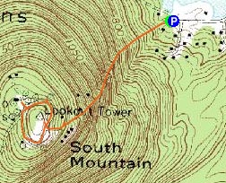
Trailheads, measurements, times, distances, and maps are all approximate and relative to the hike(s) as shown below.
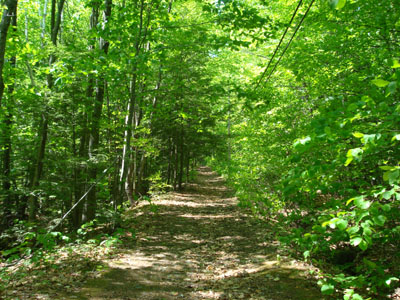
Looking up the Incline trail on the way to the top of South Uncanoonuc Mountain
Route: Incline, unknown road, (South Uncanoonuc Mountain), unknown road, Incline
After hiking North Uncanoonuc Mountain, my next stop was the nearby South Uncanoonuc Mountain. This particular peak has been compelling to me for years, as it was the location of a railroad-served ski area decades ago.
Arriving at the parking lot, which probably doubles as a beach parking area, I quickly set off up the Incline trail, which follows the old railroad grade. While never dramatically steep, it maintains a fairly consistent pitch for most of the vertical.
At the top of the Incline, I was greeted by the farm of communications towers, linked by a paved loop. The actual highpoint is fenced and off limits. Unfortunately, there wasn't much to see up there, other than a slight view thorugh some trees near a tower and a separate viewpoint near the top of the Incline trail.
| Hike Ratings |
|
Getting To Trailhead: |
Easy |
| Destination: |
South Uncanoonuc Mountain |
|
Length: |
Easy |
|
Steepness: |
Difficult |
|
Navigation: |
Easy |
|
Views: |
Minimal |
|
Crowds: |
Minimal |
|
| Hike Stats |
|
Date Hiked: |
Sunday, June 1, 2008 |
| Parking Elevation: |
665' |
| Destination: |
South Uncanoonuc Mountain |
| Time Elapsed: |
00:14 |
| Trailhead Elevation: |
655' |
| Summit Elevation: |
1,300' |
| Vertical Gain: |
645' |
|
|
| Hike Time Elapsed: |
00:47 |
| Hike Vertical Gain: |
700' |
|
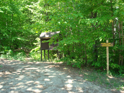
The trailhead on Mountain Base Road
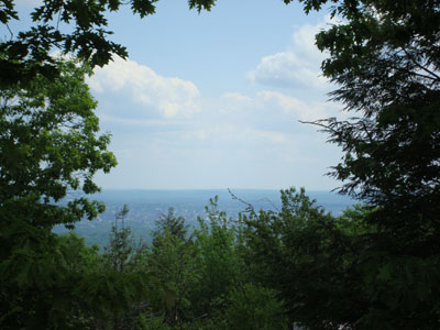
Looking at Manchester through the trees near the summit of South Uncanoonuc Mountain

Directions to trailhead: From I-89 near Concord, take Route 13 southwest to Goffstown. Take 114 southeast briefly, before going somewhat straight at an intersection onto Mountain Road. Just short of a mile, Mountain Road bears left. The small parking area is about half a mile beyond that turn, on the left side of the road, on a hill. The trailhead is across the road from the parking area, heading up an embankment.
Back to South Uncanoonuc Mountain Profile
|

