Home
States
Colorado
Connecticut
Maine
Massachusetts
New Hampshire
New York
Rhode Island
Utah
Vermont
View All
Lists
NE 4,000 Footers
NE 100 Highest
NH 4,000 Footers
NH 100 Highest
NH 52 With A View
NH Belknap Range
NH Ossipee 10
Links
Trail Conditions
Trip Log
Sunrises
Sunsets
About
|
Straightback Mountain, Mt. Major
Alton, NH
Trailheads, measurements, times, distances, and maps are all approximate and relative to the hike(s) as shown below.
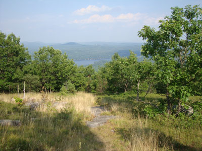
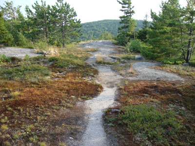
Looking down the Straightback Mountain Trail
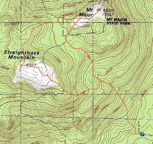
Route: Logging road/snowmobile trail, Beaver Pond Trail, Straightback Mountain Trail, (Straightback Mountain), Straightback/Major Link, Brook Trail, (Mt. Major), Brook Trail, Beaver Pond Trail
Though the skies were clouding up north, it seemed like a nice (albeit warm) afternoon in the Belknaps.
Starting adjacent a swamp on Jesus valley Road, we follow a snowmobile/logging road for a few hundred feet, then took our first right (the second right also would have worked), reaching a recent logging cut. We pushed straight up this, soon joining the Beaver Pond Trail (a snowmobile trail). The footing was a bit rocky and the trail not too interesting at first.
We then took a left onto the Straightback Mountain Trail (the junction sign was the first set of hiking markings we had seen thus far), which quickly became a very nice walk - open blueberry fields (not sparsely fruited either) and ledges with excellent views. Eventually reaching the summit (our progress slowed by the hoards of blueberries along the trail), we dropped a bit south to a nice small crag, which gave excellent southern views (the top of Straightback is rather flat, so the views aren't as good as one would think in a fairly open field).
Our next stop was Mt. Major. As soon as we left Straightback, the blueberry crop dried up. Eventually reaching the summit of Major, we had hazy views of the Lakes Region - the Sandwich Range wasn't even visible due to the oncoming weather. Nonetheless, the views were great from this open summit.
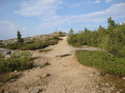
For the descent, we followed the Beaver Pond Trail. The first portion (breaking off left from the Brook Trail) was ledgy and a little bit hard to follow, however the scraped rock from snowmobiles was a sure sign. The blueberries were also much more plentiful here than anywhere else on the section between Straightback and Major.
After crossing an almost dry brook bed, the trail was basically a rocky road with few redeeming qualities - probably not something I'd go out of my way to do again unless covered with snow. The Straightback side, on the other hand, will likely warrant future visits, especially when the blueberries are ripe.
| Hike Ratings |
|
Getting To Trailhead: |
Moderate |
| Destination: |
Straightback Mountain |
|
Length: |
Moderate |
|
Steepness: |
Moderate |
|
Navigation: |
Moderate |
|
Views: |
Excellent |
|
Crowds: |
Minimal |
| Destination: |
Mt. Major |
|
Length: |
Moderate |
|
Steepness: |
Moderate |
|
Navigation: |
Easy |
|
Views: |
Excellent |
|
Crowds: |
Moderate |
|
| Hike Stats |
|
Date Hiked: |
Wednesday, July 28, 2010 |
| Hike Commenced: |
4:28 PM |
| Parking Elevation: |
730' |
| Destination: |
Straightback Mountain |
| Ascent Commenced: |
4:28 PM |
| Summit Reached: |
5:26 PM |
| Time Elapsed: |
00:58 |
| Trailhead Elevation: |
730' |
| Summit Elevation: |
1,890' |
| Distance: |
1.5 miles |
| Vertical Gain: |
1,175' |
| Destination: |
Mt. Major |
| Ascent Commenced: |
5:34 PM |
| Summit Reached: |
6:01 PM |
| Time Elapsed: |
00:27 |
| Trailhead Elevation: |
1,890' |
| Summit Elevation: |
1,786' |
| Distance: |
1.1 miles |
| Vertical Gain: |
261' |
|
|
| Hike Ended: |
6:58 PM |
| Hike Time Elapsed: |
02:30 |
| Hike Vertical Gain: |
1,576' |
|
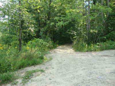
The beginning of the woods road adjacent to the marsh near the end of Jesus Valley Road
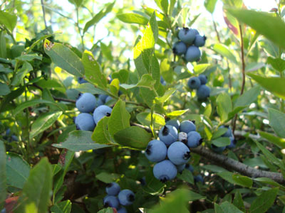
Blueberries galore on Straightback Mountain

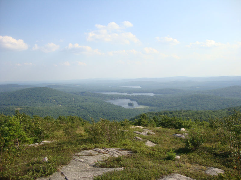
Looking at Hills Pond, Sunset Lake, and Crystal Lake from near the summit of Straightback Mountain
Looking up the Brook Trail on the way to Mt. Major
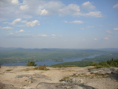
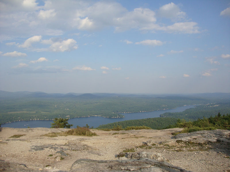
Alton Bay as seen from Mt. Major
The upper portion of the Beaver Pond Trail
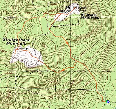

Directions to trailhead: Take Route 11 West from Alton Bay. Take a left onto Jesus Valley Road. Just prior to the road ending, there will be a swamp/pond on the left side (and just after this, a private property sign). There is room to park roadside next to the swamp. A woods road starts just after the swamp/pond on the left.
Back to Straightback Mountain Profile
Back to Mt. Major Profile
|