Home
States
Colorado
Connecticut
Maine
Massachusetts
New Hampshire
New York
Rhode Island
Utah
Vermont
View All
Lists
NE 4,000 Footers
NE 100 Highest
NH 4,000 Footers
NH 100 Highest
NH 52 With A View
NH Belknap Range
NH Ossipee 10
Links
Trail Conditions
Trip Log
Sunrises
Sunsets
About
|
Table Mountain
Bartlett, NH
Trailheads, measurements, times, distances, and maps are all approximate and relative to the hike(s) as shown below.
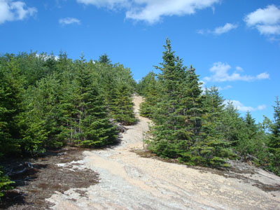
Looking up the Attitash Trail on the way to the top ledges on Table Mountain
Route: Attitash Trail, (Table Mountain ledges), Attitash Trail
Since it was such a nice day outside, I decided to do easy to moderate hike. Having never been to Table Mountain before, I figured today would be as good as any to check it out.
Arriving at the small parking lot (basically enough room for me to turn around and park on the side of the entrance), I quickly set foot on the Attitash Trail. The first portion of the trail was essentially a gradual old woods road, following a brook. After a few brook crossings (no problem), the trail became narrow and a bit grown in. The third portion of the trail a series of ledgy sections with a few short, steep parts with poor footing.
From the top ledges, I could tell I was still a bit below the true summit. I took a short herd path to another ledge, then backtracked and took the Attitash Trail a bit further, seeing if I could find a herd path to the summit or some lighter vegetation. Not finding any, I decided I wasn't going to go through the thick trees in shorts.
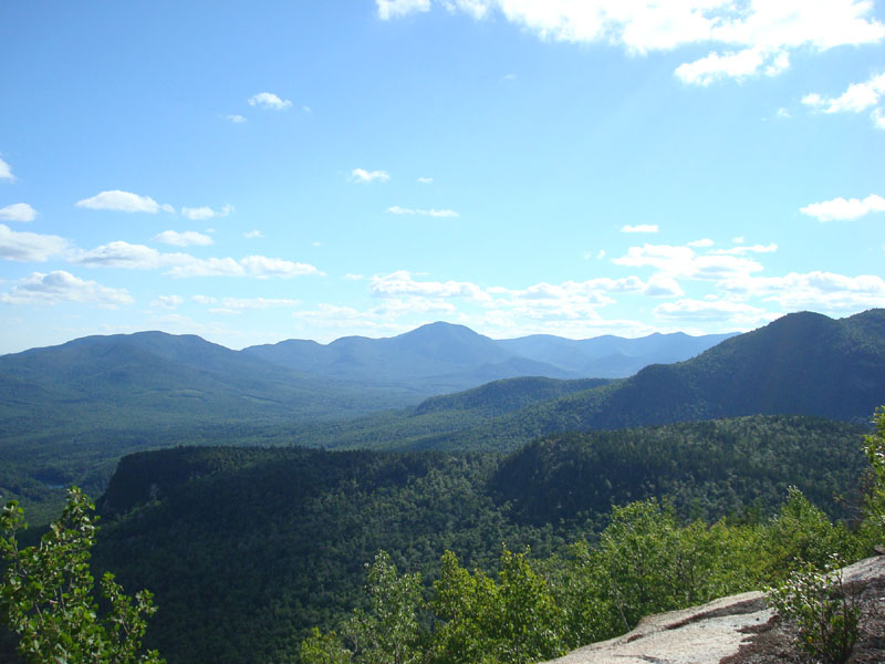
The views from the ledges were tremendous - from South Moat to the Tripyramids, the southern views were great. In addition, there were some views through the trees of points to the west, such as Mt. Carrigain.
After taking in the views for 10 or 15 minutes, I decided to call it a day.
| Hike Ratings |
|
Getting To Trailhead: |
Easy |
| Destination: |
Table Mountain |
|
Length: |
Moderate |
|
Steepness: |
Difficult |
|
Navigation: |
Easy |
|
Views: |
Excellent |
|
Crowds: |
Minimal |
|
| Hike Stats |
|
Date Hiked: |
Tuesday, July 15, 2008 |
| Hike Commenced: |
4:05 PM |
| Parking Elevation: |
1,260' |
| Destination: |
Table Mountain |
| Ascent Commenced: |
4:05 PM |
| Summit Ledges Reached: |
4:48 PM |
| Time Elapsed: |
00:43 |
| Trailhead Elevation: |
1,265' |
| Summit Ledges Elevation: |
2,610' |
| Distance: |
1.9 miles |
| Vertical Gain: |
1,380' |
|
|
| Hike Ended: |
5:47 PM |
| Hike Time Elapsed: |
01:42 |
| Hike Vertical Gain: |
1,450' |
|
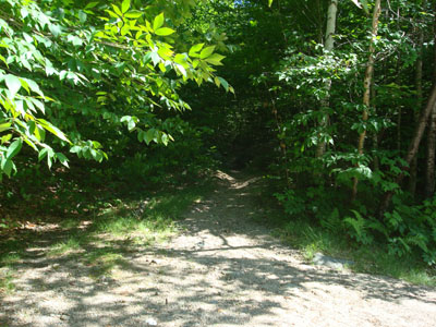
The Attitash Trail trailhead
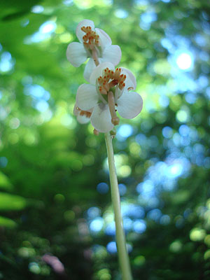
A wild flower on the side of the Attitash Trail
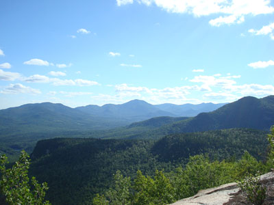
Looking at the Sandwich Range from the Table Mountain ledges
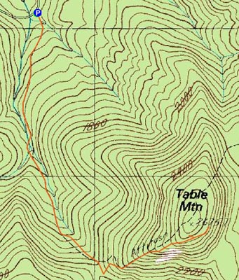

Directions to trailhead: From Route 302 West in Conway, head into Bartlett and take a left onto Bear Notch Road (closed in winter). The Attitash Trail trailhead is located on the left side of the road (at the beginning of a curve), awhile before the height of land on the road. There is a very small dirt parking lot.
Back to Table Mountain Profile
|