Home
States
Colorado
Connecticut
Maine
Massachusetts
New Hampshire
New York
Rhode Island
Utah
Vermont
View All
Lists
NE 4,000 Footers
NE 100 Highest
NH 4,000 Footers
NH 100 Highest
NH 52 With A View
NH Belknap Range
NH Ossipee 10
Links
Trail Conditions
Trip Log
Sunrises
Sunsets
About
|
Table Rock
Dixville, NH
Trailheads, measurements, times, distances, and maps are all approximate and relative to the hike(s) as shown below.
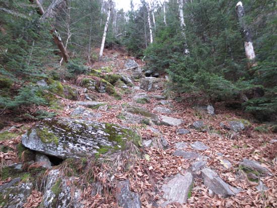
Looking up the Table Rock Trail
Route: Table Rock Trail
Trail up from the notch is relentlessly steep (about 600 vertical in .3 mile). Walk out to Table Rock is not recommended for those who have issues with heights - it's bascially a ~5-10 foot wide knife edge with massive drops on either side. Wind gusts from the notch didn't help. Views were spectacular. A shame to see the grand hotel and nearby ski area closed for another winter season.
| Hike Ratings |
|
Getting To Trailhead: |
Easy |
| Destination: |
Table Rock |
|
Length: |
Moderate |
|
Steepness: |
Very Difficult |
|
Navigation: |
Easy |
|
Views: |
Excellent |
|
Crowds: |
Minimal |
|
| Hike Stats |
|
Date Hiked: |
Sunday, October 28, 2012 |
| Parking Elevation: |
1,930' |
| Destination: |
Table Rock |
| Time Elapsed: |
00:16 |
| Trailhead Elevation: |
1,930' |
| Summit Elevation: |
2,510' |
| Distance: |
0.3 miles |
| Vertical Gain: |
600' |
|
|
| Hike Time Elapsed: |
00:47 |
| Hike Vertical Gain: |
620' |
|
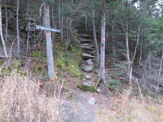
Table Rock Trail trailhead
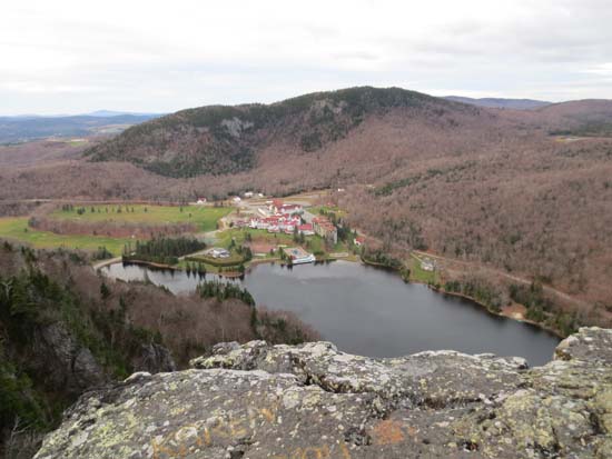
Looking at the Balsams from Table Rock
Directions to trailhead: From Route 16 in Errol, take Route 26 West, over the height of land in Dixville Notch. There will be a pull off on the left side of the road, shortly before the Balsams Entrance on the right. The Table Rock (Climbing) Trail is adjacent to the pull off.
Back to Table Rock Profile
|

