Home
States
Colorado
Connecticut
Maine
Massachusetts
New Hampshire
New York
Rhode Island
Utah
Vermont
View All
Lists
NE 4,000 Footers
NE 100 Highest
NH 4,000 Footers
NH 100 Highest
NH 52 With A View
NH Belknap Range
NH Ossipee 10
Links
Trail Conditions
Trip Log
Sunrises
Sunsets
About
|
Teapot Mountain, Goback Mountain, Savage Mountain, East Savage Mountain
Stratford, NH
Trailheads, measurements, times, distances, and maps are all approximate and relative to the hike(s) as shown below.
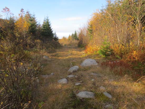
The logging road on the northeast slope of Teapot Mountain
Route: Logging roads, bushwhack, (Teapot Mountain), bushwhack, (Goback Mountain), bushwhack, (Savage Mountain), bushwhack, logging road, bushwhack, (East Savage Mountain), bushwhack, logging roads
We started off walking the road with a gate, then bearing right onto a secondary logging road. Not too far up this, there are some large open waterbars where culverts have been pulled, so via this route, one can drive maybe half a mile beyond the gate if they're willing to risk getting locked in.
We then headed up near a drainage up to the Lightning-Teapot col, generally in okay woods. Not too bad from that col up to the recognized summit of Teapot.
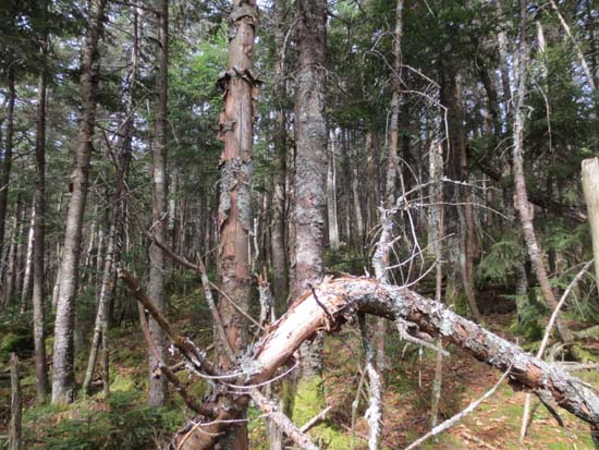
Dropping off Teapot, it was so-so initially, then nice and open in the col. We stayed on the east side of the ridge, but eventually hit some steep stuff and a large blowdown patch, which continued up to the summit ridge and around the recognized highpoint.
Also thick and steep descending toward savage with some small hidden cliff bands. We favored east a bit. Things were a little bitter near the col, then we headed up the steep, scrambly slope of Savage, staying just east of a large young spruce stand (old blowdown)- steep, but not terrible going to the recognized summit.
We then returned to the col and descended east down a drainage that was steep, scrambly in places, and had postholy soil. Eventually we hit good woods as we neared the lower col and then some old grassy logging roads. From the height of land in that col, we bushwhacked up to the 2,850 foot subpeak of Savage, favoring north to navigate through some cliffbands. Once on that ridge, the woods were generally okay to the recognized summit.
Back in the col, we followed a series of old logging roads (encountering the only mud of the day in the upper elevations), eventually leading back to the main road. Very interesting looks at the lower cliffs on Goback.
Foliage is past peak up there, but still decent. Weather was nicer than expected - dry, reasonable temperatures, and occasional sunshine.
| Hike Ratings |
|
Getting To Trailhead: |
Easy |
| Destination: |
Teapot Mountain |
|
Length: |
Moderate |
|
Steepness: |
Difficult |
|
Navigation: |
Very Difficult |
|
Views: |
Minimal |
|
Crowds: |
Minimal |
| Destination: |
Goback Mountain |
|
Length: |
Difficult |
|
Steepness: |
Difficult |
|
Navigation: |
Very Difficult |
|
Views: |
Moderate |
|
Crowds: |
Minimal |
| Destination: |
Savage Mountain |
|
Length: |
Difficult |
|
Steepness: |
Difficult |
|
Navigation: |
Very Difficult |
|
Views: |
Moderate |
|
Crowds: |
Minimal |
| Destination: |
East Savage Mountain |
|
Length: |
Difficult |
|
Steepness: |
Very Difficult |
|
Navigation: |
Very Difficult |
|
Views: |
Moderate |
|
Crowds: |
Minimal |
|
| Hike Stats |
|
Date Hiked: |
Saturday, October 5, 2013 |
| Parking Elevation: |
1,282' |
| Time to Trailhead: |
00:07 |
| Destination: |
Teapot Mountain |
| Time Elapsed: |
01:51 |
| Trailhead Elevation: |
1,341' |
| Summit Elevation: |
3,390' |
| Vertical Gain: |
2,069' |
| Destination: |
Goback Mountain |
| Time Elapsed: |
01:28 |
| Trailhead Elevation: |
3,390' |
| Summit Elevation: |
3,485' |
| Vertical Gain: |
485' |
| Destination: |
Savage Mountain |
| Time Elapsed: |
00:46 |
| Trailhead Elevation: |
3,485' |
| Summit Elevation: |
3,510' |
| Vertical Gain: |
180' |
| Destination: |
East Savage Mountain |
| Time Elapsed: |
01:37 |
| Trailhead Elevation: |
3,510' |
| Summit Elevation: |
2,850' |
| Vertical Gain: |
290' |
|
|
| Hike Time Elapsed: |
09:10 |
| Hike Vertical Gain: |
3,133' |
|
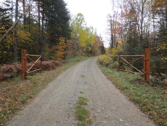
The gate at the left turn on Meriden Hill Road
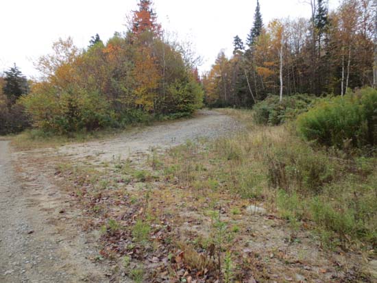
The start of the logging road heading up the northeast slope of Teapot Mountain

Looking at Scarface, Big Bickford, and Eagle Cliff from Mittersill Peak
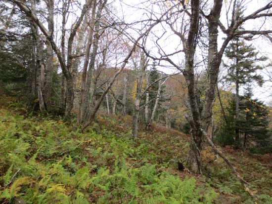
Open woods in the col between Teapot and Goback
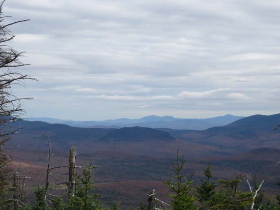
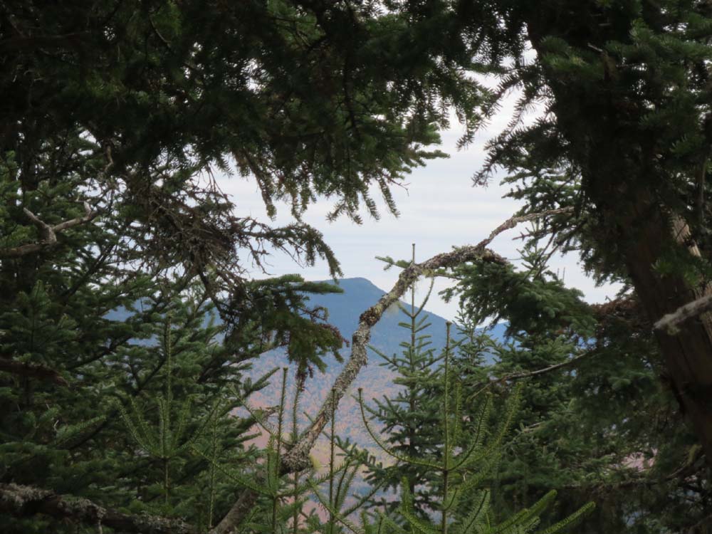
Views east from near the summit of Goback Mountain
Bushwhacking between Goback and Savage
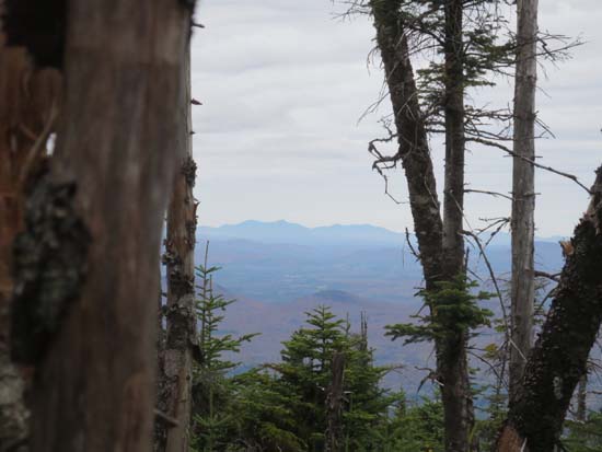
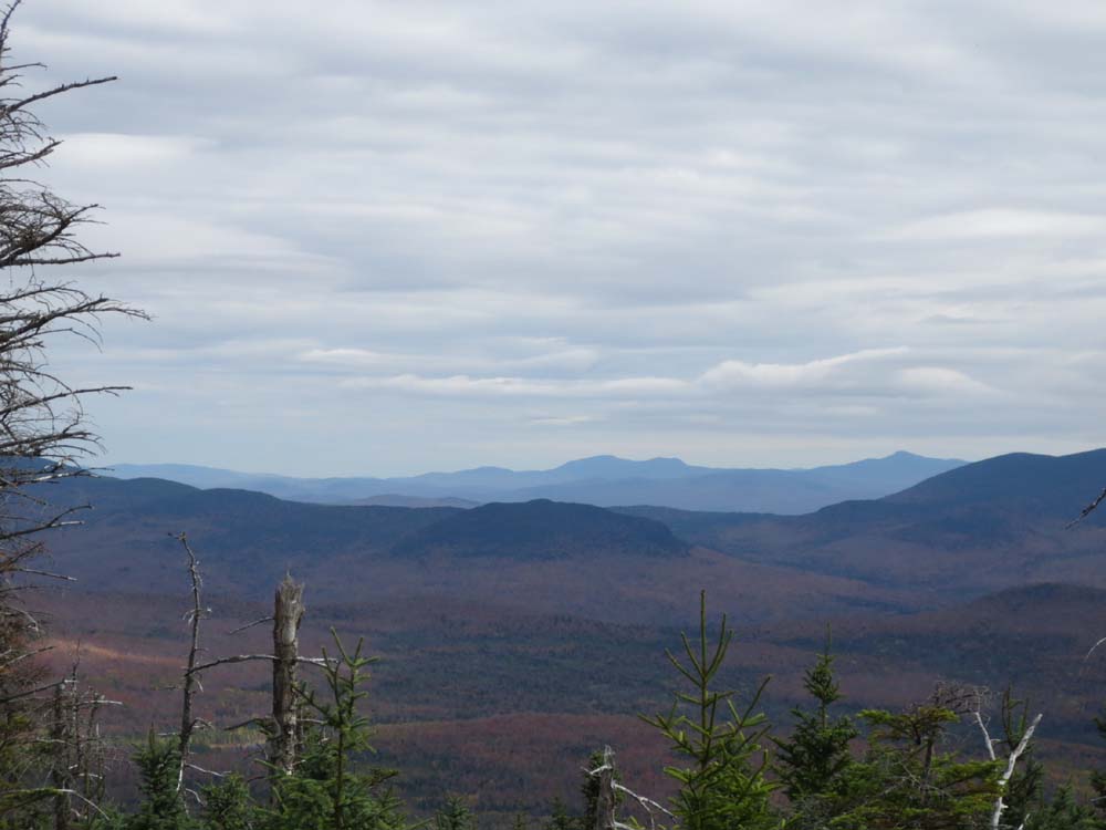
Slight views toward Jay Peak from near the summit of Savage Mountain
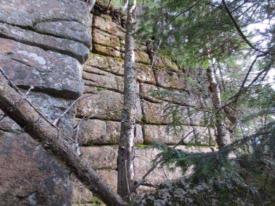
Interesting cliffs on the side of East Savage

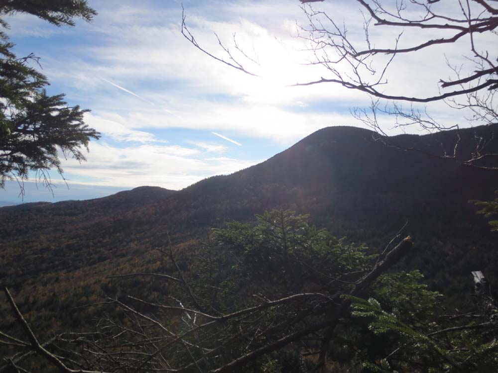
Savage Mountain as seen from the East Savage ledges
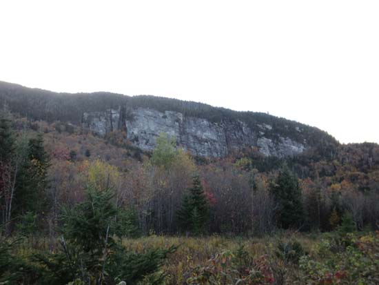
Large cliffs on the northern spur of Goback Mountain (also known as Valhalla?)
An old logging road in the Savage-East Savage col
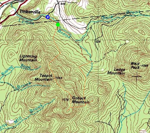

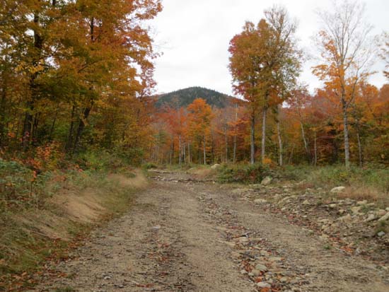
Directions to trailhead: Take US 3 North of Stratford. Take a right onto Meriden Hill Road. There will eventually be a gate straight ahead, where the road turns left. There is room to park outside of the gate (it may be closed at any time).
Back to Teapot Mountain Profile
Back to Goback Mountain Profile
Back to Savage Mountain Profile
Back to East Savage Mountain Profile
|