Home
States
Colorado
Connecticut
Maine
Massachusetts
New Hampshire
New York
Rhode Island
Utah
Vermont
View All
Lists
NE 4,000 Footers
NE 100 Highest
NH 4,000 Footers
NH 100 Highest
NH 52 With A View
NH Belknap Range
NH Ossipee 10
Links
Trail Conditions
Trip Log
Sunrises
Sunsets
About
|
The Bulge, Mt. Cabot, The Horn
Stark, NH, Kilkenny, NH
Trailheads, measurements, times, distances, and maps are all approximate and relative to the hike(s) as shown below.
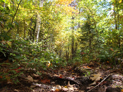
Looking up the Unknown Pond Trail
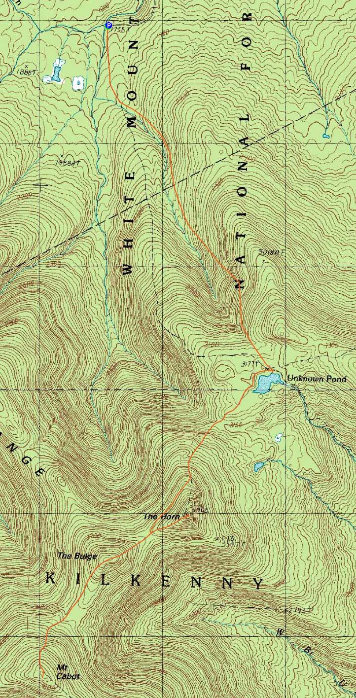
Route: Unknown Pond Trail, Kilkenny Ridge Trail, (The Bulge), Kilkenny Ridge Trail, (Mt. Cabot), Kilkenny Ridge Trail, (The Bulge), Kilkenny Ridge Trail, spur trail, (The Horn), Kilkenny Ridge Trail, Unknown Pond Trail
With a beautiful fall forecast, I decided to take a few comp hours at work and head way north. Arriving at the Mill Brook Unknown Pond Trail trailhead, I was happy to see all sorts of pre-peak fall colors.
While the flats were muddy, the balance of the Unknown Pond Trail was in good shape - and quite colorful. Since I wanted to get the balance of the hiking done prior to taking a break, I skipped the Horn on the ascent and went straight to the viewless Bulge. From there, I continued to Mt. Cabot. After reaching the highpoint, I headed over to the blowdown patch and did some exploring, finding various versions of the vista.
Back on the trail, I worked my way over the Bulge again, as I noticed the temperature dropping. Reaching the summit of the Horn, I had great views. I did some additional herdpath following near the summit, hoping to find perhaps some more vistas. I didn't explore too long, but I do suspect there might be something overlooking Unknown Pond. Perhaps another time.
Since it wasn't quite moose time, I didn't spend much time at Unknown Pond - had it been a bit later, perhaps I would have gone to the various viewpoints to see if any moose were hanging out. Instead, I reached the trailhead prior to sunset - nice to not need the handlamp!
| Hike Ratings |
|
Getting To Trailhead: |
Easy |
| Destination: |
The Bulge |
|
Length: |
Moderate |
|
Steepness: |
Difficult |
|
Navigation: |
Easy |
|
Views: |
Minimal |
|
Crowds: |
Minimal |
| Destination: |
Mt. Cabot |
|
Length: |
Moderate |
|
Steepness: |
Difficult |
|
Navigation: |
Easy |
|
Views: |
Excellent |
|
Crowds: |
Minimal |
| Destination: |
The Horn |
|
Length: |
Moderate |
|
Steepness: |
Very Difficult |
|
Navigation: |
Easy |
|
Views: |
Excellent |
|
Crowds: |
Minimal |
|
| Hike Stats |
|
Date Hiked: |
Thursday, September 24, 2009 |
| Hike Commenced: |
1:14 PM |
| Parking Elevation: |
1,755' |
| Destination: |
The Bulge |
| Ascent Commenced: |
1:14 PM |
| Summit Reached: |
3:01 PM |
| Time Elapsed: |
01:47 |
| Trailhead Elevation: |
1,755' |
| Summit Elevation: |
3,950' |
| Vertical Gain: |
2,425' |
| Destination: |
Mt. Cabot |
| Ascent Commenced: |
3:02 PM |
| Summit Reached: |
3:27 PM |
| Time Elapsed: |
00:25 |
| Trailhead Elevation: |
1,770' |
| Summit Elevation: |
4,170' |
| Vertical Gain: |
485' |
| Destination: |
The Bulge |
| Ascent Commenced: |
3:34 PM |
| Summit Reached: |
4:01 PM |
| Time Elapsed: |
00:27 |
| Trailhead Elevation: |
4,170' |
| Summit Elevation: |
3,950' |
| Vertical Gain: |
265' |
| Destination: |
The Horn |
| Ascent Commenced: |
4:01 PM |
| Summit Reached: |
4:19 PM |
| Time Elapsed: |
00:18 |
| Trailhead Elevation: |
3,950' |
| Summit Elevation: |
3,905' |
| Vertical Gain: |
255' |
|
|
| Hike Ended: |
6:17 PM |
| Hike Time Elapsed: |
05:03 |
| Hike Distance: |
10.6 miles |
| Hike Vertical Gain: |
3,650' |
|
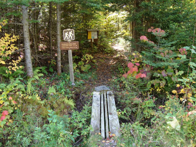
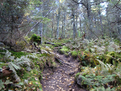
The Unknown Pond Trail trailhead
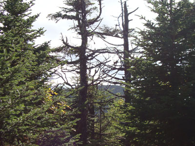
The lack of views from the Bulge
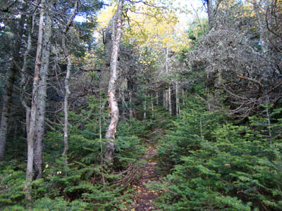
The Kilkenny Ridge Trail to Mt. Cabot

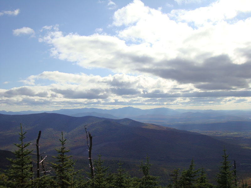
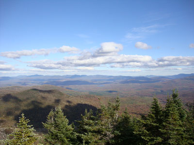
Looking at the Franconia Ridge from near the summit of Mt. Cabot
The spur trail to the Horn
The Mahoosucs as seen from the Horn
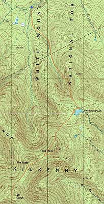

Directions to trailhead: Take 110 West from Berlin to Stark. Take a left onto Mill Brook Road. The Unknown Pond Trail trailhead will eventually be on the left, just before the second one-lane bridge, with some room for roadside parking on either end of the bridge.
Back to The Bulge Profile
Back to Mt. Cabot Profile
Back to The Horn Profile
|