Home
States
Colorado
Connecticut
Maine
Massachusetts
New Hampshire
New York
Rhode Island
Utah
Vermont
View All
Lists
NE 4,000 Footers
NE 100 Highest
NH 4,000 Footers
NH 100 Highest
NH 52 With A View
NH Belknap Range
NH Ossipee 10
Links
Trail Conditions
Trip Log
Sunrises
Sunsets
About
|
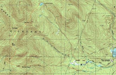
The Horn, The Bulge, Mt. Cabot
Berlin, NH, Kilkenny, NH
Trailheads, measurements, times, distances, and maps are all approximate and relative to the hike(s) as shown below.
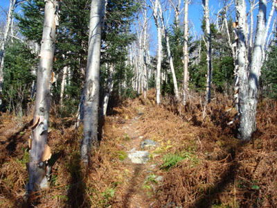
Looking up the Unknown Pond Trail
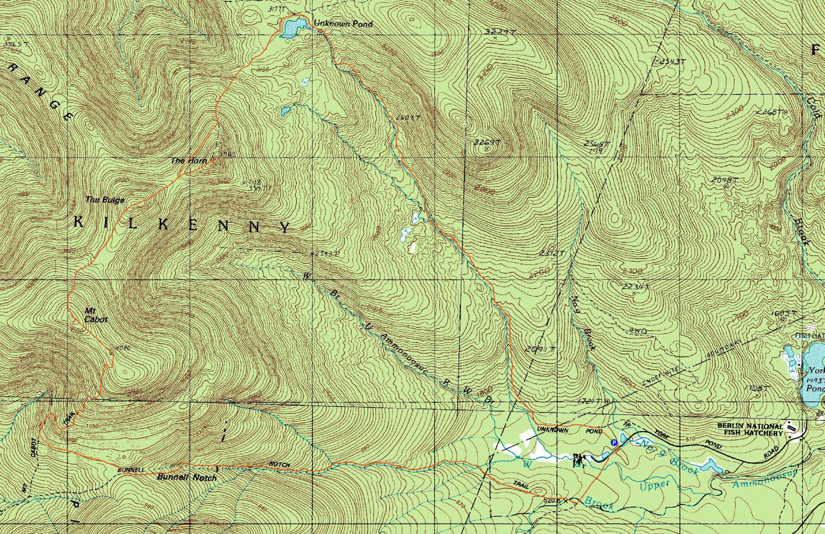
Route: Unknown Pond Trail, Kilkenny Ridge Trail, The Horn spur trail, (The Horn), The Horn spur trail, Kilkenny Ridge Trail, (The Bulge), Kilkenny Ridge Trail, (Mt. Cabot), Kilkenny Ridge Trail, Bunnell Notch Trail, York Pond Trail
It was finally time for Cabot.
I was the first (and apparently at the end of the day, only) vehicle at the Unknown Pond parking area. The trail starts off very gently. For most of the ascent to the pond, the trail follows close to a brook, making it a little bit muddy in places. Fortunately, there are only three smallish brook crossings.
The Unknown Pond area was very peaceful - the reflection of The Horn in the water was very nice. I also observed some fresh moose prints in the mud.
Heading over on the Kilkenny Ridge Trail, I was getting concerned that I had missed the spur trail to The Horn - however, at the foot of the ascent to The Bulge, there was a sign and a trail. Up to this point, there had been nothing more than a moderate pitch at best.
The very last portion of of the Horn spur trail was somewhat challenging - in that I was struggling to find a way to climb up the summit rock! My legs weren't quite long enough to ascend up the north side, but fortunately there was an easier climb on the south side.
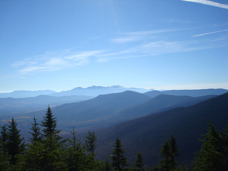
The views were great - especially into Vermont. Sadly, there was a morning haze around the Presidentials, making the view not as great as it should have been this cold morning.
After having a snack, I hopped off the north side of the rock, and headed down (and then up) The Bulge.
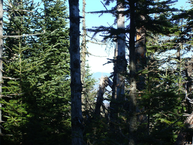
Boring. Slight view through the trees to the north/northwest. Wow.
The next stop was Mt. Cabot. The ascent did get somewhat steep for a section, as the eroded Kilkenny Ridge Trail climbed up the back of Cabot.
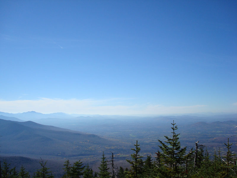
After looking at the sign/cairn, I followed a heard path over to a large blowdown section, (maybe two hundred feet from the sign). Despite hearing some accounts of there being no view from the summit of Cabot (and that one has to go to the old fire tower remains to see anything), I was surprised to see there were decent directional views from this area. Certainly nothing as strong as the Horn or many of the 4,000 footers I've been to, but certainly no Waumbek.
The next stop was the old fire tower site. There were some directional views here, and then some more from the cabin.
I took a quick look around the cabin, checking out the 3d topo map of the White Mountains. Next stop - end of hike.
Continuing down the Kilkenny Ridge Trail, I passed the first hikers I had seen all day long (ascending to spend the night at the cabin). Soon, I was at the junction of the closed Cabot Trail - keeping to the left, I ascended a bit, then dropped onto the Bunnell Notch Trail. For some reason, I had pictured this to be more like an old road, a la the Garfield Trail or Livermore Road. It is not. Rather, it's a brookside trail that eventually merges with some logging roads at the flats.
Continuing on this grassy road, I was soon back at York Pond Road - just a bit down the road from where I had parked.
| Hike Ratings |
|
Getting To Trailhead: |
Easy |
| Destination: |
The Horn |
|
Length: |
Moderate |
|
Steepness: |
Very Difficult |
|
Navigation: |
Easy |
|
Views: |
Excellent |
|
Crowds: |
Minimal |
| Destination: |
The Bulge |
|
Length: |
Moderate |
|
Steepness: |
Very Difficult |
|
Navigation: |
Easy |
|
Views: |
Minimal |
|
Crowds: |
Minimal |
| Destination: |
Mt. Cabot |
|
Length: |
Difficult |
|
Steepness: |
Difficult |
|
Navigation: |
Easy |
|
Views: |
Excellent |
|
Crowds: |
Minimal |
|
| Hike Stats |
|
Date Hiked: |
Friday, October 26, 2007 |
| Hike Commenced: |
8:41 AM |
| Parking Elevation: |
1,680' |
| Destination: |
The Horn |
| Ascent Commenced: |
8:41 AM |
| Summit Reached: |
11:04 AM |
| Time Elapsed: |
02:23 |
| Trailhead Elevation: |
1,680' |
| Summit Elevation: |
3,905' |
| Distance: |
4.9 miles |
| Vertical Gain: |
2,530' |
| Destination: |
The Bulge |
| Ascent Commenced: |
11:19 AM |
| Summit Reached: |
11:40 AM |
| Time Elapsed: |
00:21 |
| Trailhead Elevation: |
3,905' |
| Summit Elevation: |
3,950' |
| Vertical Gain: |
305' |
| Destination: |
Mt. Cabot |
| Ascent Commenced: |
11:41 AM |
| Summit Reached: |
12:08 PM |
| Time Elapsed: |
00:27 |
| Trailhead Elevation: |
3,950' |
| Summit Elevation: |
4,170' |
| Vertical Gain: |
485' |
|
|
| Hike Ended: |
2:29 PM |
| Hike Time Elapsed: |
05:48 |
| Hike Vertical Gain: |
3,635' |
|
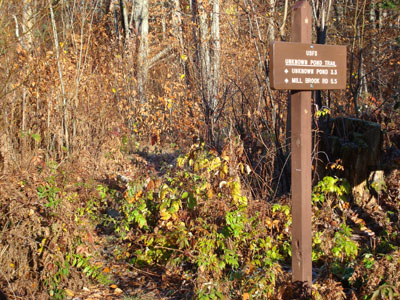
The Unknown Pond Trail trailhead near York Pond Road

Looking south at the Presidentials from the summit of The Horn
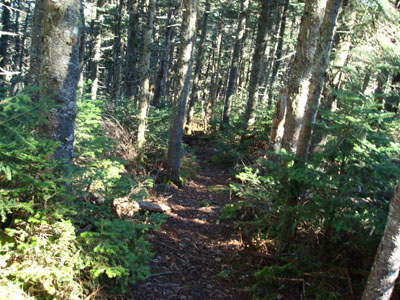
Looking down the Kilkenny Ridge Trail on the way to the Bulge

Looking at the lack-of-view from the Bulge summit
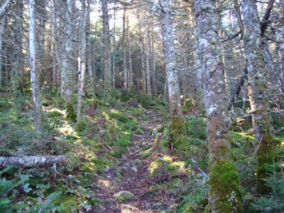
The Kilkenny Ridge Trail to Mt. Cabot

The view to the southwest from the blown down area near the Mt. Cabot summit

Directions to trailhead: Take Route 16 to Berlin, then take Route 110 northwest. York Pond Road will eventually be on the left. Continue through the Fish Hatchery (do be aware that the gates are only open during the day, usually 8 AM - 4 PM). The driveway to the Unknown Pond Trail parking area will eventually be on the right. The trailhead is next to the kiosk.
Back to The Horn Profile
Back to The Bulge Profile
Back to Mt. Cabot Profile
|