Home
States
Colorado
Connecticut
Maine
Massachusetts
New Hampshire
New York
Rhode Island
Utah
Vermont
View All
Lists
NE 4,000 Footers
NE 100 Highest
NH 4,000 Footers
NH 100 Highest
NH 52 With A View
NH Belknap Range
NH Ossipee 10
Links
Trail Conditions
Trip Log
Sunrises
Sunsets
About
|
Wildcat A
Green's Grant, NH, Bean's Purchase, NH
Trailheads, measurements, times, distances, and maps are all approximate and relative to the hike(s) as shown below.
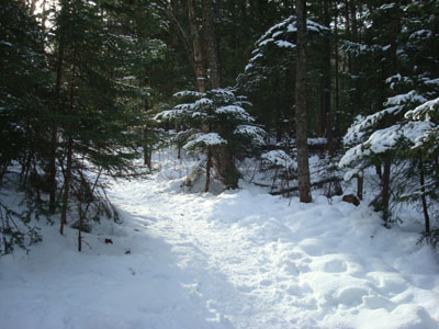
Looking up the Nineteen Mile Brook Trail
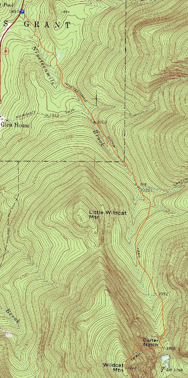
Route: Nineteen Mile Brook Trail, Wildcat Ridge Trail, (Wildcat A), Wildcat Ridge Trail, Nineteen Mile Brook Trail
Since I'd like to check out Wildcat A via Carter Notch sometime this winter, I decided to head up there in early-winter weather.
A day earlier, the Nineteen Mile Brook Trail parking lot was just about full when I passed it. This time, however, there was only one other vehicle when I arrived. After my Kelty backpack literally started bursting at the seams with winter gear a day earlier, I picked up a slightly larger pack with a much better fit. What an amazing difference!
The Nineteen Mile Brook Trail was rather well packed - there was a decent amount of snow, but with the rocks and wet spots on the trail, snowshoes would have been useless. The Wildcat Ridge Trail, however, was a different story.
Arriving at the height of land, I dealt with the only winds of the day (coming through the notch). After struggling for a good ten minutes with getting my snowshoes on to my satisfaction, I headed up the unbroken Wildcat Ridge Trail. While I was sinking down and packing significant portions of the trail, much of it was crusted over.
Crossing the slide was certainly interesting - I was glad to have my ice axe out, was the footbed was no longer visible - thus, the slope of the slide tried to pull the snowshoes downhill. Fortunately, I was on my MSRs - had I been on shoes with smooth frames, I would have probably ended up either in a self arrest or pinned a rock or tree down below.
Above the slide, there were a few short tricky sections, including a steep open slope, however it wasn't too too bad.
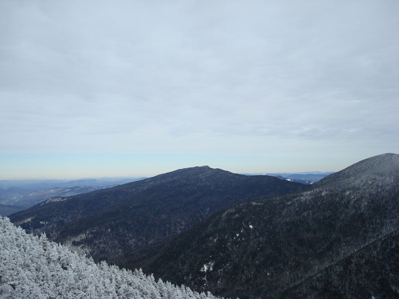
The views from the viewpoint near the highpoint were pretty decent, though a thick layer of clouds were overtaking the region. Nonetheless, there were plenty of snowcapped peaks visible to the north under blue skies.
I took my time descending the ridge trail, as the crust, bad fall lines, and overall steep sections did their best to launch me into the trees. Back on the Nineteen Mile Brook Trail, I was glad to take my snowshoes off and resume quasi-normal-fall-bare-booted-hiking.
| Hike Ratings |
|
Getting To Trailhead: |
Easy |
| Destination: |
Wildcat A |
|
Length: |
Moderate |
|
Steepness: |
Difficult |
|
Navigation: |
Easy |
|
Views: |
Excellent |
|
Crowds: |
Minimal |
|
| Hike Stats |
|
Date Hiked: |
Sunday, November 30, 2008 |
| Hike Commenced: |
9:20 AM |
| Parking Elevation: |
1,485' |
| Destination: |
Wildcat A |
| Ascent Commenced: |
9:20 AM |
| Summit Reached: |
12:05 PM |
| Time Elapsed: |
02:45 |
| Trailhead Elevation: |
1,485' |
| Summit Elevation: |
4,422' |
| Distance: |
4.3 miles |
| Vertical Gain: |
3,007' |
|
|
| Hike Ended: |
3:04 PM |
| Hike Time Elapsed: |
05:44 |
| Hike Distance: |
8.6 miles |
| Hike Vertical Gain: |
3,077' |
|
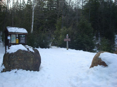
The Nineteen Mile Brook Trail trailhead off Route 16
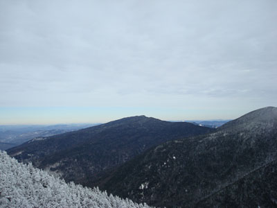
Looking at the Carters from the Wildcat A viewpoint

Directions to trailhead: Take Route 16 North past the Mt. Washington Auto Road entrance. Shortly thereafter, the Nineteen Mile Brook Trail WMNF fee parking area and trailhead are on the right side of the road, immediately after the brook.
Back to Wildcat A Profile
|