Home
States
Colorado
Connecticut
Maine
Massachusetts
New Hampshire
New York
Rhode Island
Utah
Vermont
View All
Lists
NE 4,000 Footers
NE 100 Highest
NH 4,000 Footers
NH 100 Highest
NH 52 With A View
NH Belknap Range
NH Ossipee 10
Links
Trail Conditions
Trip Log
Sunrises
Sunsets
About
|
Wildcat D
Pinkham's Grant, NH, Bean's Grant, NH
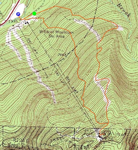
Trailheads, measurements, times, distances, and maps are all approximate and relative to the hike(s) as shown below.
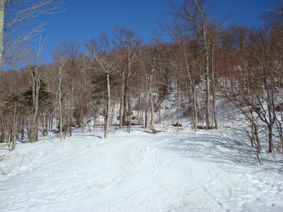
Looking down the Polecat ski trail
Route: Stray Cat, Middle Polecat, Upper Polecat, Wildcat Ridge Trail, (Wildcat D), Wildcat Ridge Trail, Upper Polecat, Upper Lynx, Lynx Connection, Middle Lynx, Lower Lynx, Lower Polecat
Wildcat D was plan B, as usual. I had originally planned to get out of work a bit early, however that ended up being a pipe dream. Wanting to get up to the Pinkham Notch area, I decided Wildcat D would be the best 2,000 vertical foot hike for this time of the year - no water crossings, packed trail, barebooting possibilities.
I started my ascent just as ski patrol was closing the mountain. The timing was great, as I was able to hike up the middle of the trails, instead of the normal stay-off-to-the-side approach. While the snow was soft, it was firm enough to allow me to keep my snowshoes on my pack. The cloudless blue sky, coupled with the snow and the spruce trees, made for a very colorful day.
The Wildcat Ridge Trail was also just barely barebootable, as it tends to get some skier (in boots) traffic this time of the year. The views from the summit were excellent, both of Mt. Washington and of points to the south.
Since I was eager to get home (via KFC), I decided to take a more direct approach down the mountain, doing some bootsliding down the Lynx Trail.
A great spring hike.
| Hike Ratings |
|
Getting To Trailhead: |
Easy |
| Destination: |
Wildcat D |
|
Length: |
Moderate |
|
Steepness: |
Difficult |
|
Navigation: |
Easy |
|
Views: |
Excellent |
|
Crowds: |
Minimal |
|
| Hike Stats |
|
Date Hiked: |
Monday, March 7, 2008 |
| Hike Commenced: |
4:14 PM |
| Parking Elevation: |
1,960' |
| Destination: |
Wildcat D |
| Ascent Commenced: |
4:18 PM |
| Summit Reached: |
5:37 PM |
| Time Elapsed: |
01:19 |
| Trailhead Elevation: |
1,950' |
| Summit Elevation: |
4,062' |
| Vertical Gain: |
2,012' |
|
|
| Hike Ended: |
6:36 PM |
| Hike Time Elapsed: |
02:22 |
| Hike Vertical Gain: |
2,122' |
|
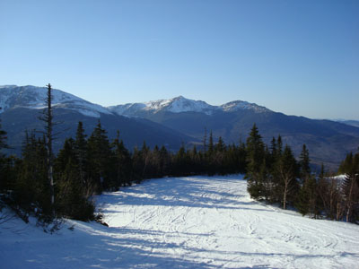
The end (beginning) of Stray Cat next to the triple chairlift
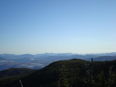
Looking at the Sandwich Range from near the Wildcat D summit
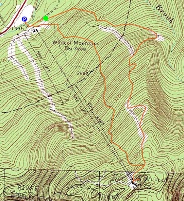

Directions to trailhead: Take Route 16 North from Jackson to the Wildcat Ski Area entrance. The Stray Cat ski trail is located just beyond the summit quad/gondola bottom terminal.
Back to Wildcat D Profile
|