Home
States
Colorado
Connecticut
Maine
Massachusetts
New Hampshire
New York
Rhode Island
Utah
Vermont
View All
Lists
NE 4,000 Footers
NE 100 Highest
NH 4,000 Footers
NH 100 Highest
NH 52 With A View
NH Belknap Range
NH Ossipee 10
Links
Trail Conditions
Trip Log
Sunrises
Sunsets
About
|
Wildcat D
Pinkham's Grant, NH, Bean's Grant, NH
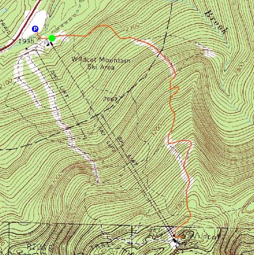
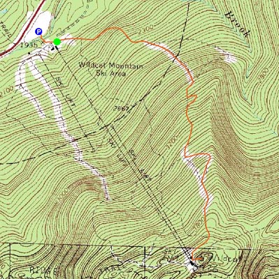
Trailheads, measurements, times, distances, and maps are all approximate and relative to the hike(s) as shown below.
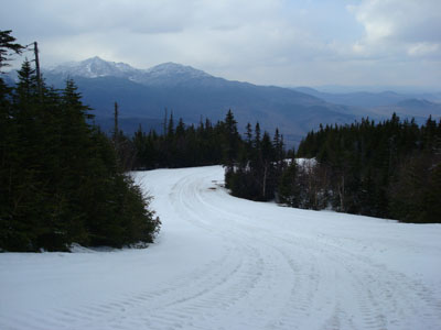
Looking down the Upper Polecat ski trail
Route: Lower Polecat, Tomcat Schuss, Middle Polecat, Upper Polecat, Wildcat Ridge Trail, (Wildcat D), Wildcat Ridge Trail, Upper Polecat, Middle Polecat, Tomcat Schuss, Lower Polecat
The forecast called for a mostly sunny day for this day and the next, with the next supposedly being the better of the two. As the clouds moved in, I wasn't exactly surprised, as the weather forecasts have seemed to be way off over the past two months. Needing some exercise, I headed up to Wildcat for a hike up the closed ski slopes.
The base area was well on its way to melting out - lots of mud and still some piles of snow.
As I headed up the Polecat ski trail, the snow became more and more abundant - once I arrived at the bottom of the Tomcat Schuss, which had been bare when I had skied Wildcat in April, I decided to go up the steeper but dryer trail. Along the way, I passed some sort of big creature which had some sort of underground home in one of the water bars. I never had the chance to get a close look or photo of him, but his head looked a bit like a seal, while his body was the size of a fat cat.
At the top of the Tomcat Schuss, back on the Polecat Trail, the snow became nearly wall to wall, 1-3 feet deep.
The short stretch of the Wildcat Ridge Trail featured the normal spring monorail of packed snow. The views from the summit weren't overly special, due to the cloud cover, however the viewpoints off the ridge trail were still decent.
For simplicity's sake, I went back down the same way I ascended. Unfortunately, the critter I saw on the Tomcat Schuss didn't re-emerge for a photo.
| Hike Ratings |
|
Getting To Trailhead: |
Easy |
| Destination: |
Wildcat D |
|
Length: |
Moderate |
|
Steepness: |
Difficult |
|
Navigation: |
Easy |
|
Views: |
Excellent |
|
Crowds: |
Minimal |
|
| Hike Stats |
|
Date Hiked: |
Thursday, May 1, 2008 |
| Hike Commenced: |
4:07 PM |
| Parking Elevation: |
1,960' |
| Destination: |
Wildcat D |
| Ascent Commenced: |
4:09 PM |
| Summit Reached: |
5:24 PM |
| Time Elapsed: |
01:15 |
| Trailhead Elevation: |
1,950' |
| Summit Elevation: |
4,062' |
| Vertical Gain: |
2,012' |
|
|
| Hike Ended: |
6:34 PM |
| Hike Time Elapsed: |
02:27 |
| Hike Vertical Gain: |
2,122' |
|
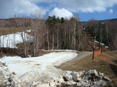
The end (beginning) of Lower Polecat next to the quad chairlift
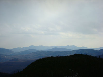
Looking at the Sandwich Range from near the Wildcat D summit

Directions to trailhead: Take Route 16 North from Jackson to the Wildcat Ski Area entrance. The Polecat ski trail is located just beyond the summit quad/gondola bottom terminal.
Back to Wildcat D Profile
|