Home
States
Colorado
Connecticut
Maine
Massachusetts
New Hampshire
New York
Rhode Island
Utah
Vermont
View All
Lists
NE 4,000 Footers
NE 100 Highest
NH 4,000 Footers
NH 100 Highest
NH 52 With A View
NH Belknap Range
NH Ossipee 10
Links
Trail Conditions
Trip Log
Sunrises
Sunsets
About
|
Wildcat D
Pinkham's Grant, NH, Bean's Grant, NH
Trailheads, measurements, times, distances, and maps are all approximate and relative to the hike(s) as shown below.
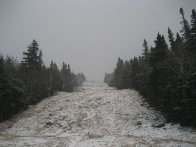
Looking up the old gondola line
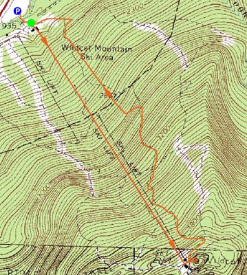
Route: Old gondola lift line, Wildcat Ridge Trail, (Wildcat D), unknown trail, Upper Polecat, Upper Lynx, Middle Lynx, Midway, Catenary, Lower Polecat
In the midst of some poor weather, I decided to head up to Wildcat for a quick exercise hike.
Arriving at the parking lot, I realized I was in the midst of a light snowstorm with moderate winds. Since it looked recently mowed, I decided to head straight up the old gondola line.
As I climbed, the winds and snow picked up. I also had to proceed with more caution, as there was an inch or so of snow and a decent amount of ice. By the time I reached the top of the ski area, it was a full fledged snowstorm. After reaching the summit, I took an alterative trail back down to the top of the ski area.
For the descent, I took the Lynx trail to the Caternary trail. The high altitude areas were rather windy - windy enough that I had to use my face mask for the first time this season. Is it really October?
| Hike Ratings |
|
Getting To Trailhead: |
Easy |
| Destination: |
Wildcat D |
|
Length: |
Moderate |
|
Steepness: |
Difficult |
|
Navigation: |
Easy |
|
Views: |
Minimal (due to weather) |
|
Crowds: |
Minimal |
|
| Hike Stats |
|
Date Hiked: |
Wednesday, October 29, 2008 |
| Hike Commenced: |
3:59 PM |
| Parking Elevation: |
1,960' |
| Destination: |
Wildcat D |
| Ascent Commenced: |
4:01 PM |
| Summit Reached: |
5:01 PM |
| Time Elapsed: |
01:00 |
| Trailhead Elevation: |
1,950' |
| Summit Elevation: |
4,062' |
| Vertical Gain: |
2,012' |
|
|
| Hike Ended: |
5:57 PM |
| Hike Time Elapsed: |
01:58 |
| Hike Vertical Gain: |
2,122' |
|
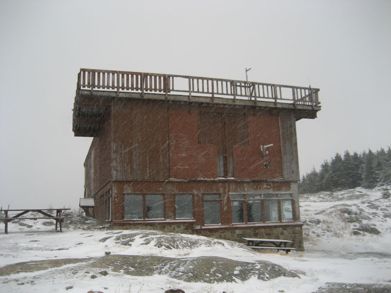
Looking up at the old gondola terminal and lift line
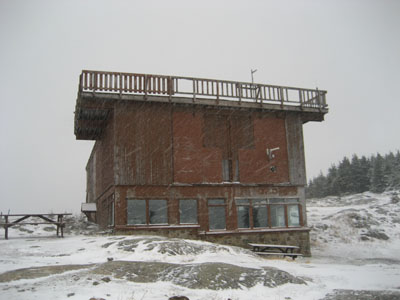
The old Wildcat Gondola summit terminal in a snow storm

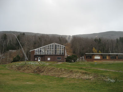
Directions to trailhead: Take Route 16 North from Jackson to the Wildcat Ski Area entrance. The old gondola terminal is located between the current gondola terminal and the upper lodge.
Back to Wildcat D Profile
|