Home
States
Colorado
Connecticut
Maine
Massachusetts
New Hampshire
New York
Rhode Island
Utah
Vermont
View All
Lists
NE 4,000 Footers
NE 100 Highest
NH 4,000 Footers
NH 100 Highest
NH 52 With A View
NH Belknap Range
NH Ossipee 10
Links
Trail Conditions
Trip Log
Sunrises
Sunsets
About
|
Wildcat D
Pinkham's Grant, NH, Bean's Grant, NH
Trailheads, measurements, times, distances, and maps are all approximate and relative to the hike(s) as shown below.
Looking up the Wildcat Ridge Trail
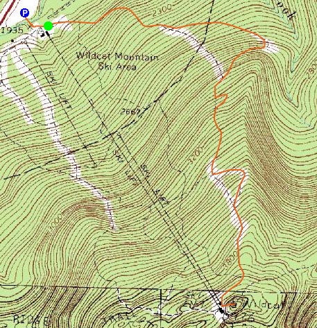
Route: Lower Polecat, Middle Polecat, Upper Polecat, Wildcat Ridge Trail, (Wildcat D), Wildcat Ridge Trail, Upper Polecat, Middle Polecat, Lower Polecat
While I had intended to hike up in the Gorham area in a cold day, as I made my way north, I could tell there was a heavy dose of clouds likely in that area. Seeing the Wildcats were in the clear, I decided to stop along the way and instead hike up the Wildcat ski area.
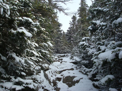
While snowmaking was in full force with the 23 degree base temperature, the Polecat Trail was fortunately not being targetted. With only a fraction of an inch of snow, and not too much ice, I was able to bareboot up it. The winds were bitter cold, especially up high.
The views from the near-summit vistas (observation deck still closed) were rather good (though visibility was limited due to the fog). Mount Washington was particularly neat looking, as it had just enough fog spilling over the top of it to disguise the topography a bit.
I wasn't quite sure what the temperature was at the summit, with or without wind chill, but needless to say, I was quite cold by the time I reached the base. While it was nice to get out, it was perhaps just as nice to get out of the cold!
| Hike Ratings |
|
Getting To Trailhead: |
Easy |
| Destination: |
Wildcat D |
|
Length: |
Moderate |
|
Steepness: |
Difficult |
|
Navigation: |
Easy |
|
Views: |
Excellent |
|
Crowds: |
Minimal |
|
| Hike Stats |
|
Date Hiked: |
Thursday, November 20, 2008 |
| Hike Commenced: |
12:19 PM |
| Parking Elevation: |
1,960' |
| Destination: |
Wildcat D |
| Ascent Commenced: |
12:21 PM |
| Summit Reached: |
1:25 PM |
| Time Elapsed: |
01:04 |
| Trailhead Elevation: |
1,950' |
| Summit Elevation: |
4,062' |
| Vertical Gain: |
2,012' |
|
|
| Hike Ended: |
2:37 PM |
| Hike Time Elapsed: |
02:18 |
| Hike Vertical Gain: |
2,122' |
|
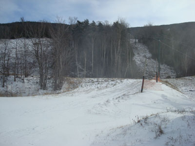
The end (beginning) of Lower Polecat next to the quad-gondola lift
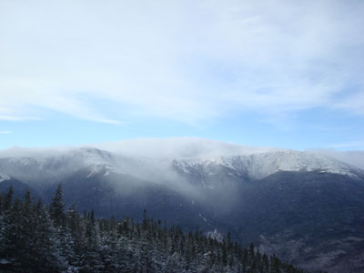
Mount Washington in disguise as seen from near the summit of Wildcat Peak D


Directions to trailhead: Take Route 16 North from Jackson to the Wildcat Ski Area entrance. The Polecat ski trail starts (ends) at the summit quad/gondola bottom terminal.
Back to Wildcat D Profile
|