Home
States
Colorado
Connecticut
Maine
Massachusetts
New Hampshire
New York
Rhode Island
Utah
Vermont
View All
Lists
NE 4,000 Footers
NE 100 Highest
NH 4,000 Footers
NH 100 Highest
NH 52 With A View
NH Belknap Range
NH Ossipee 10
Links
Trail Conditions
Trip Log
Sunrises
Sunsets
About
|
Wildcat D
Pinkham's Grant, NH, Bean's Grant, NH
Trailheads, measurements, times, distances, and maps are all approximate and relative to the hike(s) as shown below.
Looking down Polecat
Route: Lower Polecat, Middle Polecat, Upper Polecat, Wildcat Ridge Trail, (Wildcat D), Wildcat Ridge Trail, Upper Polecat, Middle Polecat, Lower Polecat
With limited daylight and iffy weather, I decided to head up to Wildcat and get a quick exercise hike in prior to the forecasted junky midweek weather.
While the ski area was open top to bottom, snowmaking had not yet begun on the Polecat trail. Nonetheless, much of the trail was packed by snowcat and snowmobile traffic. The middle section, however, wasn't - and with a crust and a good foot or so of natural, I didn't bareboot for long. There was one (deafening) snowgun going on the trail, just before reaching the top chairlift terminal.
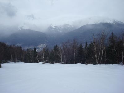
Though it looked like some views might open up, the mountain was in the midst of a light snowstorm when I reached the summit. As a result, there wasn't too much to see. On the descent, however, the clouds starting lifting off the Presidentials, offering some decent views.
| Hike Ratings |
|
Getting To Trailhead: |
Easy |
| Destination: |
Wildcat D |
|
Length: |
Moderate |
|
Steepness: |
Difficult |
|
Navigation: |
Easy |
|
Views: |
Moderate (due to weather) |
|
Crowds: |
Moderate |
|
| Hike Stats |
|
Date Hiked: |
Sunday, December 7, 2008 |
| Hike Commenced: |
11:39 AM |
| Parking Elevation: |
1,960' |
| Destination: |
Wildcat D |
| Ascent Commenced: |
11:41 AM |
| Summit Reached: |
1:07 PM |
| Time Elapsed: |
01:26 |
| Trailhead Elevation: |
1,950' |
| Summit Elevation: |
4,062' |
| Vertical Gain: |
2,012' |
|
|
| Hike Ended: |
2:05 PM |
| Hike Time Elapsed: |
02:26 |
| Hike Vertical Gain: |
2,122' |
|
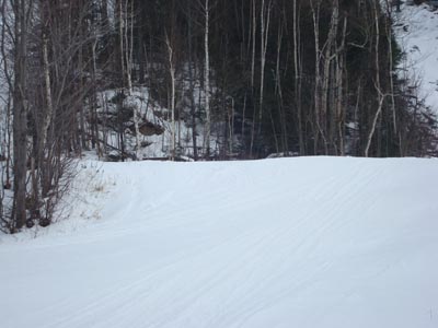
The end (beginning) of Lower Polecat next to the quad-gondola lift
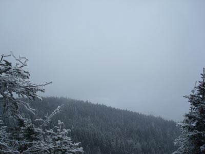
The limited views to the south as seen from near the summit of Wildcat D
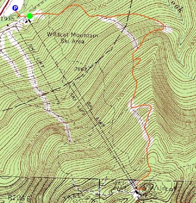

Directions to trailhead: Take Route 16 North from Jackson to the Wildcat Ski Area entrance. The Polecat ski trail starts (ends) at the summit quad/gondola bottom terminal.
Back to Wildcat D Profile
|


