Home
States
Colorado
Connecticut
Maine
Massachusetts
New Hampshire
New York
Rhode Island
Utah
Vermont
View All
Lists
NE 4,000 Footers
NE 100 Highest
NH 4,000 Footers
NH 100 Highest
NH 52 With A View
NH Belknap Range
NH Ossipee 10
Links
Trail Conditions
Trip Log
Sunrises
Sunsets
About
|
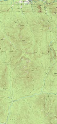
Zealand Mountain, Mt. Guyot, Mt. Bond (West Peak), Mt. Bond, Bondcliff
Bethlehem, NH, Livermore, NH, Lincoln, NH
Trailheads, measurements, times, distances, and maps are all approximate and relative to the hike(s) as shown below.
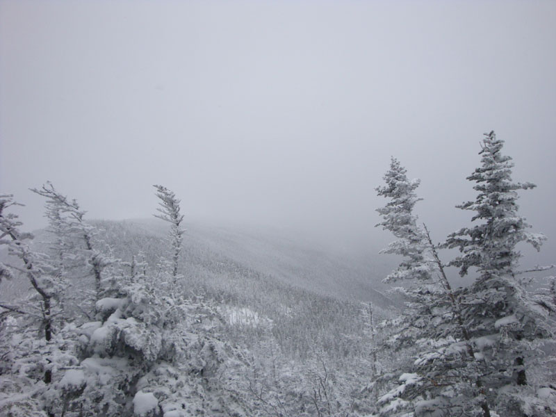
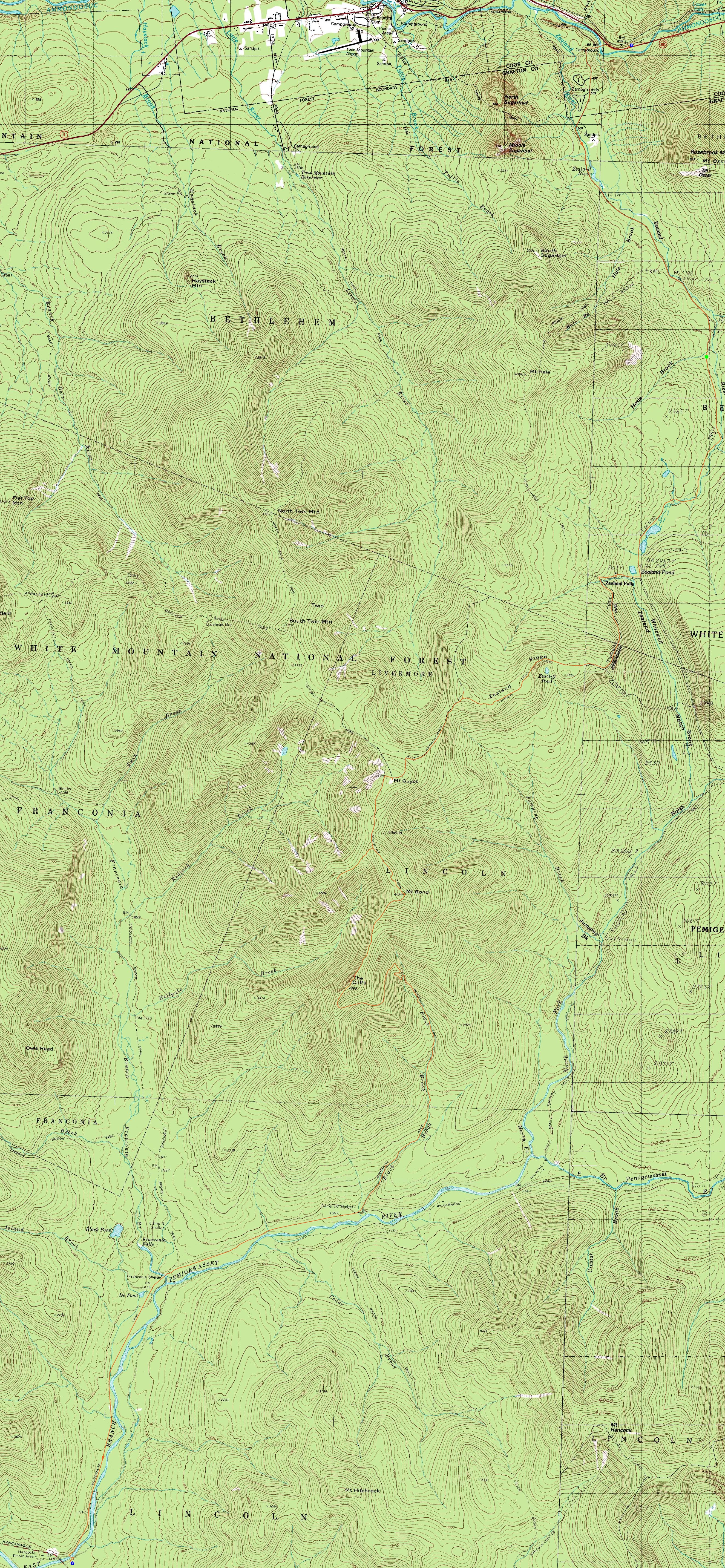
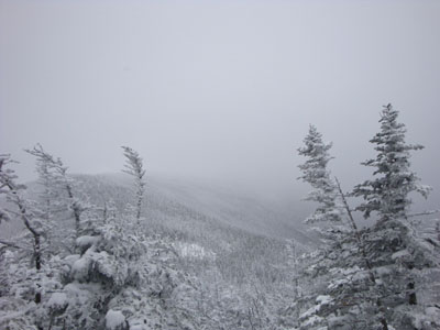
Looking up the Twinway on the way to Zealand Mountain
Route: Zealand Road, Zealand Trail, Twinway, spur trail, (Zealand Mountain), spur trail, Twinway, (Mt. Guyot), Twinway, Bondcliff Trail, West Bond Trail, (West Bond), West Bond Trail, Bondcliff Trail, (Mt. Bond), Bondcliff Trail, (Bondcliff), Bondcliff Trail, Wilderness Trail, Lincoln Woods Trail
It was time for a Bonds traverse. This, of course, required waking up at a ridculously early hour. Arriving at Zealand, we soon set foot down the snowmobile trail, linking up to Zealand Road. Though generally plowed and/or packed this winter, the proximity of this day to the recent snow required us to snowshoe the entire roadwalk. Finally at the actual trailhead and under cloudy skies, I was growing sick of the hike already.
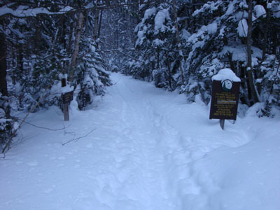
Not too long after reaching the boardwalks on the Zealand Trail, we spotted a bull moose. After posing for some photos, he continued south along the trail. We soon caught up to him again - this time, however, he decided to turn around and charge at us! Come to find out, there were some skiers just around the corner, so he was probably feeling a bit trapped. We would later learn that he went after a guy and his dog, and then shortly after we encountered him, a young skier.
Upon reaching the hut, I was pleasantly surprised to discover some basic food and beverage could be obtained - boy was it nice to have a hot chocolate and Snickers bar in a somewhat warm building! As a result, I ended up loitering for a good half an hour - it was tempting to call it a day!
The Twinway Trail was fortunately broken out above the hut. Though the uphill dragged on, I finally reached the height of land and soon caught up to my group (they didn't want to spend the whole day sitting in the hut, go figure!). If not for the previous tracks, the trail would have been a bit difficult to follow in places due to the snowpack.
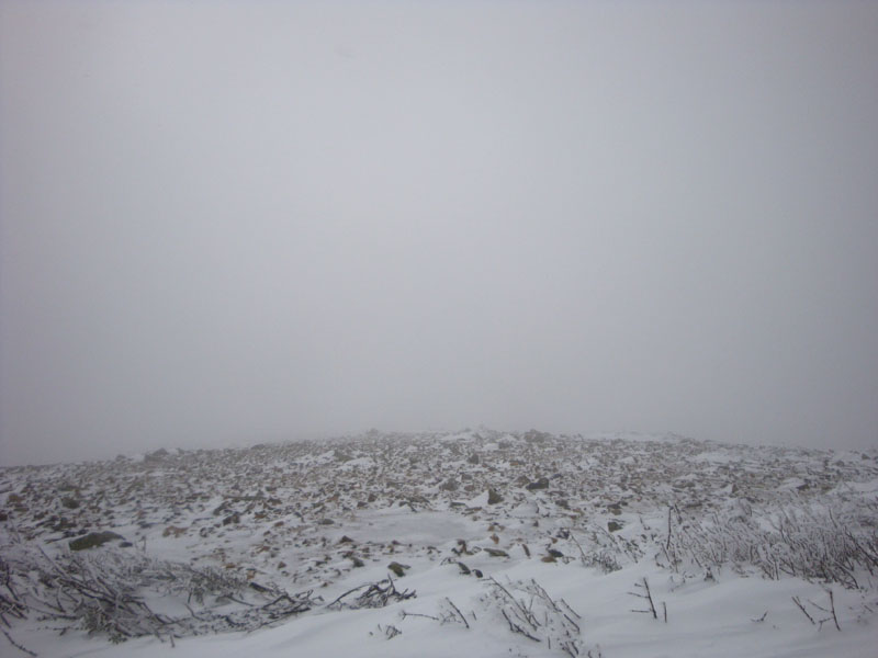
Reaching the height of land on Zealand, we spent a good half an hour trying to find the actual summit. While in the summer the area has a halfway decent canopy, it was a completely different area at this point - deep snow drifts and no obvious high point. If not for someone finally seeing the spur trail sign at ground level, it would have been an even longer wait! As it was, the actual summit sign seemed to be a few feet lower than the higher snowdrifts nearby.
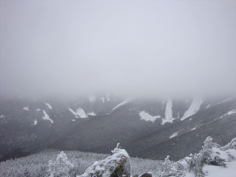
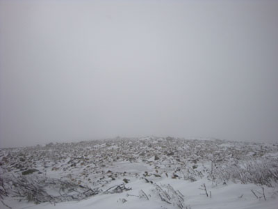
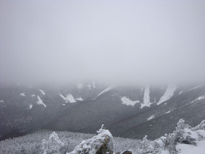
Back on the Twinway, we were now breaking trail. Though it was generally one to two feet of powder, it was a workout nonetheless. Finally nearing Guyot, we switched over to winter gear and headed out into the windy summit area with limited visibility.
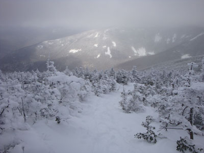
Back in the trees, we were soon at the West Bond Trail junction. By the time we broke out the trail to the summit, the clouds were starting to lift - finally, some views! Back at the trail junction once again, we bumped into another group. Continuing on our way to Bond (and losing the trail at one point, but finding it again via a bushwhack, we soon reached that summit we even better views. While my group continued to Bondcliff, I waited for the West Bond-tagging group and enjoyed increasingly better views on Bond - it was turning into a nice day!
The trek across the ridge to Bondcliff was a bit windy, but nonetheless doable. The walk was mostly clear of snow - basically rock and ice. The views from Bondcliff were tremendous as usual.
The upper portion of the Bondcliff Trail from Bondcliff down was quite annoying - constant chest level tree branches. While I'm not at all a fan of the trail, the open Wilderness Trail was a welcome sight.
The Wilderness and Lincoln Woods Trails, as usual, were a long slog at the end of the day. Nonetheless, we were able to make it out not too long after sunset without the aide of headlamps. Though it started off as a dreary day, it turned into a nice day for the Bonds!
| Hike Ratings |
|
Getting To Trailhead: |
Difficult |
| Destination: |
Zealand Mountain |
|
Length: |
Difficult |
|
Steepness: |
Difficult |
|
Navigation: |
Difficult |
|
Views: |
Minimal |
|
Crowds: |
Moderate |
| Destination: |
Mt. Guyot |
|
Length: |
Very Difficult |
|
Steepness: |
Difficult |
|
Navigation: |
Difficult |
|
Views: |
Minimal (due to weather) |
|
Crowds: |
Minimal |
| Destination: |
Mt. Bond (West Peak) |
|
Length: |
Very Difficult |
|
Steepness: |
Difficult |
|
Navigation: |
Difficult |
|
Views: |
Excellent |
|
Crowds: |
Minimal |
| Destination: |
Mt. Bond |
|
Length: |
Very Difficult |
|
Steepness: |
Difficult |
|
Navigation: |
Difficult |
|
Views: |
Excellent |
|
Crowds: |
Minimal |
| Destination: |
Bondcliff |
|
Length: |
Very Difficult |
|
Steepness: |
Difficult |
|
Navigation: |
Easy |
|
Views: |
Excellent |
|
Crowds: |
Moderate |
|
| Hike Stats |
|
Date Hiked: |
Saturday, February 21, 2009 |
| Hike Commenced: |
6:02 AM |
| Parking Elevation: |
1,480' |
| Destination: |
Zealand Mountain |
| Ascent Commenced: |
7:31 AM |
| Summit Reached: |
11:02 AM |
| Time Elapsed: |
03:31 |
| Trailhead Elevation: |
2,000' |
| Summit Elevation: |
4,260' |
| Distance: |
5.7 miles |
| Vertical Gain: |
2,490' |
| Destination: |
Mt. Guyot |
| Ascent Commenced: |
11:02 AM |
| Summit Reached: |
12:07 PM |
| Time Elapsed: |
01:05 |
| Trailhead Elevation: |
4,260' |
| Summit Elevation: |
4,580' |
| Distance: |
1.4 miles |
| Vertical Gain: |
640' |
| Destination: |
Mt. Bond (West Peak) |
| Ascent Commenced: |
12:07 PM |
| Summit Reached: |
12:59 PM |
| Time Elapsed: |
00:52 |
| Trailhead Elevation: |
4,580' |
| Summit Elevation: |
4,540' |
| Distance: |
1.3 miles |
| Vertical Gain: |
470' |
| Destination: |
Mt. Bond |
| Ascent Commenced: |
12:59 PM |
| Summit Reached: |
1:57 PM |
| Time Elapsed: |
00:58 |
| Trailhead Elevation: |
4,540' |
| Summit Elevation: |
4,698' |
| Distance: |
1 mile |
| Vertical Gain: |
448' |
| Destination: |
Bondcliff |
| Ascent Commenced: |
2:23 PM |
| Summit Reached: |
2:56 PM |
| Time Elapsed: |
00:33 |
| Trailhead Elevation: |
4,698' |
| Summit Elevation: |
4,265' |
| Distance: |
1.2 miles |
| Vertical Gain: |
285' |
|
|
| Hike Ended: |
6:13 PM |
| Hike Time Elapsed: |
12:11 |
| Hike Vertical Gain: |
5,053' |
|
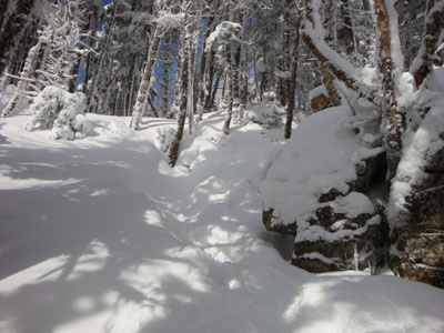
The Zealand Trail trailhead at the end of Zealand Road
A bull moose on the Zealand Trail
A quasi-view down the Twinway Trail near the Zealand Mountain summit
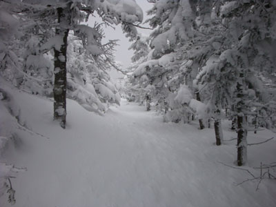
The Twinway between Zealand and Guyot
Looking into the clouds from Mt. Guyot
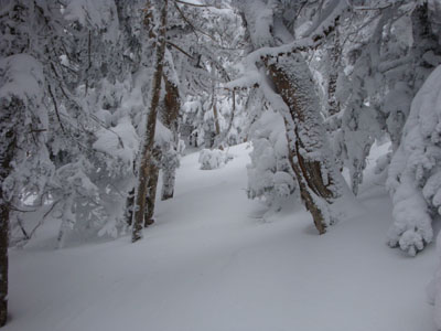
The West Bond Trail
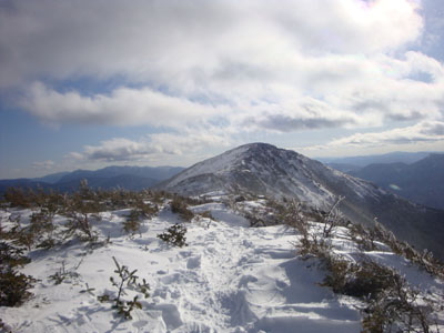
The clouds starting to rise as seen from West Bond summit
Looking down the Bondcliff Trail on the way to Mt. Bond

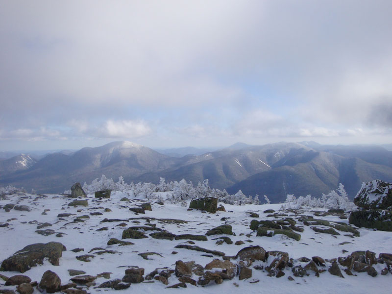
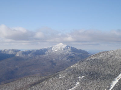
Mt. Carrigain and Mt. Hancock as seen from the Mt. Bond summit
Looking up the Bondcliff Trail at Bondcliff
Looking at Mt. Garfield from Bondcliff

Directions to trailhead: Take US 302 west from Bartlett past Bretton Woods Ski Area. In winter, there is a parking area on the right side of US 302, just prior to the gated and closed Zealand Road. The Zealand WMNF fee parking area and Zealand Trail trailhead are located at the end of Zealand Road.
Back to Zealand Mountain Profile
Back to Mt. Guyot Profile
Back to Mt. Bond - West Peak Profile
Back to Mt. Bond Profile
Back to Bondcliff Profile
|