Home
States
Colorado
Connecticut
Maine
Massachusetts
New Hampshire
New York
Rhode Island
Utah
Vermont
View All
Lists
NE 4,000 Footers
NE 100 Highest
NH 4,000 Footers
NH 100 Highest
NH 52 With A View
NH Belknap Range
NH Ossipee 10
Links
Trail Conditions
Trip Log
Sunrises
Sunsets
About
|
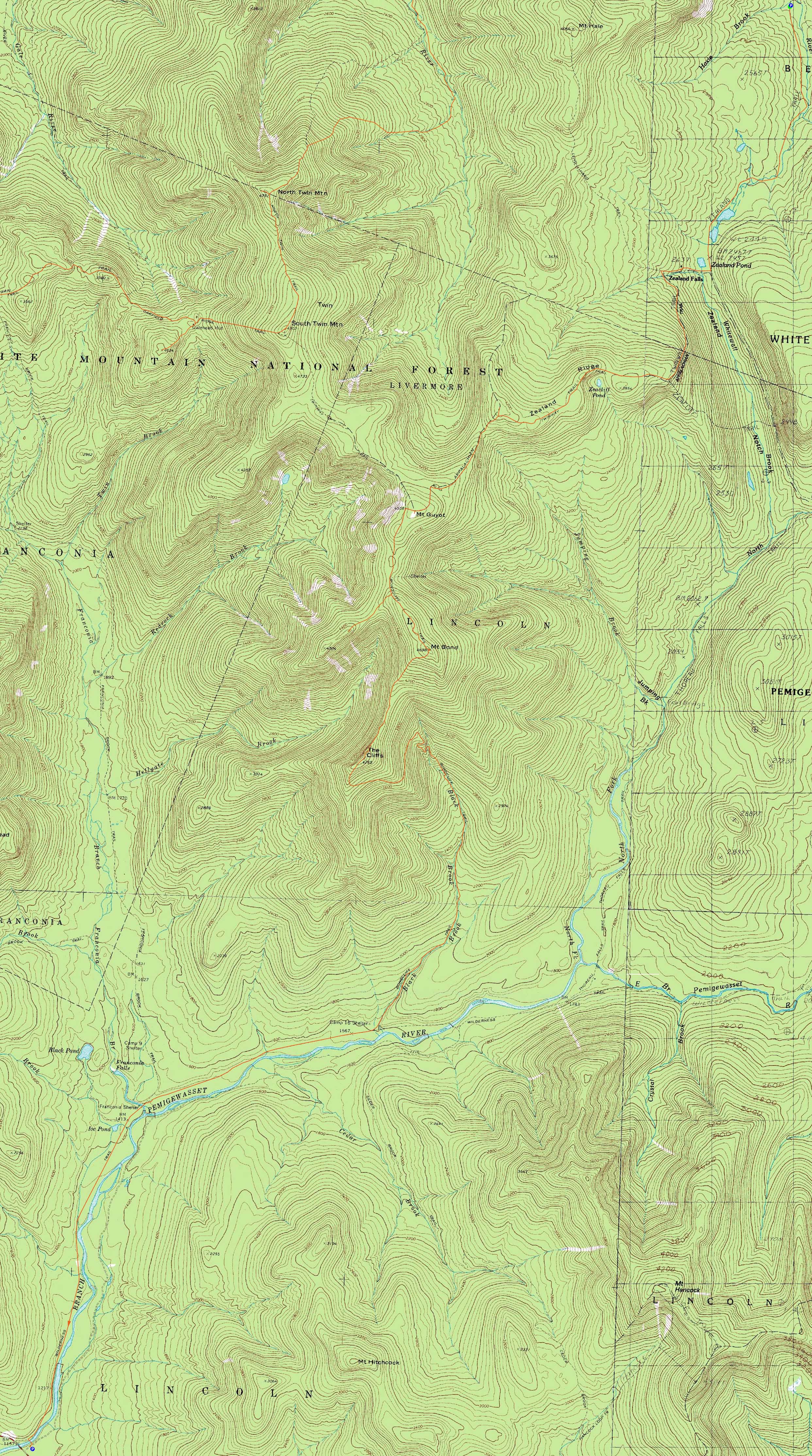
Zealand Mountain, Mt. Guyot, Mt. Bond (West Peak), Mt. Bond, Bondcliff
Bethlehem, NH, Livermore, NH, Lincoln, NH
Trailheads, measurements, times, distances, and maps are all approximate and relative to the hike(s) as shown below.
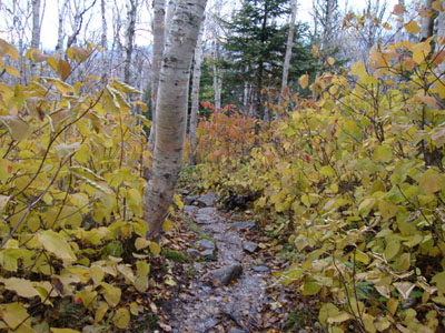
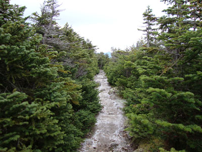
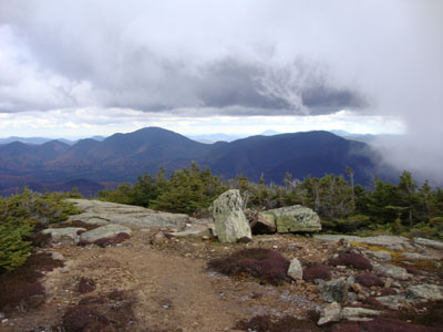
Looking down the Twinway on the way to Zealand Mountain
Route: Zealand Road, Zealand Trail, Twinway, Zeacliff spur trail, (Zeacliff), Zeacliff spur trail, Twinway, spur trail, (Zealand Mountain), spur trail, Twinway, (Mt. Guyot), Twinway, Bondcliff Trail, West Bond Trail, (West Bond), West Bond Trail, Bondcliff Trail, (Mt. Bond), Bondcliff Trail, (Bondcliff), Bondcliff Trail, Wilderness Trail, Lincoln Woods Trail
The forecast was for a mostly sunny day. Of course, in recent weeks, this could mean anything.
The ascent to Zeacliff was fairly pleasant - while tree foliage was past peak, the hobblebush colors were quite nice (as was a stop at the Zealand Hut for hot chocolate and apple cake). As we climbed, we noticed some strange white substance falling from the fully overcast sky (mostly sunny?). It appeared to be sleet at first, and then snow. Clearly there must have been some sort of confusion.
The views from Zeacliff were quite nice, though I was a bit underwhelmed based upon my expectations (first visit, despite walking near it 4 times). It was, of course, much nicer than the wooded Zealand summit further up the ridge.
After the rocky, rough walk up to treeline, we were confronted with decent winds on Guyot - and decent views, too. While there had once been herd paths to the rocky summit area on Guyot, brush had been dragged into the openings, as to keep folks out.
After crossing the second summit of Guyot on the Bondcliff Trail, we soon dropped back into the trees and climbed up to the West Bond spur trail. Dropping pack, we ascended up to a virtually wind-free summit of West Bond and were treated with excellent views, including nice foliage on Owl's Head and points south.
After a lunch break at the trail junction, our next stop was Mt. Bond. In between passages of clouds, the views were also quite strong. Descending toward Bondcliff, we were surprised to see (feel?) dramatically less wind than on Guyot - despite the weather forecast of increased winds. Blue sky started to break through as well.
After a leisurely break on Bondcliff, we set out for the long, 9+ mile walk down to Lincoln Woods. Reaching the suspension bridge, we were not-so-surprised to see traffic backed up on Route 112 - apparently 8 miles west of Lincoln Woods.
| Hike Ratings |
|
Getting To Trailhead: |
Easy |
| Destination: |
Zealand Mountain |
|
Length: |
Moderate |
|
Steepness: |
Difficult |
|
Navigation: |
Difficult |
|
Views: |
Minimal |
|
Crowds: |
Heavy |
| Destination: |
Mt. Guyot |
|
Length: |
Difficult |
|
Steepness: |
Difficult |
|
Navigation: |
Difficult |
|
Views: |
Excellent |
|
Crowds: |
Moderate |
| Destination: |
Mt. Bond (West Peak) |
|
Length: |
Very Difficult |
|
Steepness: |
Difficult |
|
Navigation: |
Difficult |
|
Views: |
Excellent |
|
Crowds: |
Heavy |
| Destination: |
Mt. Bond |
|
Length: |
Very Difficult |
|
Steepness: |
Difficult |
|
Navigation: |
Difficult |
|
Views: |
Excellent |
|
Crowds: |
Moderate |
| Destination: |
Bondcliff |
|
Length: |
Very Difficult |
|
Steepness: |
Difficult |
|
Navigation: |
Easy |
|
Views: |
Excellent |
|
Crowds: |
Heavy |
|
| Hike Stats |
|
Date Hiked: |
Sunday, October 11, 2009 |
| Hike Commenced: |
8:09 AM |
| Parking Elevation: |
2,000' |
| Destination: |
Zealand Mountain |
| Ascent Commenced: |
8:09 AM |
| Summit Reached: |
11:01 AM |
| Time Elapsed: |
02:52 |
| Trailhead Elevation: |
2,000' |
| Summit Elevation: |
4,260' |
| Vertical Gain: |
2,510' |
| Destination: |
Mt. Guyot |
| Ascent Commenced: |
11:03 AM |
| Summit Reached: |
11:48 AM |
| Time Elapsed: |
00:45 |
| Trailhead Elevation: |
4,260' |
| Summit Elevation: |
4,580' |
| Distance: |
1.4 miles |
| Vertical Gain: |
640' |
| Destination: |
Mt. Bond (West Peak) |
| Ascent Commenced: |
11:49 AM |
| Summit Reached: |
12:31 PM |
| Time Elapsed: |
00:42 |
| Trailhead Elevation: |
4,580' |
| Summit Elevation: |
4,540' |
| Distance: |
1.3 miles |
| Vertical Gain: |
470' |
| Destination: |
Mt. Bond |
| Ascent Commenced: |
12:40 PM |
| Summit Reached: |
1:19 PM |
| Time Elapsed: |
00:58 |
| Trailhead Elevation: |
4,540' |
| Summit Elevation: |
4,698' |
| Distance: |
1 mile |
| Vertical Gain: |
448' |
| Destination: |
Bondcliff |
| Ascent Commenced: |
1:28 PM |
| Summit Reached: |
2:00 PM |
| Time Elapsed: |
00:32 |
| Trailhead Elevation: |
4,698' |
| Summit Elevation: |
4,265' |
| Distance: |
1.2 miles |
| Vertical Gain: |
285' |
|
|
| Hike Ended: |
6:13 PM |
| Hike Time Elapsed: |
10:04 |
| Hike Vertical Gain: |
4,503' |
|
The Zealand Trail trailhead at the end of Zealand Road
A slighty-snowy Zeacliff

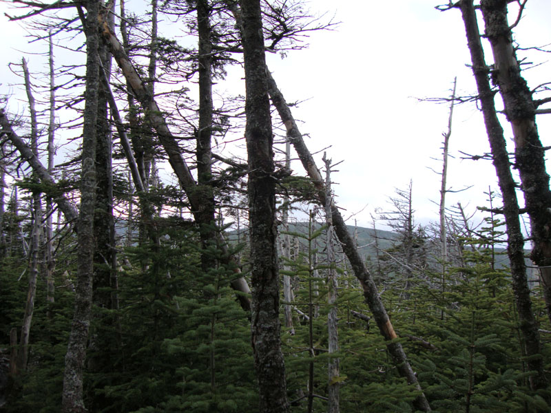
A lack of views from near the Zealand Mountain summit
The Twinway between Zealand and Guyot
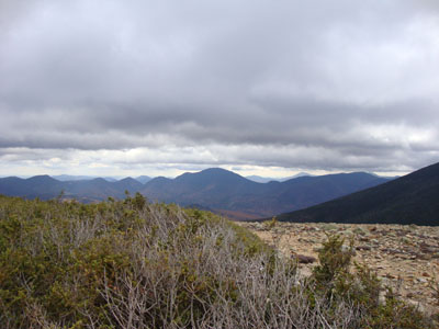
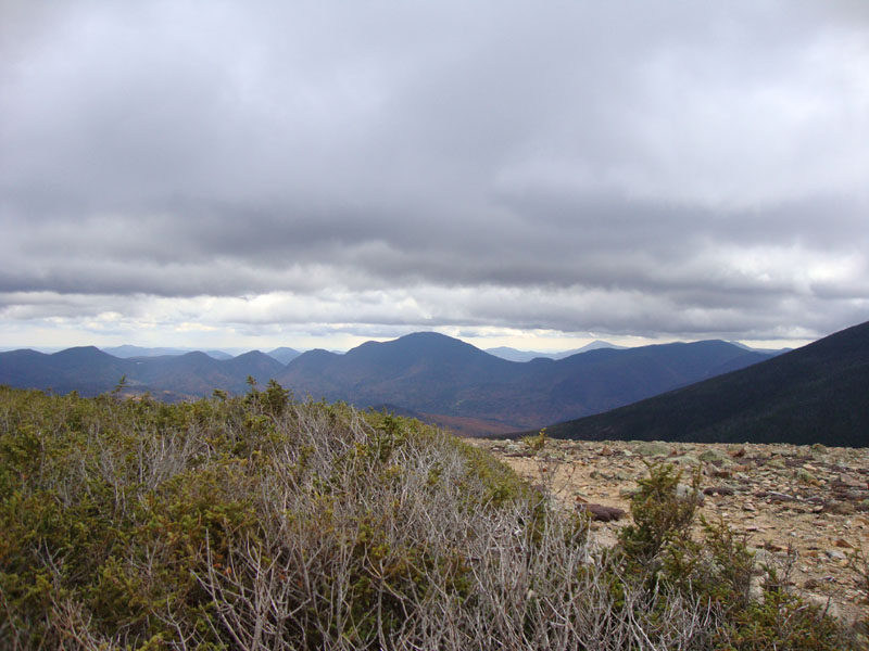
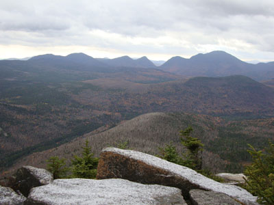
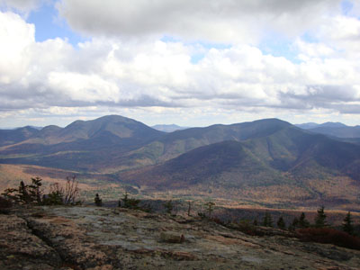
Looking at Mt. Carrigain from Mt. Guyot
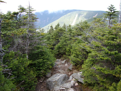
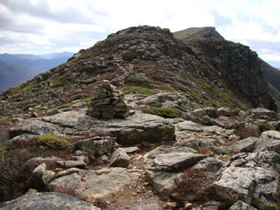
The Bondcliff Trail on the way to West Bond

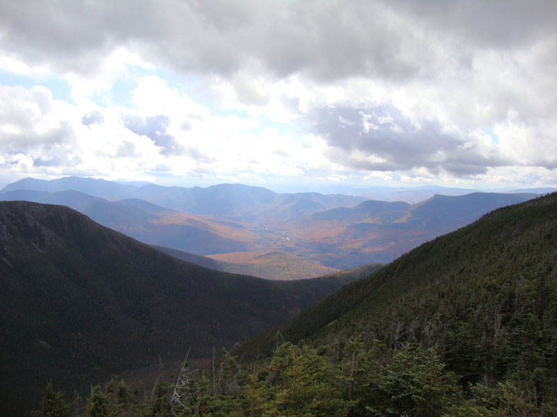
Looking down the Pemi toward Scar Ridge from the West Bond summit
Looking down the Bondcliff Trail on the way to Mt. Bond
Mt. Carrigain and Mt. Hancock as clouds pass over the Mt. Bond summit
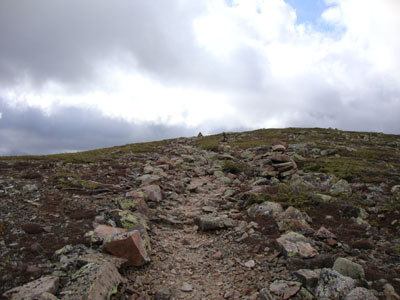
Looking up the Bondcliff Trail on the way to Bondcliff
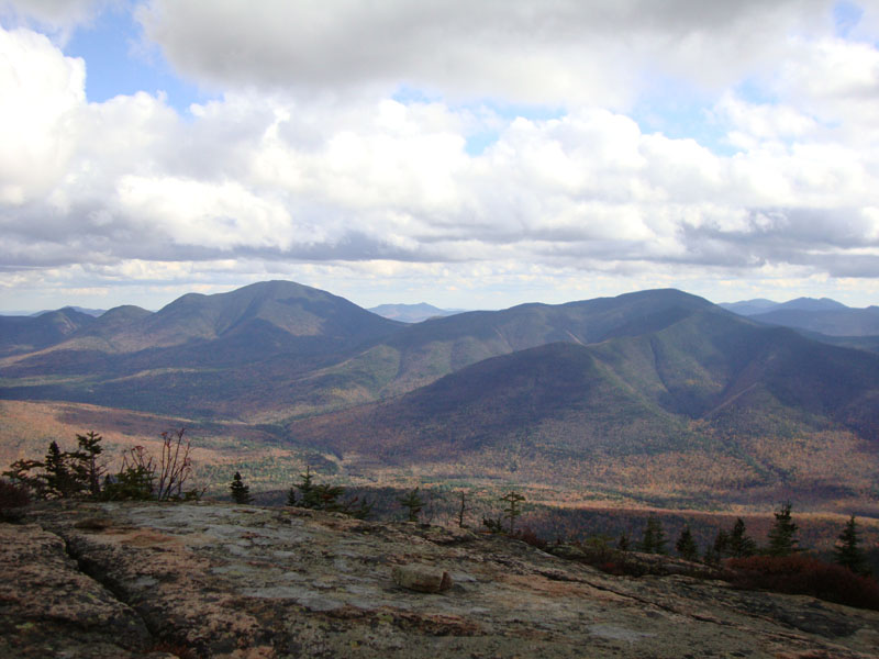
Looking at Mt. Carrigain and Mt. Hancock from Bondcliff

Directions to trailhead: Take US 302 west from Bartlett past Bretton Woods Ski Area. A few minutes after, take a left onto Zealand Road. The Zealand WMNF fee parking area and Zealand Trail trailhead are located at the end of the road.
Back to Zealand Mountain Profile
Back to Mt. Guyot Profile
Back to Mt. Bond - West Peak Profile
Back to Mt. Bond Profile
Back to Bondcliff Profile
|