Home
States
Colorado
Connecticut
Maine
Massachusetts
New Hampshire
New York
Rhode Island
Utah
Vermont
View All
Lists
NE 4,000 Footers
NE 100 Highest
NH 4,000 Footers
NH 100 Highest
NH 52 With A View
NH Belknap Range
NH Ossipee 10
Links
Trail Conditions
Trip Log
Sunrises
Sunsets
About
|
Zealand Mountain, Mt. Guyot, Mt. Bond (West Peak), Mt. Bond, Bondcliff
Bethlehem, NH, Livermore, NH, Lincoln, NH
Trailheads, measurements, times, distances, and maps are all approximate and relative to the hike(s) as shown below.
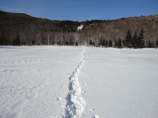
Crossing the pond on the way to the Zealand Hut
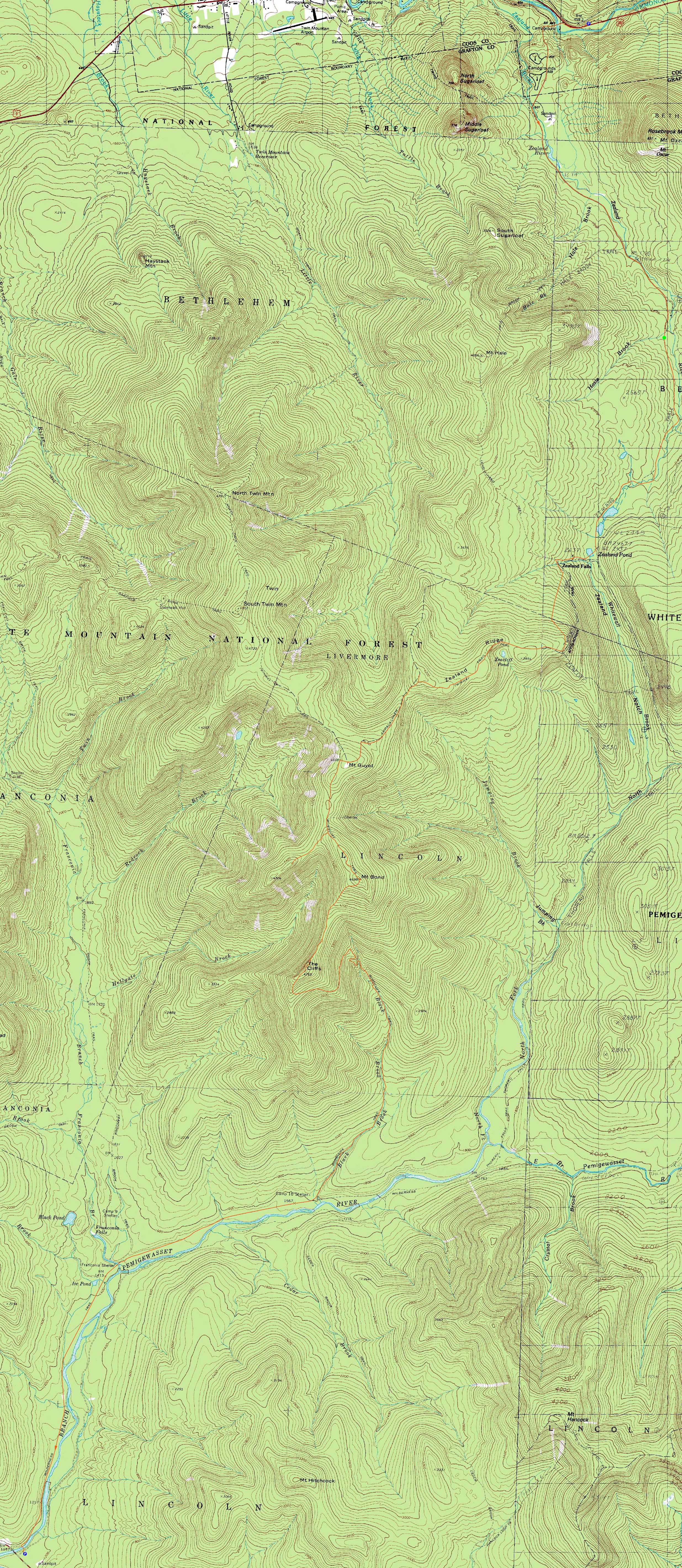
Route: Zealand Road, Zealand Trail, pond, Twinway, spur trail, (Zealand Mountain), spur trail, Twinway, (Mt. Guyot), Twinway, Bondcliff Trail, West Bond Trail, (West Bond), West Bond Trail, Bondcliff Trail, (Mt. Bond), Bondcliff Trail, (Bondcliff), Bondcliff Trail, Wilderness Trail, Lincoln Woods Trail
With a rare winter 2011 Bonds opportunity, we decided to give a go. With a crust in the lower elevations, we made the decision to head north to south, as to climb above it as quickly as possible, for as easy as possible trailbreaking.
It was fairly smooth sailing to the hut. Shortly after passing the hut, the tracks ran out and the trailbreaking began. The trail was a little bit tough to follow from Zeacliff to Zealand, however based upon memory and logic, we were able to follow it, while breaking out 6-12" of powder with deeper drifts. Zealand gave its classic late winter view near the summit of the Twins.
Beyond Zealand, the trail was still a bit tough to follow, but we eventually found ourselves on Guyot with superb views. Continuing onward, we headed through the Guyot Campsite col and to the West Bond Spur junction. Eventually reaching West Bond, we had great views once again under blue skies, though there were clouds in every direction in the distance.
Continuing with the trailbreaking, we eventually topped out on Bond, where we had yet again great views. Our trailbreaking finally ended in the Bondcliff col, where we reached bare ground, and then, on the other side of Bondcliff, freshly broken out trail. Though not well packed out due to limited traffic and the crust in the lower elevations, it was nice to be able to go into autopilot mode, rather than trying to trailbreak and trailfind in the dark. Due to the snowpack and previous cold weather, we were able to follow the brookbed down from crossing 4 to crossing 3, saving a little bit of time. The Wilderness and Lincoln Woods trails were tedious at the end of the day, but upon reaching the parking lot, it was nice to know we had made it across the Bonds this winter.
| Hike Ratings |
|
Getting To Trailhead: |
Difficult |
| Destination: |
Zealand Mountain |
|
Length: |
Difficult |
|
Steepness: |
Difficult |
|
Navigation: |
Difficult |
|
Views: |
Excellent |
|
Crowds: |
Minimal |
| Destination: |
Mt. Guyot |
|
Length: |
Very Difficult |
|
Steepness: |
Difficult |
|
Navigation: |
Difficult |
|
Views: |
Excellent |
|
Crowds: |
Minimal |
| Destination: |
Mt. Bond (West Peak) |
|
Length: |
Very Difficult |
|
Steepness: |
Difficult |
|
Navigation: |
Difficult |
|
Views: |
Excellent |
|
Crowds: |
Minimal |
| Destination: |
Mt. Bond |
|
Length: |
Very Difficult |
|
Steepness: |
Difficult |
|
Navigation: |
Difficult |
|
Views: |
Excellent |
|
Crowds: |
Minimal |
| Destination: |
Bondcliff |
|
Length: |
Very Difficult |
|
Steepness: |
Difficult |
|
Navigation: |
Difficult |
|
Views: |
Excellent |
|
Crowds: |
Minimal |
|
| Hike Stats |
|
Date Hiked: |
Friday, March 4, 2011 |
| Hike Commenced: |
6:44 AM |
| Parking Elevation: |
1,480' |
| Destination: |
Zealand Mountain |
| Ascent Commenced: |
8:12 AM |
| Summit Reached: |
12:10 PM |
| Time Elapsed: |
03:58 |
| Trailhead Elevation: |
2,000' |
| Summit Elevation: |
4,260' |
| Vertical Gain: |
2,490' |
| Destination: |
Mt. Guyot |
| Ascent Commenced: |
12:19 PM |
| Summit Reached: |
1:27 PM |
| Time Elapsed: |
01:08 |
| Trailhead Elevation: |
4,260' |
| Summit Elevation: |
4,580' |
| Vertical Gain: |
640' |
| Destination: |
Mt. Bond (West Peak) |
| Ascent Commenced: |
1:30 PM |
| Summit Reached: |
2:27 PM |
| Time Elapsed: |
00:57 |
| Trailhead Elevation: |
4,580' |
| Summit Elevation: |
4,540' |
| Distance: |
1.3 miles |
| Vertical Gain: |
470' |
| Destination: |
Mt. Bond |
| Ascent Commenced: |
2:31 PM |
| Summit Reached: |
3:16 PM |
| Time Elapsed: |
00:45 |
| Trailhead Elevation: |
4,540' |
| Summit Elevation: |
4,698' |
| Distance: |
1 mile |
| Vertical Gain: |
448' |
| Destination: |
Bondcliff |
| Ascent Commenced: |
3:23 PM |
| Summit Reached: |
4:15 PM |
| Time Elapsed: |
00:52 |
| Trailhead Elevation: |
4,698' |
| Summit Elevation: |
4,265' |
| Distance: |
1.2 miles |
| Vertical Gain: |
285' |
|
|
| Hike Ended: |
8:07 PM |
| Hike Time Elapsed: |
13:23 |
| Hike Vertical Gain: |
5,053' |
|
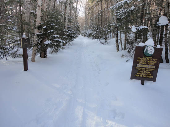
The Zealand Trail trailhead at the end of Zealand Road
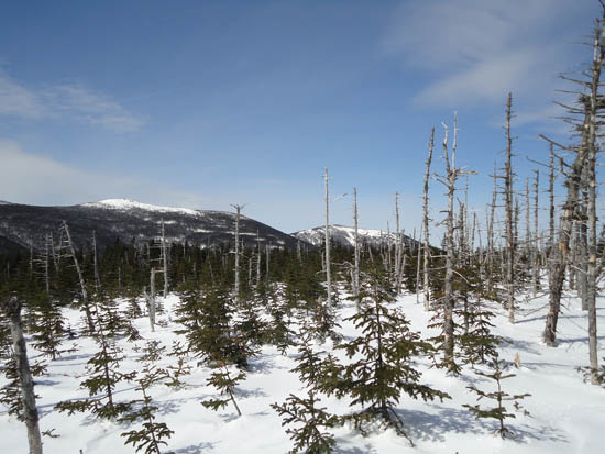
Looking at the Twins from near the highpoint of Zealand Mountain
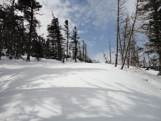
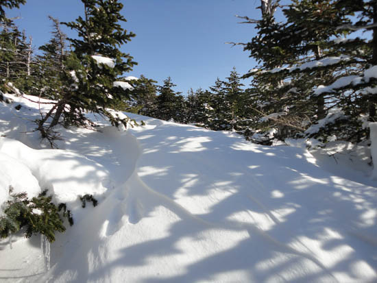
Drifted snow between Zealand and Guyot
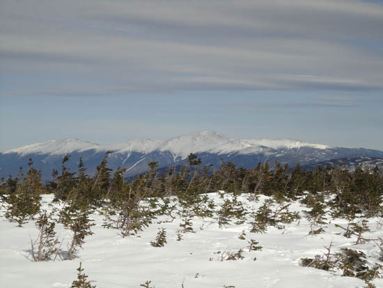
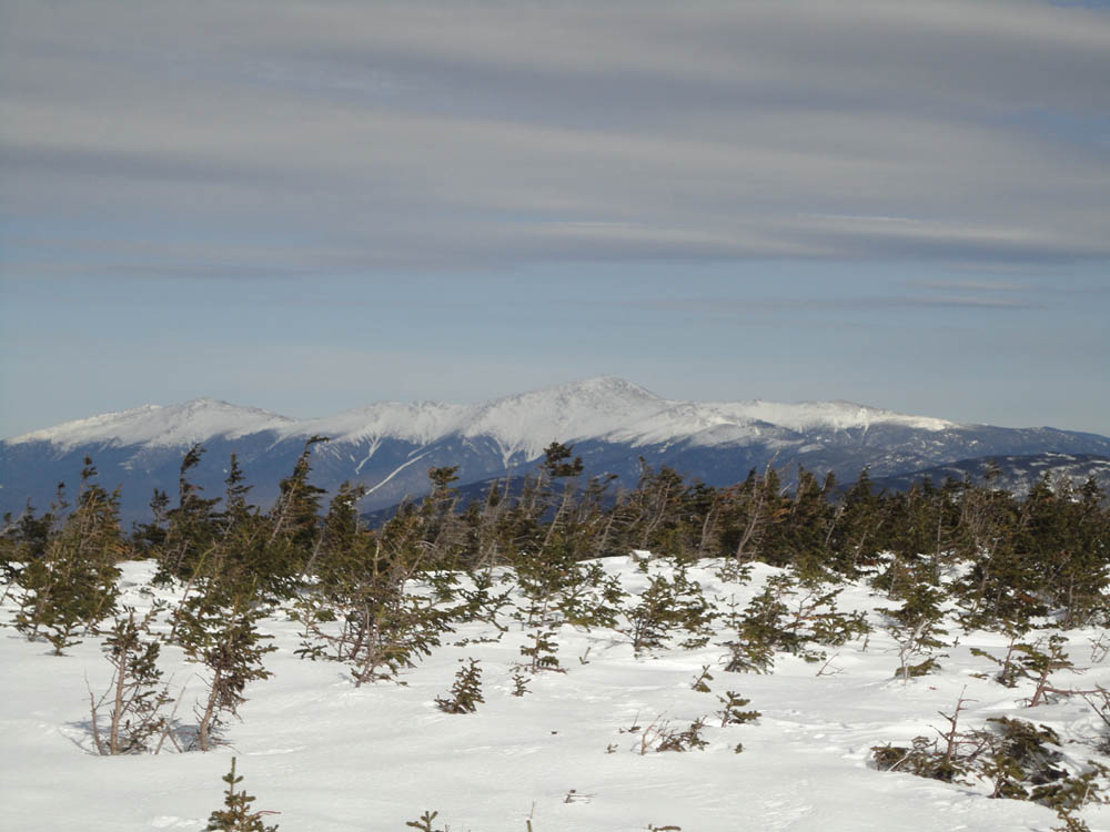
The Presidentials as seen from Mt. Guyot
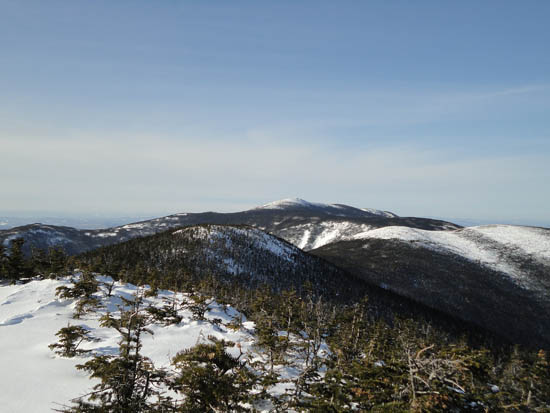
Heading over South Guyot to West Bond on the Bondcliff Trail
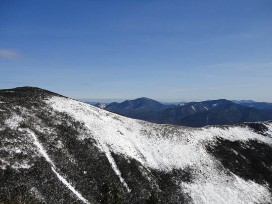
Looking over the Bondcliff Ridge at Mt. Carrigain from West Bond
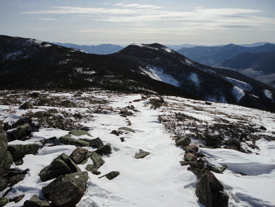
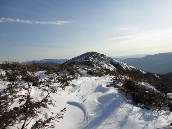
Looking up the Bondcliff Trail on the way to Mt. Bond
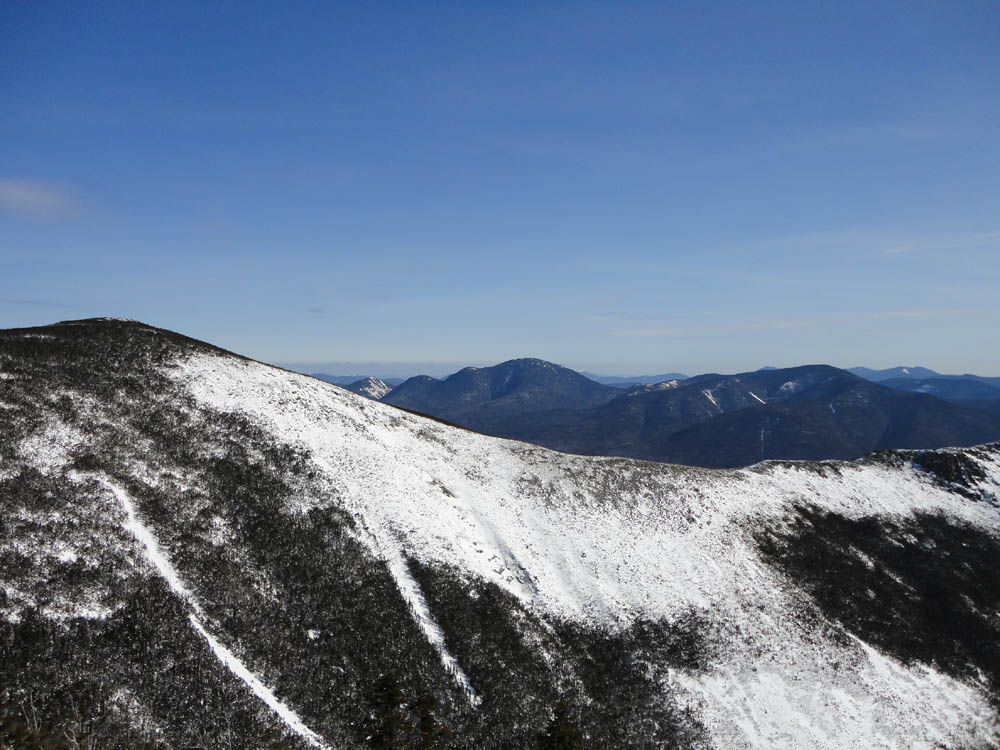
Looking at South Twin from Mt. Bond
Looking up the Bondcliff Trail at Bondcliff
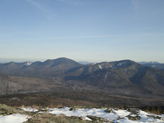
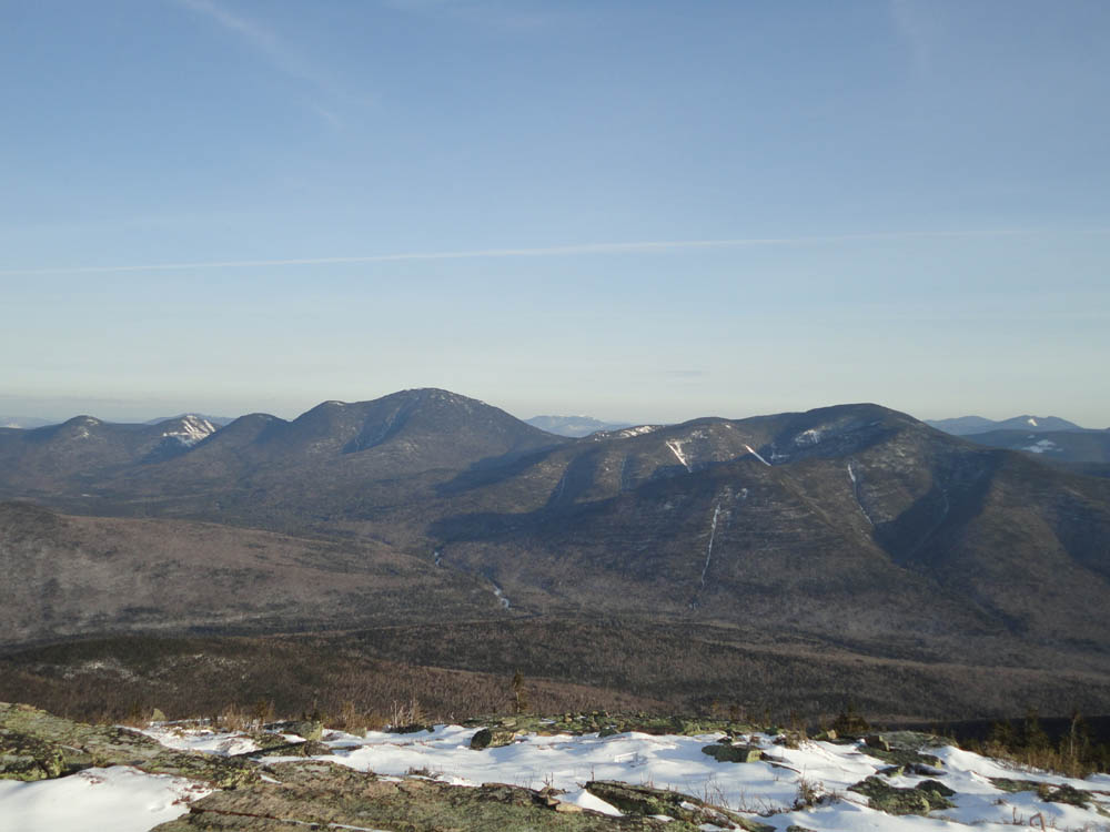
Looking Anderson, Lowell, Carrigain, and Hancock from Bondcliff

Directions to trailhead: Take US 302 west from Bartlett past Bretton Woods Ski Area. In winter, there is a parking area on the right side of US 302, just prior to the gated and closed Zealand Road. The Zealand WMNF fee parking area and Zealand Trail trailhead are located at the end of Zealand Road.
Back to Zealand Mountain Profile
Back to Mt. Guyot Profile
Back to Mt. Bond - West Peak Profile
Back to Mt. Bond Profile
Back to Bondcliff Profile
|