Home
States
Colorado
Connecticut
Maine
Massachusetts
New Hampshire
New York
Rhode Island
Utah
Vermont
View All
Lists
NE 4,000 Footers
NE 100 Highest
NH 4,000 Footers
NH 100 Highest
NH 52 With A View
NH Belknap Range
NH Ossipee 10
Links
Trail Conditions
Trip Log
Sunrises
Sunsets
About
|
Zealand Mountain, Mt. Guyot, Mt. Bond (West Peak), Mt. Bond, Bondcliff
Bethlehem, NH, Livermore, NH, Lincoln, NH
Trailheads, measurements, times, distances, and maps are all approximate and relative to the hike(s) as shown below.
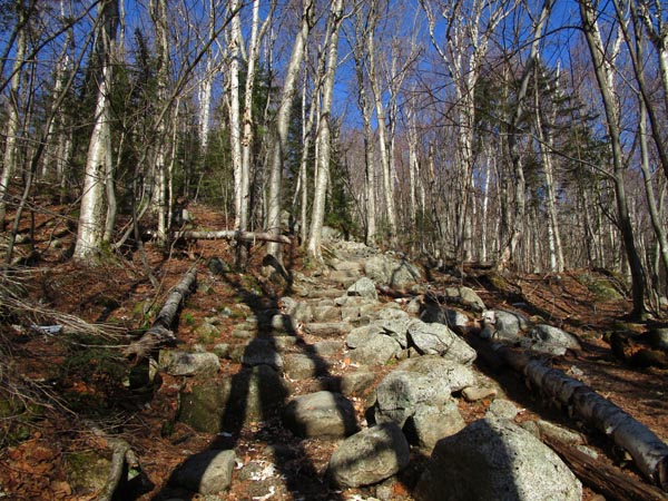
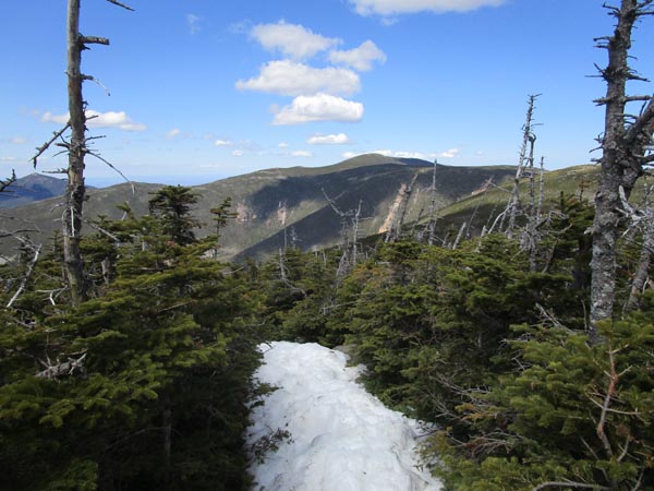
The Twinway on the way to Zealand Hut
Route: Zealand Road, Zealand Trail, Twinway, spur trail, (Zealand Mountain), spur trail, Twinway, (Mt. Guyot), Twinway, Bondcliff Trail, West Bond Trail, (West Bond), West Bond Trail, Bondcliff Trail, (Mt. Bond), Bondcliff Trail, (Bondcliff), Bondcliff Trail, Wilderness Trail, Lincoln Woods Trail
Zealand Road was dry and firm.
Zealand Trail initially had a few patches of snow, but then transitioned to a few extended stretches of monorail, followed by more stretches of patchy monorail (and long stretches of nothing). We barebooted with care first thing this morning, but softer conditions could have warranted musical snowshoes.
Deep pocket of snow prior to the steep up to the hut. Steep up to the hut was mostly snow free.
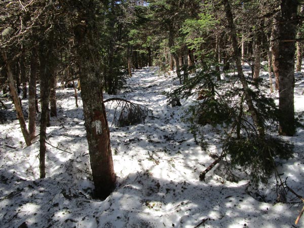
Varying intermittent monorail above the hut, however at 2,900 feet we started postholing deeply, so snowshoes went on. Kept them on all the way to Guyot. Some bare ledge between the Zeacliff view spur and the Zeacliff Trail (as well as slightly floating bog bridges), but still deep snow in the scrubby areas. Ladder has melted out. Generally 1-2 feet of snowpack on the ridge to Zealand.
Deeper snow from Zealand to Guyot, with a few blazes at knee to pocket level. Probably 2-4 feet of snowpack. Can't imagine this without snowshoes right now.
Guyot was bare, as was South Guyot. We barebooted the short scrubby patch between the two and found it to be tedious; stretch is borderline too short to justify snowshoes, but it was very soft and resulted in some deep postholes.
Snowshoes went on again as soon as we reached the scrub off South Guyot. Still plenty of snow thereafter to West Bond and Bond. West Bond Spur col would be tedious without snowshoes, as various routes this winter did not follow the trail and are now unstable. The top 10-20 vertical feet on West Bond has melted.
Snow stopped roughly 50 feet in either direction on Bond. Snowshoes stayed on for the initial descent through the trees to Bondcliff, as there was plenty of snow in there (though the scramble ledge has emerged and is wet). Bondcliff ridge was dry/snow free.
Hillary Stumble has melted out. A little snow above it in the scrub, but consistent snow starting at the foot of it. Snowshoes went back on there, as the monorail was not particularly solid. Snow remains on the trail shelf, but the adjacent slopes are melting quickly. Snowshoes stayed on until about 3,250 feet in elevation, at which point the monorail became patchy. A few extended stretches of monorail remained near water crossings, but virtually no snow by the time we reached the bottom crossing. Some muck in places thereafter.
Bondcliff Trail railgrade had zero snow and was fairly dry, other than the usual mucky areas. Lincoln Woods Trail also had zero snow and was very dry.
Nice local weather today (was raining just south of Lincoln this morning and looked cloudy in the Eastern Slope region for awhile), with blue skies and minimal winds. Only saw four other people today. Had from Zeacliff to Bondcliff completely to ourselves.
Though the approaches are melting out quickly, lots of snow remains at elevation. I would not advise doing this without carrying snowshoes in the coming days.
| Hike Ratings |
|
Getting To Trailhead: |
Difficult |
| Destination: |
Zealand Mountain |
|
Length: |
Difficult |
|
Steepness: |
Difficult |
|
Navigation: |
Moderate |
|
Views: |
Excellent |
|
Crowds: |
Minimal |
| Destination: |
Mt. Guyot |
|
Length: |
Very Difficult |
|
Steepness: |
Difficult |
|
Navigation: |
Difficult |
|
Views: |
Excellent |
|
Crowds: |
Minimal |
| Destination: |
Mt. Bond (West Peak) |
|
Length: |
Very Difficult |
|
Steepness: |
Difficult |
|
Navigation: |
Moderate |
|
Views: |
Excellent |
|
Crowds: |
Minimal |
| Destination: |
Mt. Bond |
|
Length: |
Very Difficult |
|
Steepness: |
Difficult |
|
Navigation: |
Moderate |
|
Views: |
Excellent |
|
Crowds: |
Minimal |
| Destination: |
Bondcliff |
|
Length: |
Very Difficult |
|
Steepness: |
Difficult |
|
Navigation: |
Easy |
|
Views: |
Excellent |
|
Crowds: |
Minimal |
|
| Hike Stats |
|
Date Hiked: |
Wednesday, April 14, 2021 |
| Parking Elevation: |
1,480' |
| Destination: |
Zealand Mountain |
| Time Elapsed: |
03:14 |
| Trailhead Elevation: |
2,000' |
| Summit Elevation: |
4,260' |
| Vertical Gain: |
2,490' |
| Destination: |
Mt. Guyot |
| Time Elapsed: |
00:43 |
| Trailhead Elevation: |
4,260' |
| Summit Elevation: |
4,580' |
| Vertical Gain: |
640' |
| Destination: |
Mt. Bond (West Peak) |
| Time Elapsed: |
00:59 |
| Trailhead Elevation: |
4,580' |
| Summit Elevation: |
4,540' |
| Distance: |
1.3 miles |
| Vertical Gain: |
470' |
| Destination: |
Mt. Bond |
| Time Elapsed: |
00:36 |
| Trailhead Elevation: |
4,540' |
| Summit Elevation: |
4,698' |
| Distance: |
1 mile |
| Vertical Gain: |
448' |
| Destination: |
Bondcliff |
| Time Elapsed: |
00:48 |
| Trailhead Elevation: |
4,698' |
| Summit Elevation: |
4,265' |
| Distance: |
1.2 miles |
| Vertical Gain: |
285' |
|
|
| Hike Time Elapsed: |
12:07 |
| Hike Vertical Gain: |
5,053' |
|
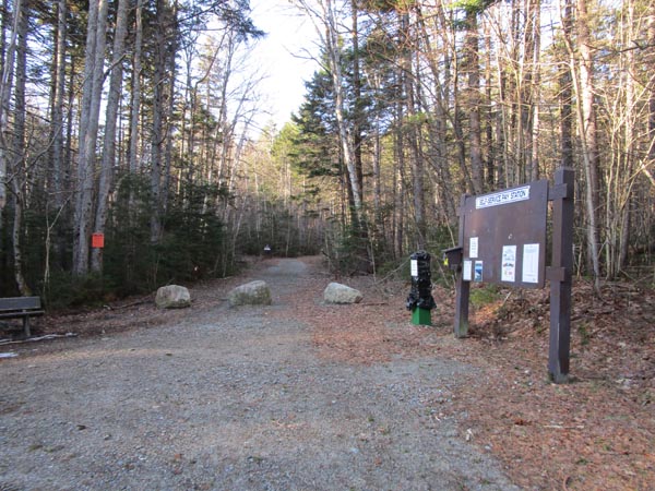
The Zealand Trail trailhead at the end of Zealand Road
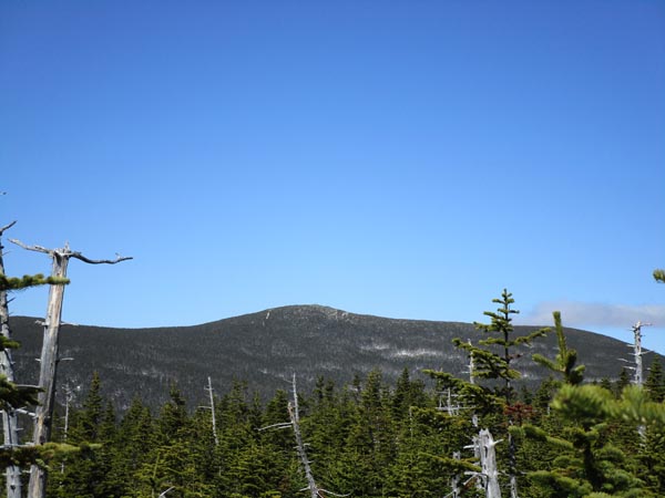
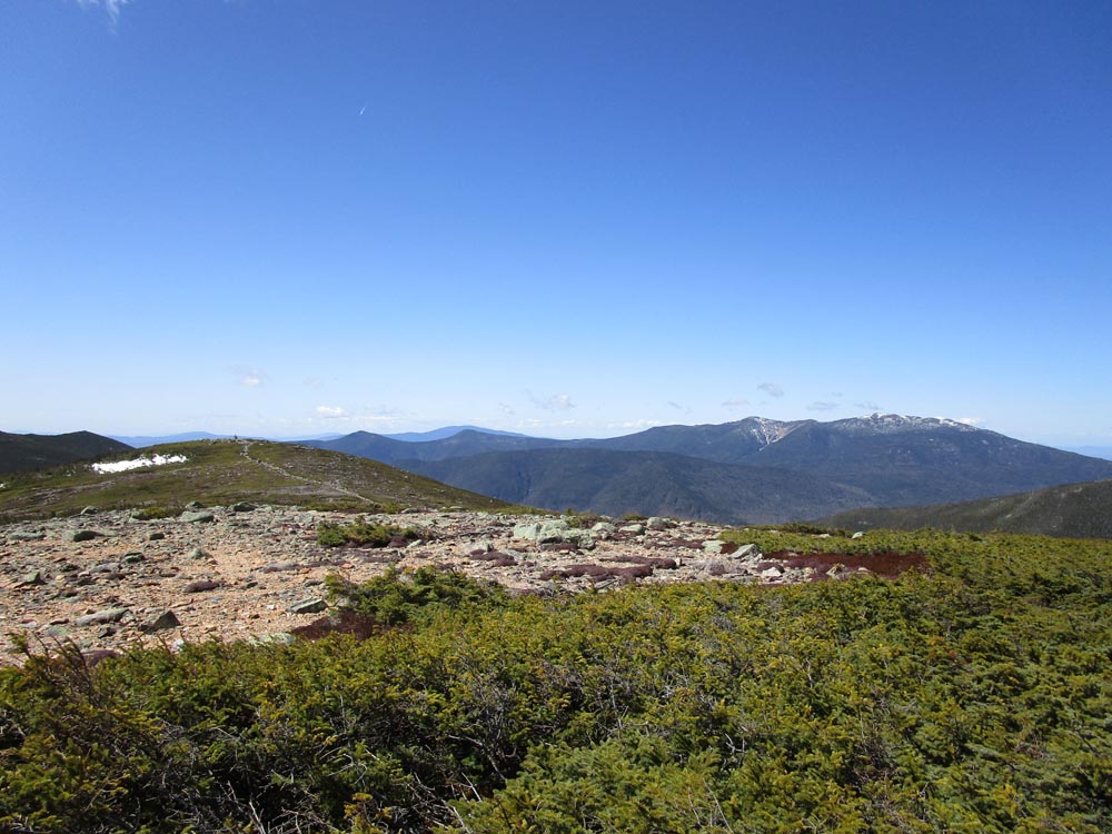
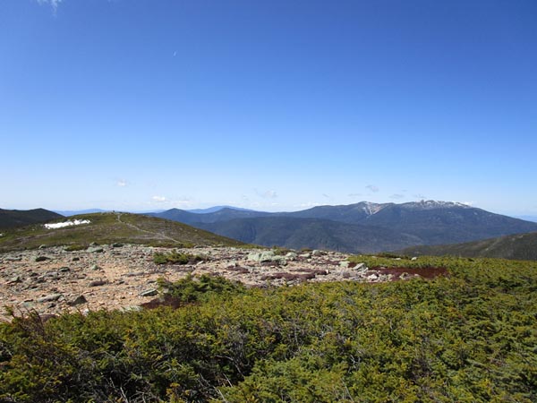
Looking at the Twins from near the highpoint of Zealand Mountain
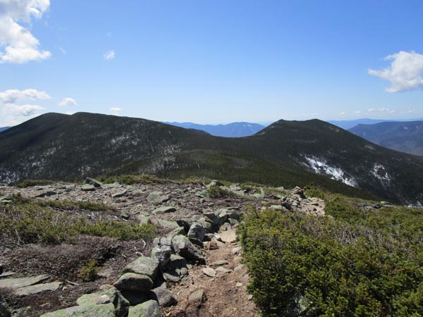
The Twinway between Zealand and Guyot
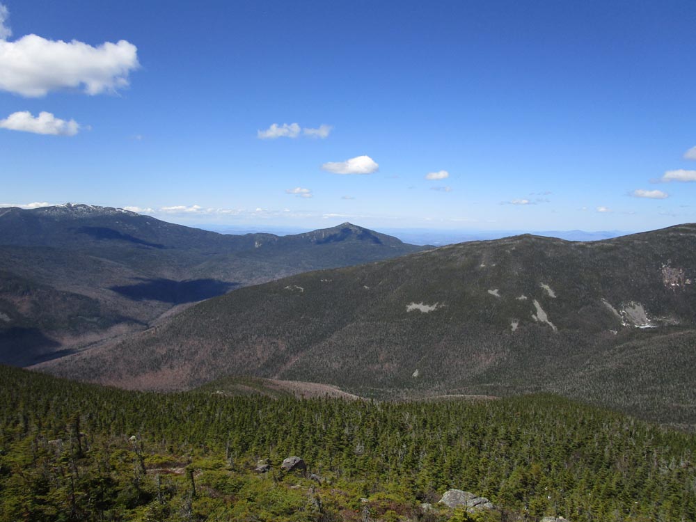
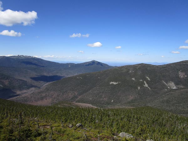
The South Guyot, Owl's Head, and the Franconia Ridge as seen from Mt. Guyot
Heading to West Bond on the Bondcliff Trail
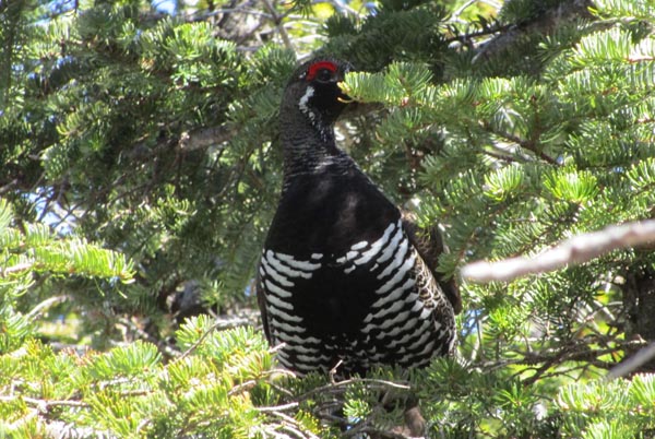
Attack chicken on the Bondcliff Trail
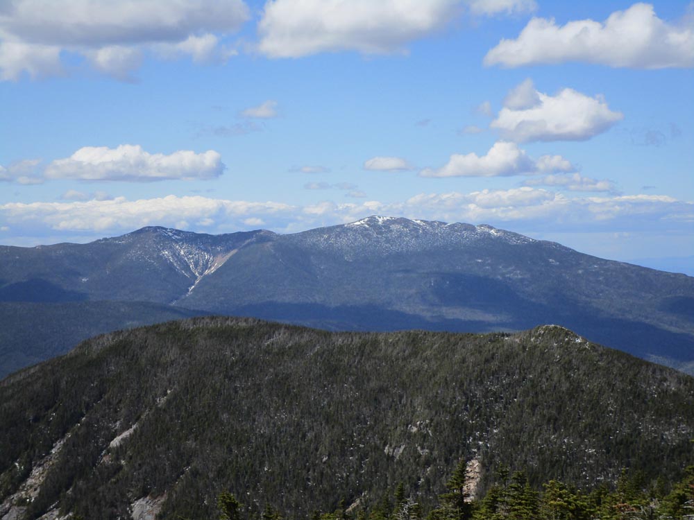
Looking at Mt. Garfield from West Bond
The Bondcliff Trail on the way to Mt. Bond

Looking at West Bond and the Franconia Ridge from Mt. Bond
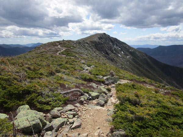
Looking up the Bondcliff Trail at Bondcliff
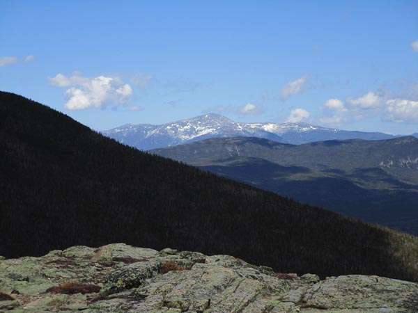
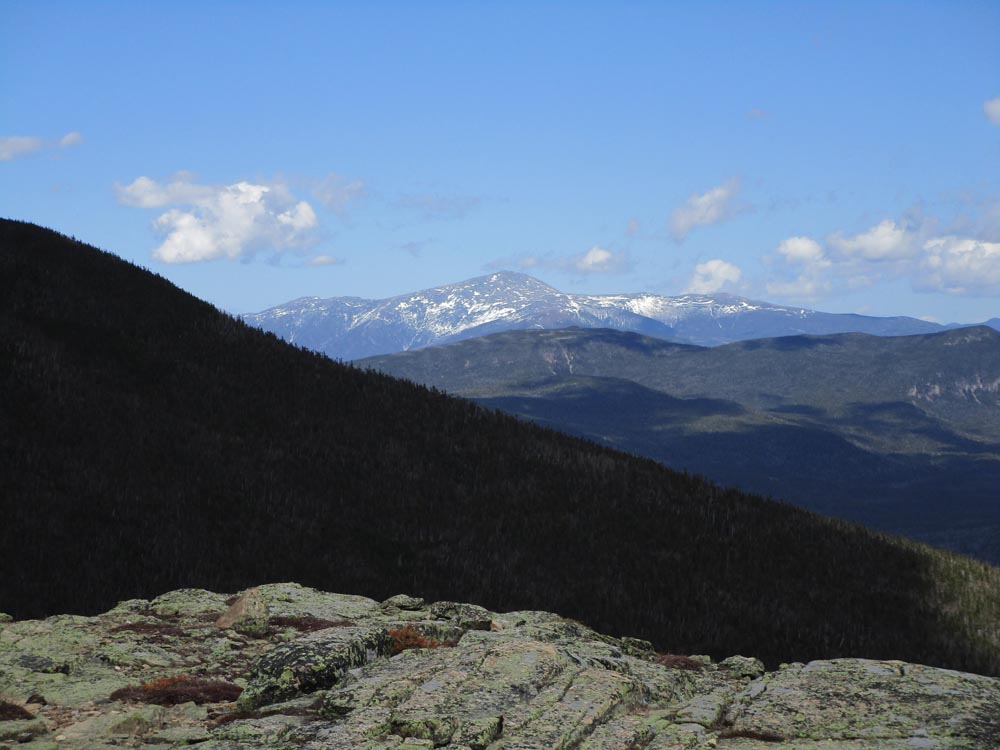
Looking Mt. Washington from Bondcliff
Directions to trailhead: Take US 302 west from Bartlett past Bretton Woods Ski Area. In winter, there is a parking area on the right side of US 302, just prior to the gated and closed Zealand Road. The Zealand WMNF fee parking area and Zealand Trail trailhead are located at the end of Zealand Road.
Back to Zealand Mountain Profile
Back to Mt. Guyot Profile
Back to Mt. Bond - West Peak Profile
Back to Mt. Bond Profile
Back to Bondcliff Profile
|