Home
States
Colorado
Connecticut
Maine
Massachusetts
New Hampshire
New York
Rhode Island
Utah
Vermont
View All
Lists
NE 4,000 Footers
NE 100 Highest
NH 4,000 Footers
NH 100 Highest
NH 52 With A View
NH Belknap Range
NH Ossipee 10
Links
Trail Conditions
Trip Log
Sunrises
Sunsets
About
|
Burnt Rock Mountain
Fayston, VT
Trailheads, measurements, times, distances, and maps are all approximate and relative to the hike(s) as shown below.
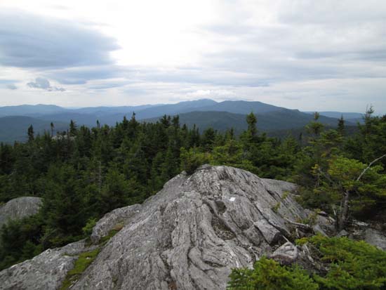
Nearing Burnt Rock Mountain on the Long Trail
Route: Hedgehog Brook Trail, Long Trail
Trail was generally dry down low, but lots of slippery ledge slabs before and on the Long Trail. Some minor mud, but not too bad.
Very, very nice views with a nice ledgy ridgewalk for the last quarter mile or so. One of the nicest summits I've been to yet on the Long Trail.
| Hike Ratings |
|
Getting To Trailhead: |
Easy |
| Destination: |
Burnt Rock Mountain |
|
Length: |
Moderate |
|
Steepness: |
Difficult |
|
Navigation: |
Easy |
|
Views: |
Excellent |
|
Crowds: |
Moderate |
|
| Hike Stats |
|
Date Hiked: |
Saturday, August 16, 2014 |
| Parking Elevation: |
1,150' |
| Destination: |
Burnt Rock Mountain |
| Time Elapsed: |
01:26 |
| Trailhead Elevation: |
1,150' |
| Summit Elevation: |
3,168' |
| Vertical Gain: |
2,118' |
|
|
| Hike Time Elapsed: |
02:49 |
| Hike Vertical Gain: |
2,218' |
|
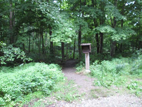
The Hedgehog Brook Trail trailhead
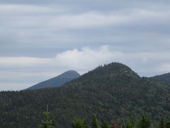
Looking north at Ira Allen and Camel's Hump from Burnt Rock Mountain
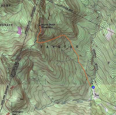

Directions to trailhead: From Waitsfield, take Route 100 North, then take a left onto Center Fayston Road. At a junction with North Fayston Road, take a left onto Big Basin Road. The Hedgehog Brook Trail parking lot and trailhead will eventually be at the end of public portion of the road.
Back to Burnt Rock Mountain Profile
|

