Home
States
Colorado
Connecticut
Maine
Massachusetts
New Hampshire
New York
Rhode Island
Utah
Vermont
View All
Lists
NE 4,000 Footers
NE 100 Highest
NH 4,000 Footers
NH 100 Highest
NH 52 With A View
NH Belknap Range
NH Ossipee 10
Links
Trail Conditions
Trip Log
Sunrises
Sunsets
About
|
Burnt Rock Mountain
Fayston, VT
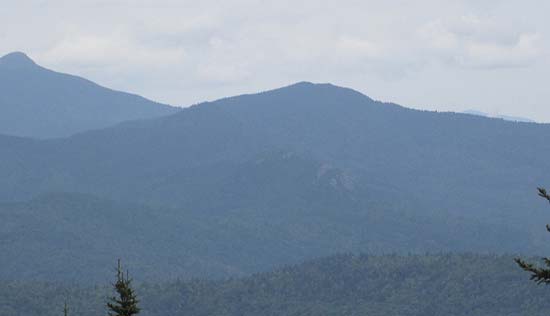
Burnt Rock Mountain (in front of Camel's Hump and the Allens) as seen from Mad River Glen
 Summary Summary
Located along the Long Trail between General Stark Mountain and Camel's Hump, Burnt Rock Mountain features dramatic views in all directions from various ledges
Summit Elevation
3,168 feet
Summit Facilities
None.
Trip Reports:
Click on the date for photos, timestamps, and maps.
More Information
|
