Home
States
Colorado
Connecticut
Maine
Massachusetts
New Hampshire
New York
Rhode Island
Utah
Vermont
View All
Lists
NE 4,000 Footers
NE 100 Highest
NH 4,000 Footers
NH 100 Highest
NH 52 With A View
NH Belknap Range
NH Ossipee 10
Links
Trail Conditions
Trip Log
Sunrises
Sunsets
About
|
Dorset Peak
Dorset, VT, Danby, VT
Trailheads, measurements, times, distances, and maps are all approximate and relative to the hike(s) as shown below.
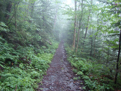
Looking down the Jeep road just above the first height of land
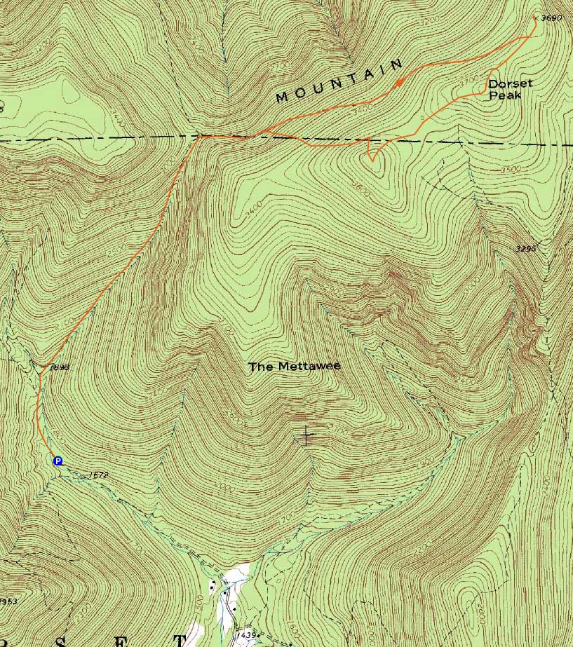
Route: Jeep road, herd path, (Dorset Peak North Peak), herd path, (Dorset Peak), herd path, (Dorset Peak South Peak), herd path, jeep road
With rain in the forecast, I decided to do one of those more-driving-than-hiking days. After driving through some downpours, I eventually made it to Dorset in cloudy conditions.
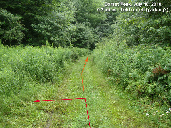
I was able to drive about 3/4 of a mile up the Jeep road with out many issues, though cars with low clearance may not fare as well. Parking in a field, I continued on foot up the road, passing two small water crossings, then, about 8 minutes later (not taking any left hand turns), an old cabin on the left.
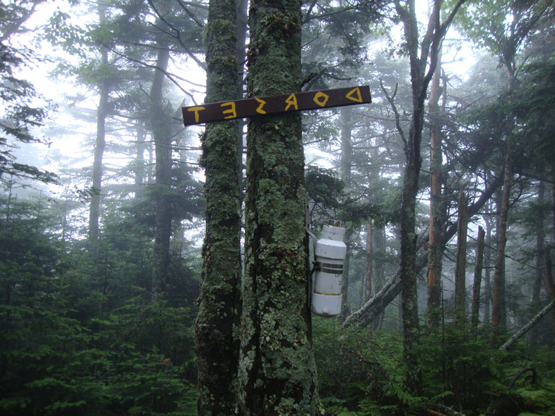
The road steepened up after this, becoming a bit of a workout (though never overly steep). Reaching an obvious height of land, the Jeep road reached a T intersection. Left went downhill, while right went uphill. Heading right and thus uphill, the grades were much more gradual. I avoided taking any of the right hand turns thereafter and eventually found myself at another height of land (with some makeshift trail markers pointing right). I went left first, to the northern peak, to see if there might be any views. I didn't look around too long and found none (not that there would be any in the fog). Back at the junction, I followed the makeshift signs (to the right) southwest and soon found myself at the highpoint of Dorset Peak, marked with a backwards sign and cannister. I didn't see any evidence of any views. After taking a bit of a break, I continued southwest.
About 7 minutes later, I found myself at a junction marked with an old trail sign. I went straight through it, heading to what the sign said was Dorset Peak (contrary to the USGS topo maps).
Five minutes after passing the old trail sign, I found myself at another trail junction, marked with the famous doorknob tree. I took a right, then an immediate left, noticably going uphill on perhaps a snowmobile trail.
Three minutes later, I found myself at the old fire tower. I suspect there could be directional views down a trail cut from this peak, however otherwise there probably wouldn't be much to see.
From the tower, I took what would have been a sharp right turn, dropping steeply down a straight (at first) trail. Three minutes later, I hit a Jeep or logging road and took a left to continue downhill. About a dozen minutes after that, I reached the original Jeep road I had ascended. From there, I continued down to the lower height of land, took the left, and descended back to my vehicle.
| Hike Ratings |
|
Getting To Trailhead: |
Moderate |
| Destination: |
Dorset Mountain |
|
Length: |
Moderate |
|
Steepness: |
Moderate |
|
Navigation: |
Moderate |
|
Views: |
Minimal |
|
Crowds: |
Minimal |
|
| Hike Stats |
|
Date Hiked: |
Saturday, July 10, 2010 |
| Hike Commenced: |
10:00 AM |
| Parking Elevation: |
1,720' |
| Destination: |
Dorset Peak |
| Ascent Commenced: |
10:00 AM |
| Summit Reached: |
11:26 AM |
| Time Elapsed: |
01:26 |
| Trailhead Elevation: |
1,720' |
| Summit Elevation: |
3,770' |
| Vertical Gain: |
2,085' |
|
|
| Hike Ended: |
12:54 PM |
| Hike Time Elapsed: |
2:54 |
| Hike Vertical Gain: |
2,220' |
|
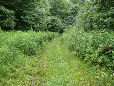
Looking up the Jeep road from the field about .7 mile up.

Dorset Peak
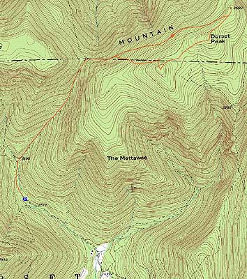

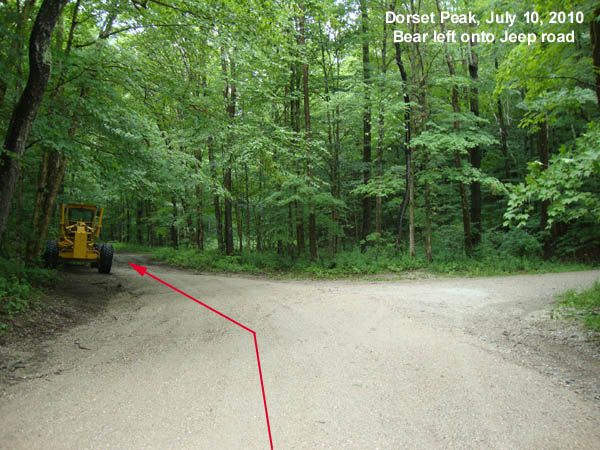
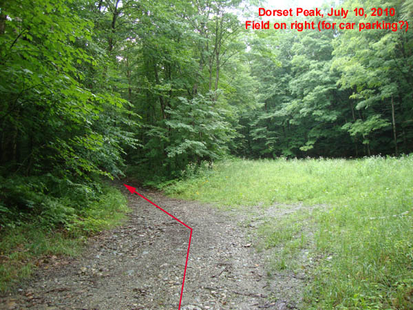
Directions to trailhead: From Manchester, take Route 30 north to Dorset. Take a right onto Dorset Hollow Road. Bear left onto Upper Hollow Road. Lower Hollow Road will eventually rejoin Upper Hollow Road, the sum of the two becoming "Tower Road." Continue on Tower Road, bearing left at a junction onto a Jeep road. Shortly thereafter, there is room to park on the right. With decent vehicle ground clearance in summer 2010, one could continue up the Jeep road for .7 miles and park in a small field on the left, then continue on foot.
Back to Dorset Peak Profile
|
